Category:Holyhead
English: Holyhead (pronounced /ˈhɒlɪhɛd/ ( listen); Welsh: Caergybi "the fort of Saint Cybi") is the largest town in the county of Anglesey in the north west of Wales. Although it is the largest town in the county, it is neither the county town nor actually on the island of Anglesey. In fact, it is located on Holy Island which is connected to Anglesey by Four Mile Bridge, so called because it is four miles (6 km) from Holyhead on the old post road from London, and a causeway (known locally as "the cob").
Deutsch: Holyhead ist eine kleine Stadt in der britischen Grafschaft Anglesey vor der walisischen Küste.
Cymraeg: Tref fwya a phorthladd yn Sir Fôn yw Caergybi
town in the county of Anglesey in Wales  | |||||
| Upload media | |||||
| Instance of | |||||
|---|---|---|---|---|---|
| Location |
| ||||
| Heritage designation |
| ||||
| official website | |||||
 | |||||
Subcategories
This category has the following 22 subcategories, out of 22 total.
*
A
- Anglesey Aluminium (25 F)
- Holyhead in art (22 F)
B
- Beddmanarch Bay (9 F)
C
- Caer Gybi Roman Fort (47 F)
- Celtic Gateway Footbridge (19 F)
H
- Holyhead Marina (22 F)
- Holyhead War Memorial (6 F)
L
- Llaingogh (17 F)
P
R
S
- Signs in Holyhead (12 F)
- Stanley Embankment (34 F)
T
- Trefignath (19 F)
Media in category "Holyhead"
The following 200 files are in this category, out of 1,016 total.
(previous page) (next page)-
 "The Standing Stones" - geograph.org.uk - 3378539.jpg 1,074 × 776; 150 KB
-
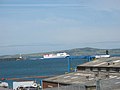
 'Bardsey Island` and pier in Holyhead Harbour - geograph.org.uk - 2602454.jpg 2,322 × 1,587; 1.27 MB
-
 'Bardsey Island` in Holyhead Harbour - geograph.org.uk - 2602446.jpg 2,853 × 2,094; 1.97 MB
-

-
 'The Journey' by Market Square, Holyhead - geograph.org.uk - 2312249.jpg 640 × 480; 158 KB
-
 'X' Marks the Spot, Anglesey Aluminium Jetty, Holyhead - geograph.org.uk - 3731901.jpg 2,881 × 2,074; 1.37 MB
-

-
 20230625 1647 Holyhead, Wales.jpg 3,648 × 2,736; 4.95 MB
-

-

-

-
 A bollard and a bench mark - geograph.org.uk - 2314638.jpg 480 × 640; 193 KB
-
 A bunkering supplier in Holyhead Harbour - geograph.org.uk - 2240820.jpg 1,024 × 704; 119 KB
-
 A col with a view - geograph.org.uk - 899344.jpg 640 × 480; 86 KB
-
 A field full of grazing black sheep - geograph.org.uk - 153131.jpg 640 × 480; 84 KB
-
 A fishy numberplate - geograph.org.uk - 2070565.jpg 768 × 1,024; 161 KB
-
 A Griffin on the Heath - geograph.org.uk - 1444128.jpg 640 × 387; 51 KB
-
 A Griffin over The Range - geograph.org.uk - 1445109.jpg 480 × 640; 34 KB
-
-

-
 A ship with no name - geograph.org.uk - 873805.jpg 640 × 403; 52 KB
-
 A5 heading to Holyhead - geograph.org.uk - 5931806.jpg 1,024 × 683; 460 KB
-
 Access ramps to the Dublin ferry - geograph.org.uk - 4785232.jpg 1,024 × 768; 179 KB
-

-
-

-
 Admiralty Arch Holyhead - geograph.org.uk - 5377290.jpg 1,024 × 773; 164 KB
-
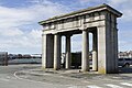 Admiralty Arch Holyhead - geograph.org.uk - 5507040.jpg 2,000 × 1,333; 2.18 MB
-
 Admiralty Arch, Holyhead - geograph.org.uk - 4192389.jpg 2,000 × 1,533; 791 KB
-
 Admiralty Chart No 1170A Holyhead to Great Ormes Head, Published 1873.jpg 16,143 × 10,891; 14.6 MB
-
 Admiralty Chart No 1413 Wales Holyhead Bay, Published 1881.jpg 8,302 × 11,901; 11.61 MB
-
 After The Storm - geograph.org.uk - 5698968.jpg 3,024 × 4,032; 3.15 MB
-
 Allotments in Plas Road - geograph.org.uk - 903891.jpg 640 × 356; 63 KB
-
 Allotments, Prince of Wales Road - geograph.org.uk - 4858838.jpg 640 × 480; 124 KB
-
 Along Llanfawr Road - geograph.org.uk - 5931843.jpg 1,024 × 683; 504 KB
-
 Along South Stack Road - geograph.org.uk - 5870680.jpg 1,024 × 683; 490 KB
-
 Along the breakwater - geograph.org.uk - 5870437.jpg 1,024 × 683; 486 KB
-
 Along the breakwater - geograph.org.uk - 5870481.jpg 1,024 × 683; 540 KB
-

-
 An exhibit inside the Crusher site - geograph.org.uk - 6217995.jpg 4,032 × 3,024; 1.68 MB
-

-
 Ancient and modern - geograph.org.uk - 6619173.jpg 4,642 × 2,980; 2.24 MB
-
 Anglesey Aluminium - geograph.org.uk - 3745599.jpg 800 × 530; 545 KB
-

-
 Anglesey Coast Path - geograph.org.uk - 4852581.jpg 640 × 475; 51 KB
-
 Anglesey Coast Path - geograph.org.uk - 4852587.jpg 640 × 480; 106 KB
-
 Anglesey Coast Path - geograph.org.uk - 4852604.jpg 640 × 476; 49 KB
-
 Anglesey Coast Path - geograph.org.uk - 4852655.jpg 640 × 480; 102 KB
-
 Anglesey Coastal Path at Porth-y-felin - geograph.org.uk - 3134723.jpg 3,264 × 1,840; 1.38 MB
-
 Anglesey Coastal Path at Porth-y-felin - geograph.org.uk - 3134742.jpg 3,264 × 1,840; 1.22 MB
-
 Anglesey coastline - geograph.org.uk - 408481.jpg 640 × 480; 284 KB
-
 Anglesey coastline - geograph.org.uk - 4852589.jpg 640 × 477; 76 KB
-

-
 Apartments at Holyhead Marina - geograph.org.uk - 2605560.jpg 3,264 × 2,448; 3.21 MB
-
 Approach road onto the breakwater - geograph.org.uk - 2469890.jpg 640 × 480; 291 KB
-
 Approaching Holyhead breakwater - geograph.org.uk - 1457485.jpg 640 × 386; 39 KB
-
 Approaching Holyhead Breakwater - geograph.org.uk - 2076552.jpg 1,024 × 552; 111 KB
-
 Approaching the end of the breakwater - geograph.org.uk - 5870447.jpg 1,024 × 683; 466 KB
-

-
 Art Gallery in the Brickworks - geograph.org.uk - 5870651.jpg 1,024 × 683; 580 KB
-
 Art in the brickworks - geograph.org.uk - 5870654.jpg 683 × 1,024; 680 KB
-
 Artspace - geograph.org.uk - 386540.jpg 480 × 640; 84 KB
-
 Assembly area for cars, Holyhead ferry port - geograph.org.uk - 2301956.jpg 1,024 × 768; 98 KB
-
 B24 Bomber crash memorial - geograph.org.uk - 159929.jpg 640 × 480; 95 KB
-
 B24 Bomber Crash Memorial - geograph.org.uk - 53464.jpg 640 × 419; 124 KB
-
 Barclays Bank, Holyhead - geograph.org.uk - 2938362.jpg 640 × 638; 86 KB
-
 Barnacles Holyhead.jpg 2,048 × 1,536; 2.89 MB
-

-
 Bay at Penrhos - geograph.org.uk - 923853.jpg 640 × 480; 45 KB
-
 Bay near Prince of Wales Road - geograph.org.uk - 5870104.jpg 1,024 × 683; 566 KB
-

-
 BBC Wales mobile studio - geograph.org.uk - 171944.jpg 640 × 480; 98 KB
-
 Beach and aluminium works - geograph.org.uk - 5931839.jpg 1,024 × 683; 510 KB
-
 Beach between Holyhead and Penrhos - geograph.org.uk - 4852630.jpg 640 × 480; 70 KB
-

-
 Beach north of Penrhos Park - geograph.org.uk - 4852584.jpg 640 × 480; 75 KB
-
 Beach Road Holyhead-2.jpg 1,074 × 806; 217 KB
-
 Beach Road, Holyhead (6).jpg 1,002 × 752; 277 KB
-
 Beach Road, Porth-y-felin - geograph.org.uk - 5806586.jpg 640 × 427; 104 KB
-
 Beached boat - geograph.org.uk - 6104726.jpg 1,024 × 683; 177 KB
-
 Beached boats near the Marina Holyhead - geograph.org.uk - 3041117.jpg 1,024 × 758; 102 KB
-
 Goodbye Holyhead - geograph.org.uk - 2855981.jpg 1,024 × 768; 130 KB
-
 Beddmanarch Bay - geograph.org.uk - 5931827.jpg 1,024 × 683; 521 KB
-

-
 Bedmanarch Bay - geograph.org.uk - 5931808.jpg 1,024 × 683; 347 KB
-
 Bedraggled (1433917075).jpg 1,600 × 1,200; 375 KB
-
 Below the lighthouse - geograph.org.uk - 5870455.jpg 1,024 × 683; 475 KB
-
 Bench at Holyhead Commemorating John Cave MBE - geograph.org.uk - 6163196.jpg 1,024 × 682; 196 KB
-
 Benchmark on town hall, Holyhead - geograph.org.uk - 2917860.jpg 3,240 × 4,320; 2.95 MB
-
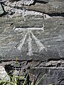 Benchmark^1 on Turkey Shore Road, Holyhead - geograph.org.uk - 3125019.jpg 3,240 × 4,320; 3.27 MB
-
 Benchmark^2 on Turkey Shore Road, Holyhead - geograph.org.uk - 3125025.jpg 3,240 × 4,320; 3.24 MB
-
 Benchmark^4 on Turkey Shore Road, Holyhead - geograph.org.uk - 3125034.jpg 3,240 × 4,320; 3.19 MB
-
 Bend in the breakwater - geograph.org.uk - 5870423.jpg 1,024 × 683; 481 KB
-
 Bend in the breakwater - geograph.org.uk - 5870440.jpg 1,024 × 683; 504 KB
-
 Big Groove - geograph.org.uk - 23582.jpg 554 × 640; 184 KB
-
 Blocked doorway in the market hall - geograph.org.uk - 2314812.jpg 480 × 640; 204 KB
-
 Blocks on the beach - geograph.org.uk - 2606485.jpg 2,444 × 2,791; 2.77 MB
-

-
 Boarding the transfer bus at Holyhead - geograph.org.uk - 4911750.jpg 640 × 480; 177 KB
-
 Boat and concrete blocks - geograph.org.uk - 5870400.jpg 1,024 × 683; 595 KB
-
-

-
 Boathouse Hotel, Holyhead - geograph.org.uk - 4858950.jpg 640 × 445; 49 KB
-
 Boathouse Remains at Penrhos - geograph.org.uk - 6275506.jpg 1,024 × 683; 309 KB
-
 Boats in Holyhead Harbour - geograph.org.uk - 2605467.jpg 2,352 × 1,420; 1.13 MB
-
 Boats in Holyhead Harbour - geograph.org.uk - 3113539.jpg 3,000 × 2,000; 1.74 MB
-
 Boats in the harbour - geograph.org.uk - 5870357.jpg 1,024 × 683; 488 KB
-
 Boats in the marina - geograph.org.uk - 5870386.jpg 1,024 × 683; 472 KB
-
 Boats moored inside the breakwater - geograph.org.uk - 5870427.jpg 1,024 × 683; 449 KB
-
 Boston House in Boston Street, Holyhead - geograph.org.uk - 2314530.jpg 640 × 480; 103 KB
-
 Breakwater and Holyhead Mountain - geograph.org.uk - 5870475.jpg 1,024 × 683; 477 KB
-
 Breakwater at Holyhead - geograph.org.uk - 5870444.jpg 1,024 × 683; 470 KB
-

-
 Breakwater Country Park lake, Anglesey - geograph.org.uk - 5086025.jpg 640 × 427; 589 KB
-

-

-

-

-

-
 Breakwater Lighthouse - geograph.org.uk - 4666421.jpg 2,477 × 1,392; 1.06 MB
-
 Breakwater lighthouse - geograph.org.uk - 5870450.jpg 683 × 1,024; 387 KB
-

-

-

-
 Breakwater Lighthouse, Holyhead - geograph.org.uk - 3974430.jpg 640 × 427; 44 KB
-
 Breakwater Lighthouse, Holyhead - geograph.org.uk - 4206264.jpg 640 × 480; 308 KB
-

-

-

-
 Brickworks chimney - geograph.org.uk - 5870655.jpg 683 × 1,024; 500 KB
-
 Bridge at Breakwater Park - geograph.org.uk - 4858988.jpg 640 × 462; 81 KB
-
 Bridge in Holyhead Breakwater Country Park - geograph.org.uk - 5571854.jpg 4,000 × 3,000; 3.6 MB
-
 Bridge leading to the jetty at Doc Bach - geograph.org.uk - 2070988.jpg 1,024 × 577; 134 KB
-
 Bridge over the Inner Harbour, Holyhead - geograph.org.uk - 5625480.jpg 640 × 427; 321 KB
-
 Bridge to the town - geograph.org.uk - 5870016.jpg 1,024 × 683; 538 KB
-
 Bridges over the A55 at Holyhead - geograph.org.uk - 5625807.jpg 640 × 427; 312 KB
-
 Britannia Inn, Holyhead - geograph.org.uk - 2938233.jpg 640 × 510; 67 KB
-
 Britannia Inn,Holyhead - geograph.org.uk - 4166098.jpg 640 × 419; 50 KB
-
 British Rail Class 175's TFW @ Holyhead, Wales June 2023.jpg 3,648 × 2,736; 4.3 MB
-
 British Stores, Holyhead - geograph.org.uk - 2938251.jpg 480 × 640; 57 KB
-
 British Under 17's Champion 2012.jpg 419 × 640; 37 KB
-
 Building at Penrhos Coastal Park - geograph.org.uk - 6275495.jpg 1,024 × 683; 194 KB
-
 Building site along the track - geograph.org.uk - 876638.jpg 640 × 340; 48 KB
-

-
 Bus stop on Trehwfa Crescent Holyhead - geograph.org.uk - 3041144.jpg 1,024 × 643; 67 KB
-
 Business units in Cytir Road - geograph.org.uk - 895955.jpg 640 × 480; 42 KB
-
 Byers stockless anchor, Holyhead - geograph.org.uk - 2938391.jpg 640 × 560; 86 KB
-

-

-
 Caernarfon Castle Public House - geograph.org.uk - 6273033.jpg 1,024 × 727; 138 KB
-
 Cafe and brickworks chimney - geograph.org.uk - 5870650.jpg 1,024 × 683; 499 KB
-
 Cambria Inn, Cambria Street Holyhead - geograph.org.uk - 6122062.jpg 3,807 × 2,797; 2.5 MB
-
 Cambria Inn, Holyhead - geograph.org.uk - 2938313.jpg 640 × 437; 58 KB
-
 Cambria Inn, Holyhead - geograph.org.uk - 4165875.jpg 640 × 480; 64 KB
-

-
 Causeway to Anglesey - geograph.org.uk - 5931809.jpg 1,024 × 683; 451 KB
-
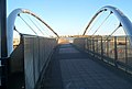
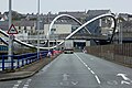
 Celtic Gateway Bridge, Holyhead - 1 - geograph.org.uk - 3734467.jpg 4,507 × 3,005; 2.69 MB
-
 Celtic Gateway Bridge, Holyhead - 2 - geograph.org.uk - 3734471.jpg 4,608 × 3,072; 3.14 MB
-
 Celtic Gateway Bridge, Holyhead - geograph.org.uk - 4393040.jpg 640 × 480; 76 KB
-
 Celtic Gateway footbridge, Holyhead - geograph.org.uk - 2938760.jpg 640 × 480; 67 KB
-
 Celtic Gateway footbridge, Holyhead - geograph.org.uk - 2976521.jpg 640 × 482; 66 KB
-
 Chadwicks Newsagents, Boston House, Boston Street, Holyhead - geograph.org.uk - 3738796.jpg 4,530 × 3,020; 2.78 MB
-
 Chimney at Holyhead breakwater country park - geograph.org.uk - 3041130.jpg 1,024 × 758; 88 KB
-
 Class 08 at Holyhead, 1989 - geograph.org.uk - 2752468.jpg 640 × 437; 86 KB
-
-
 Cliff rescue practice - geograph.org.uk - 586039.jpg 640 × 480; 102 KB
-
 Cliffs and rocks - geograph.org.uk - 586015.jpg 640 × 480; 106 KB
-

-

-
 Coast near Prince of Wales Road - geograph.org.uk - 5870250.jpg 1,024 × 683; 481 KB
-

-
 Coastal Defence, Porth Namarch - geograph.org.uk - 3024406.jpg 2,288 × 1,712; 731 KB
-
 Coastal path above Porth y Pwll - geograph.org.uk - 1436752.jpg 640 × 480; 69 KB
-
 Coastline north of Penrhos Farm - geograph.org.uk - 874895.jpg 640 × 480; 66 KB
-
 Coed Penrhos Woodland - geograph.org.uk - 897856.jpg 640 × 480; 66 KB
-

-

-

-
 Converted warehouses in Holyhead's Inner Harbour - geograph.org.uk - 2159991.jpg 1,024 × 716; 158 KB
-
 Coop on Market Street - geograph.org.uk - 5869977.jpg 1,024 × 683; 434 KB
-

-
 Cormorants on Ynysoedd y Ffrydiau - geograph.org.uk - 1438964.jpg 640 × 520; 121 KB
-
 Cove west of Soldier's Point - geograph.org.uk - 877116.jpg 640 × 480; 55 KB
-
 Coves of Porth Namarch - geograph.org.uk - 6293404.jpg 1,600 × 1,200; 516 KB
-
 Craggy coastline near Holyhead - geograph.org.uk - 4852590.jpg 640 × 480; 89 KB
-
 Crossing the Inner Harbour Bridge - geograph.org.uk - 2164835.jpg 1,024 × 564; 125 KB
-
 Curve in the breakwater - geograph.org.uk - 5870429.jpg 1,024 × 683; 460 KB
-
 Customs House, Salt Island - geograph.org.uk - 5823588.jpg 800 × 600; 645 KB
-
 Cybi Felyn - geograph.org.uk - 404564.jpg 640 × 480; 117 KB
-
 Cycle path near London Road - geograph.org.uk - 5931829.jpg 683 × 1,024; 767 KB
-
 Date stone on Capel y Bedyddwyr - geograph.org.uk - 4192224.jpg 2,000 × 1,527; 527 KB
-
-

-

-
 Development of Ysgol Cybi site - geograph.org.uk - 4964264.jpg 640 × 480; 87 KB
-

-
 Disused Farm Building - geograph.org.uk - 6275498.jpg 1,024 × 683; 227 KB
-
 Disused railway sidings in Holyhead - geograph.org.uk - 5571463.jpg 4,000 × 3,000; 4.36 MB
-
 Disused slipway, Porth-y-felin - geograph.org.uk - 4192320.jpg 2,000 × 1,500; 1.24 MB
-


.jpg)


.jpg)


.jpg)


_-_geograph.org.uk_-_5086005.jpg)
_-_geograph.org.uk_-_5086007.jpg)
_-_geograph.org.uk_-_5086014.jpg)
_-_geograph.org.uk_-_5086017.jpg)
_-_geograph.org.uk_-_5086019.jpg)


,_Wales,_where_lies_a_wonderful_Celtic_fort_17.jpg)


