Category:Hopton Wafers
English: Hopton Wafers is a small village and parish in Shropshire, England, near to Kidderminster. There is a pub - "The Crown".
village in Shropshire, England, UK  | |||||
| Upload media | |||||
| Instance of | |||||
|---|---|---|---|---|---|
| Location | Shropshire, West Midlands, England | ||||
 | |||||
Subcategories
This category has the following 4 subcategories, out of 4 total.
Media in category "Hopton Wafers"
The following 200 files are in this category, out of 219 total.
(previous page) (next page)-
 "Git orf moi land" - geograph.org.uk - 2432816.jpg 640 × 480; 111 KB
-
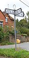
 A crossing of the ways - geograph.org.uk - 5451549.jpg 1,024 × 768; 223 KB
-
 A wheat field near Catherton - geograph.org.uk - 5451590.jpg 1,024 × 768; 285 KB
-
 A4117 along Hopton Bank - geograph.org.uk - 4273355.jpg 640 × 480; 44 KB
-
 A4117 at Hopton Wafers - geograph.org.uk - 2571282.jpg 640 × 480; 85 KB
-
 A4117 at Rochehead Farm - geograph.org.uk - 2571287.jpg 640 × 480; 76 KB
-
 A4117 descending Hopton Bank - geograph.org.uk - 2571280.jpg 640 × 480; 83 KB
-
 A4117 east into Hopton Wafers - geograph.org.uk - 2860628.jpg 640 × 468; 68 KB
-
 A4117 east of The Smithy - geograph.org.uk - 2571284.jpg 640 × 480; 66 KB
-
 A4117 to Cleobury - geograph.org.uk - 2257543.jpg 640 × 430; 124 KB
-
 A4117 to Cleobury - geograph.org.uk - 2257553.jpg 640 × 430; 98 KB
-
 A4117, Hopton Wafers - geograph.org.uk - 1001920.jpg 640 × 480; 127 KB
-

-
 Battered sign on Magpie Hill - geograph.org.uk - 2255515.jpg 640 × 430; 46 KB
-
-
 Bethel chapel, Foxwood - geograph.org.uk - 3280648.jpg 640 × 480; 108 KB
-
 Bird's nest in a shed - geograph.org.uk - 2707796.jpg 640 × 480; 79 KB
-
 Bridleway crossing Catherton Common - geograph.org.uk - 5451534.jpg 1,024 × 768; 260 KB
-
 Catherton Common - geograph.org.uk - 2211266.jpg 1,024 × 768; 416 KB
-
 Catherton Common - geograph.org.uk - 3178292.jpg 1,024 × 683; 228 KB
-
 Catherton Common - geograph.org.uk - 4421537.jpg 800 × 450; 316 KB
-
 Catherton Common - geograph.org.uk - 4421540.jpg 800 × 450; 329 KB
-
 Catherton Common - geograph.org.uk - 5450980.jpg 1,024 × 768; 220 KB
-
 Catherton Common - geograph.org.uk - 5952496.jpg 1,024 × 684; 405 KB
-
 Catherton Common in the heat - geograph.org.uk - 5952500.jpg 1,024 × 684; 480 KB
-
 Catherton Common nature reserve - geograph.org.uk - 5451579.jpg 1,024 × 768; 319 KB
-
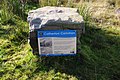 Catherton Common notice - geograph.org.uk - 3178274.jpg 3,936 × 2,624; 477 KB
-

-
 Circle of bricks - geograph.org.uk - 1988514.jpg 3,000 × 4,000; 2.83 MB
-
 Classic Landrover in Hopton Wafers - geograph.org.uk - 3248350.jpg 640 × 480; 89 KB
-

-
 Clee Hill Common - geograph.org.uk - 4402154.jpg 800 × 533; 405 KB
-
 Clee Hill Common - geograph.org.uk - 4402181.jpg 800 × 533; 410 KB
-
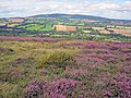
 Clee Hill Common, Whatshill - geograph.org.uk - 2532552.jpg 640 × 359; 238 KB
-
 Cleeton St Mary and Silvington Village Hall - geograph.org.uk - 2211434.jpg 1,024 × 765; 266 KB
-
 Cleobury seen from Clee Hill - geograph.org.uk - 2533384.jpg 640 × 359; 219 KB
-
 Collapsed Building On Clee Hill - geograph.org.uk - 1763679.jpg 4,000 × 3,000; 2.58 MB
-
 Concrete footbridge over Wellings Brook - geograph.org.uk - 2708257.jpg 640 × 480; 144 KB
-
 Conifer Woods near Hopton Court - geograph.org.uk - 4273360.jpg 640 × 480; 88 KB
-
 Conifers, Hopton Court - geograph.org.uk - 2260687.jpg 640 × 430; 159 KB
-
 Country road crossing Catherton Common - geograph.org.uk - 5451557.jpg 1,024 × 768; 245 KB
-
 Cut up tree trunk - geograph.org.uk - 5452114.jpg 1,024 × 768; 281 KB
-
 Disused mine workings at Magpie Hill - geograph.org.uk - 2211488.jpg 1,024 × 768; 266 KB
-
 Disused Quarry south of Hoar Edge - geograph.org.uk - 2255363.jpg 640 × 430; 22 KB
-
 Ditton Brook - geograph.org.uk - 4421532.jpg 800 × 533; 379 KB
-
 Entrance to Craven Cottage - geograph.org.uk - 2212097.jpg 1,024 × 768; 303 KB
-
 Entrance to Hopton Court - geograph.org.uk - 2211144.jpg 1,024 × 768; 281 KB
-
 Entrance to Hopton Court - geograph.org.uk - 2260683.jpg 640 × 430; 127 KB
-
 Entrance to Rochehead Farm - geograph.org.uk - 3487768.jpg 1,024 × 1,023; 260 KB
-
 Farm building near Foxwood - geograph.org.uk - 2257500.jpg 640 × 430; 96 KB
-
 Farm pond, Sproseley Farm - geograph.org.uk - 2261912.jpg 640 × 430; 114 KB
-
 Farm track north of Hopton Wafers - geograph.org.uk - 2212110.jpg 1,024 × 768; 337 KB
-
 Farmhouse, Shote Farm - geograph.org.uk - 2257547.jpg 640 × 430; 90 KB
-
 Farmland near Hopton Court - geograph.org.uk - 5453695.jpg 1,024 × 768; 282 KB
-
 Farmland near Hopton Wafers - geograph.org.uk - 2165279.jpg 640 × 395; 137 KB
-
 Field by Lower Down - geograph.org.uk - 2744654.jpg 640 × 360; 203 KB
-
 Field entrance - geograph.org.uk - 5452108.jpg 1,024 × 768; 346 KB
-
 Field entrance - geograph.org.uk - 5453691.jpg 1,024 × 768; 326 KB
-
 Field near Hillocks Farm - geograph.org.uk - 5452118.jpg 1,024 × 768; 270 KB
-
 Field, Earls Ditton - geograph.org.uk - 4421536.jpg 800 × 533; 340 KB
-
-
 Filling station and garage near Foxwood - geograph.org.uk - 3487697.jpg 1,024 × 768; 97 KB
-
 Footpath across fields - geograph.org.uk - 2433034.jpg 640 × 480; 69 KB
-
-

-
 Footpath off Stockhall Lane - geograph.org.uk - 2261890.jpg 640 × 430; 101 KB
-
 Footpath to Foxwood - geograph.org.uk - 2257451.jpg 640 × 430; 162 KB
-
 Footpath to Hoptonbank - geograph.org.uk - 2257468.jpg 640 × 430; 127 KB
-
 Footpath to the A4117 - geograph.org.uk - 2257514.jpg 640 × 430; 127 KB
-
 Ford at Earls Ditton - geograph.org.uk - 4596342.jpg 1,084 × 725; 379 KB
-

-
-

-
 Heathland at Catherton Common - geograph.org.uk - 5823876.jpg 6,811 × 2,386; 3.86 MB
-
 Hedge laying near Coreley - geograph.org.uk - 2744649.jpg 640 × 360; 229 KB
-
 Hopton Bank - geograph.org.uk - 3488669.jpg 1,024 × 683; 106 KB
-
 Hopton Bank, A4117 - geograph.org.uk - 2571276.jpg 640 × 480; 99 KB
-
 Hopton Bridge - geograph.org.uk - 3487764.jpg 1,024 × 768; 159 KB
-
 Hopton Brook - geograph.org.uk - 2260679.jpg 640 × 430; 171 KB
-
 Hopton Brook - geograph.org.uk - 2260680.jpg 640 × 430; 153 KB
-
 Hopton Court Bridge.jpg 640 × 430; 144 KB
-
 Hopton Park - geograph.org.uk - 2211158.jpg 1,024 × 768; 318 KB
-
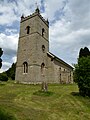
 Hopton Wafers church - geograph.org.uk - 5453757.jpg 1,024 × 768; 217 KB
-
 Hopton Wafers church - geograph.org.uk - 5453759.jpg 1,024 × 768; 183 KB
-
 Hopton Wafers church - geograph.org.uk - 5453761.jpg 1,024 × 768; 204 KB
-
 Hopton Wafers church - geograph.org.uk - 5453762.jpg 768 × 1,024; 216 KB
-
 Hopton Wafers sewage treatment works - geograph.org.uk - 2260670.jpg 640 × 430; 120 KB
-

-
 Horse looking on near Magpie Hill - geograph.org.uk - 2255563.jpg 640 × 430; 45 KB
-
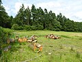
 Horses from the footpath - geograph.org.uk - 2432847.jpg 640 × 480; 73 KB
-
 House and caravans off Stockhall Lane - geograph.org.uk - 2211224.jpg 1,024 × 768; 358 KB
-
-
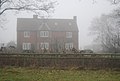
 House near Hoptonbank in the mist - geograph.org.uk - 2257473.jpg 640 × 430; 101 KB
-
 House near Peacock Farm - geograph.org.uk - 2257461.jpg 640 × 430; 108 KB
-
 House, Hopton Wafers - geograph.org.uk - 2260529.jpg 640 × 411; 75 KB
-
 Houses in Hopton Wafers - geograph.org.uk - 2260524.jpg 640 × 374; 49 KB
-
 Knowlebank Hill - geograph.org.uk - 2211194.jpg 1,024 × 768; 262 KB
-
 Lady rider on Clee Hill - geograph.org.uk - 2433099.jpg 640 × 480; 78 KB
-
 Lake, Sproseley Farm - geograph.org.uk - 2261911.jpg 640 × 430; 168 KB
-
 Land drain near Hoptonbank - geograph.org.uk - 2257493.jpg 640 × 430; 159 KB
-
 Lane across Catherton Common - geograph.org.uk - 2211290.jpg 1,024 × 768; 235 KB
-
 Lane Junction, Hopton Wafers - geograph.org.uk - 2260621.jpg 640 × 430; 136 KB
-
 Lane, Catherton - geograph.org.uk - 4421545.jpg 800 × 450; 309 KB
-
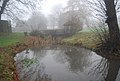
 Little Woodhouse in mist - geograph.org.uk - 2262079.jpg 640 × 430; 51 KB
-
 Lush sheep pasture at Hoptonbank - geograph.org.uk - 2212103.jpg 1,024 × 768; 243 KB
-
 Magpie Hill - geograph.org.uk - 2520114.jpg 640 × 359; 244 KB
-
 Malvern Hills seen from Clee Hill - geograph.org.uk - 2691946.jpg 640 × 359; 78 KB
-
 Manor Cottage, Hopton Wafers.jpg 640 × 430; 110 KB
-
 Marshy area near Peacock Farm - geograph.org.uk - 2257457.jpg 640 × 430; 130 KB
-
 Mast base, Clee Hill Common - geograph.org.uk - 4401010.jpg 800 × 533; 405 KB
-
 Misty lane south of Woodhouse - geograph.org.uk - 2261906.jpg 640 × 430; 86 KB
-
 Misty road to Whatsill - geograph.org.uk - 4273348.jpg 640 × 480; 34 KB
-
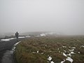 Misty road up Clee Hill - geograph.org.uk - 4273342.jpg 640 × 480; 33 KB
-
 Misty track on Clee Hill - geograph.org.uk - 4273337.jpg 640 × 480; 29 KB
-
 Molehills in the mist - geograph.org.uk - 2257535.jpg 640 × 430; 113 KB
-
 Moorland on Magpie Hill - geograph.org.uk - 2255511.jpg 640 × 430; 45 KB
-
 Murco petrol station at Doddington - geograph.org.uk - 5454346.jpg 1,024 × 768; 180 KB
-

-
-
-
 Old Mill House, Hopton Wafers - geograph.org.uk - 2708280.jpg 640 × 480; 61 KB
-
 Old path, Clee Hill - geograph.org.uk - 2520094.jpg 640 × 480; 309 KB
-
 Old quarry workings, Whatsill - geograph.org.uk - 2255396.jpg 640 × 430; 34 KB
-
 Old small shed in a field - geograph.org.uk - 2707788.jpg 640 × 480; 133 KB
-
 On Catherton Common - geograph.org.uk - 2707896.jpg 640 × 480; 75 KB
-
 Outbuildings at The Manor, Hopton Wafers.jpg 640 × 430; 130 KB
-
 Parkland near Hopton Court - geograph.org.uk - 5453710.jpg 1,024 × 768; 216 KB
-
 Parkland, Hopton Court - geograph.org.uk - 5453717.jpg 1,024 × 768; 197 KB
-
 Part of the hillside on Clee Hill - geograph.org.uk - 2433145.jpg 640 × 480; 79 KB
-

-
 Pasture, Hopton Wafers - geograph.org.uk - 203392.jpg 640 × 480; 102 KB
-
 Path junction on Catherton Common - geograph.org.uk - 2752063.jpg 640 × 480; 94 KB
-
 Path through winter wheat - geograph.org.uk - 2262091.jpg 640 × 430; 43 KB
-
 Quarry track near Whatsill - geograph.org.uk - 2255378.jpg 640 × 430; 28 KB
-
 Random - geograph.org.uk - 2520103.jpg 640 × 359; 224 KB
-
 Random - geograph.org.uk - 2520121.jpg 640 × 359; 211 KB
-
 Rectory Cottage - geograph.org.uk - 2257550.jpg 640 × 430; 93 KB
-
 Road across Catherton Common - geograph.org.uk - 5450981.jpg 1,024 × 768; 177 KB
-
 Road across Catherton Common, near to Catherton - geograph.org.uk - 3178243.jpg 1,024 × 667; 233 KB
-
 Road from Doddington to Earls Ditton - geograph.org.uk - 5454370.jpg 1,024 × 768; 240 KB
-
 Road high up near Clee Hill - geograph.org.uk - 2752089.jpg 640 × 480; 55 KB
-
 Road over the Common - geograph.org.uk - 644938.jpg 640 × 426; 63 KB
-
 Road to Doddington - geograph.org.uk - 2257509.jpg 640 × 430; 108 KB
-
 Road to Hoptonbank - geograph.org.uk - 2257503.jpg 640 × 430; 94 KB
-
 Road, Clee Hill Common - geograph.org.uk - 4401005.jpg 800 × 533; 423 KB
-
 Rough grazing on Catherton Common - geograph.org.uk - 5451569.jpg 1,024 × 768; 275 KB
-
 Round bales, Earls Ditton - geograph.org.uk - 4421528.jpg 640 × 426; 292 KB
-

-
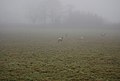
 Sheep huddled in the mist - geograph.org.uk - 2261899.jpg 640 × 430; 96 KB
-
 Sheep in the mist near Hopton Wafer - geograph.org.uk - 2257564.jpg 640 × 430; 104 KB
-
 Sheep in the mist near Hopton Wafers - geograph.org.uk - 2260519.jpg 640 × 430; 47 KB
-
 Sheep near Sproseley Farm - geograph.org.uk - 2261908.jpg 640 × 430; 95 KB
-
 Shropshire Way signposted of A4117 - geograph.org.uk - 2257558.jpg 640 × 430; 122 KB
-
 Silvington Common - geograph.org.uk - 2211387.jpg 1,024 × 768; 375 KB
-
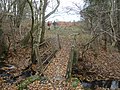
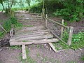 Sleeper footbridge - geograph.org.uk - 2432735.jpg 640 × 480; 134 KB
-
 Small lake, Sproseley Farm - geograph.org.uk - 2261910.jpg 640 × 430; 134 KB
-
 Small stream by the footpath - geograph.org.uk - 2257529.jpg 640 × 430; 167 KB
-
 Snow on a quarry spoil heap - geograph.org.uk - 2255366.jpg 640 × 430; 24 KB
-

-
 Stile and gate - geograph.org.uk - 2257484.jpg 640 × 430; 114 KB
-
 Stile near Foxwood - geograph.org.uk - 2257526.jpg 640 × 430; 175 KB
-
 Stile near Little Woodhouse - geograph.org.uk - 2262083.jpg 640 × 430; 65 KB
-
 Stile near the A4117 - geograph.org.uk - 2257531.jpg 640 × 430; 139 KB
-
-

-

-
 Stile, Shropshire Way - geograph.org.uk - 2261913.jpg 640 × 430; 120 KB
-
 Stile, Shropshire Way, Hopton Wafers - geograph.org.uk - 2260528.jpg 640 × 430; 202 KB
-
-
 Stockhall Lane - geograph.org.uk - 2260675.jpg 640 × 430; 127 KB
-
 Stockhall Lane - geograph.org.uk - 2261901.jpg 640 × 430; 94 KB
-
 Stockhall Lane - geograph.org.uk - 5454340.jpg 1,024 × 768; 258 KB
-
 Stockhall Lane at Woodhouse - geograph.org.uk - 2261904.jpg 640 × 430; 102 KB
-
 Stockhall Lane in mist - geograph.org.uk - 2261888.jpg 640 × 430; 115 KB
-
 The A4117 - geograph.org.uk - 2257540.jpg 640 × 430; 96 KB
-
 The Common, Clee Hill - geograph.org.uk - 2520108.jpg 640 × 359; 219 KB
-
 The Common, Clee Hill - geograph.org.uk - 2532533.jpg 640 × 480; 312 KB
-

-

-
 The Manor, Hopton Wafers.jpg 640 × 480; 104 KB
-
 The Stocking near Hopton Wafers - geograph.org.uk - 2752106.jpg 640 × 480; 69 KB
-
 The track to Whatsill - geograph.org.uk - 2255368.jpg 640 × 430; 25 KB
-
 The Village, Hopton Wafers.jpg 1,024 × 768; 220 KB
-
 Titterstone Clee from Catherton Common - geograph.org.uk - 5857289.jpg 1,280 × 800; 625 KB
-
 Track above Hoptonbank - geograph.org.uk - 2433056.jpg 640 × 480; 82 KB
-
 Track and bridleway on Catherton Common - geograph.org.uk - 5451545.jpg 1,024 × 768; 257 KB
-
 Track to Doddington - geograph.org.uk - 2255519.jpg 640 × 430; 54 KB
-
 Track to Foxwood - geograph.org.uk - 2257448.jpg 640 × 430; 114 KB
-
 Track to Hoptonbank - geograph.org.uk - 2257477.jpg 640 × 430; 138 KB
-
 Track to the A4117 - geograph.org.uk - 2257519.jpg 640 × 430; 118 KB
-
 Tracks divide, Whatsill - geograph.org.uk - 2255398.jpg 640 × 430; 27 KB
-

-
 Two trees at Whatsill - geograph.org.uk - 2255389.jpg 640 × 430; 34 KB
-
 View across Catherton Common - geograph.org.uk - 5451584.jpg 1,024 × 768; 299 KB
-
 View to Magpie Hill - geograph.org.uk - 5450984.jpg 1,024 × 768; 209 KB
-
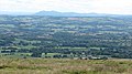
 View to the south east over farmland - geograph.org.uk - 5454364.jpg 1,024 × 768; 254 KB
-
 Wall by an entrance to Hopton Court - geograph.org.uk - 2260689.jpg 640 × 430; 94 KB
-
 Wall Hopton Court - geograph.org.uk - 2260693.jpg 640 × 430; 40 KB
-
 Warning sign near The Birches - geograph.org.uk - 2211421.jpg 1,024 × 768; 278 KB
-
 Waymark in the mist, Whatsill - geograph.org.uk - 2255393.jpg 640 × 430; 24 KB


