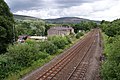
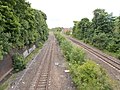
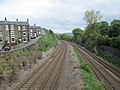
Category:Huddersfield Line
English: The Huddersfield Line connects Leeds and Huddersfield with Manchester (Victoria & Piccadilly), Manchester Airport and Liverpool.
Main Wikipedia article: Huddersfield Line.
inter-regional railway in Northern England  | |||||
| Upload media | |||||
| Instance of | |||||
|---|---|---|---|---|---|
| Location | Yorkshire and the Humber, England | ||||
| Owned by | |||||
| Operator | |||||
| Terminus | |||||
| |||||
Subcategories
This category has the following 33 subcategories, out of 33 total.
A
B
- Batley railway station (19 F)
C
D
- Deighton railway station (9 F)
- Diggle railway station (3 F)
- Dragon Bridge, Leeds (6 F)
G
- Greenfield railway station (36 F)
H
- Huddersfield Tunnels (7 F)
L
M
- Marsden railway station (37 F)
- Miles Platting Junction (2 F)
- Mirfield railway station (23 F)
- Morley Tunnel (6 F)
- Mossley railway station (43 F)
P
- Park railway station (2 F)
R
- Railway cutting at Horbury (6 F)
- Ravensthorpe railway station (20 F)
S
- Slaithwaite railway station (19 F)
- Stalybridge railway station (181 F)
W
- Whitehall Junction, Leeds (13 F)
Media in category "Huddersfield Line"
The following 67 files are in this category, out of 67 total.
-
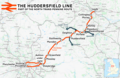 Huddersfield line.png 2,062 × 1,336; 2.52 MB
-
 Huddersfield line.svg 1,417 × 921; 3.15 MB
-
 Addingford Lane bridge - geograph.org.uk - 6184091.jpg 1,024 × 768; 238 KB
-

-
 Approaching Standedge Tunnel - geograph.org.uk - 5036466.jpg 1,280 × 851; 554 KB
-
 Approaching the railway bridge on Dudfleet Lane - geograph.org.uk - 6184498.jpg 1,024 × 768; 184 KB
-
 Ashton Moss Curve - geograph.org.uk - 1398828.jpg 640 × 480; 196 KB
-

-
 Batley signal box Rutland Road - geograph.org.uk - 6261540.jpg 1,024 × 768; 169 KB
-
 Battyeford - railway footbridge - geograph.org.uk - 1579582.jpg 640 × 480; 146 KB
-

-
 Bradley Junction from Colliery Bridge - geograph.org.uk - 4318731.jpg 1,148 × 1,075; 241 KB
-
 Branch Street Bridge MLV3-84 - geograph.org.uk - 5608763.jpg 1,600 × 1,200; 692 KB
-
 Bridge BRB ROY 38 - Headfield Road - geograph.org.uk - 3932742.jpg 640 × 480; 66 KB
-
 Bridge MVL3-81 - Clough Lane, Paddock - geograph.org.uk - 921688.jpg 640 × 522; 279 KB
-
 BridgeBBW-1 - Station Road, Bradley - geograph.org.uk - 762574.jpg 640 × 403; 70 KB
-
 Building site near Woodend Road, Hopton - geograph.org.uk - 470599.jpg 640 × 480; 102 KB
-
 Calder Bank Mills, Dewsbury - geograph.org.uk - 2198506.jpg 640 × 480; 61 KB
-
 Canal and railway at Tunnel End - geograph.org.uk - 1883598.jpg 1,024 × 768; 162 KB
-
 Closed footpath at the end of Royds Lane - geograph.org.uk - 5718802.jpg 683 × 1,024; 320 KB
-

-
 Cooper-Bridge-entrance-by-Humphrey-Bolton.jpg 640 × 473; 87 KB
-
 Dewsbury Junction, looking west - geograph.org.uk - 5260615.jpg 1,024 × 768; 76 KB
-
 Diggle - geograph.org.uk - 5448103.jpg 3,456 × 5,184; 1.61 MB
-
 Eastern approach to Standedge Rail Tunnel - geograph.org.uk - 3571370.jpg 2,936 × 2,223; 3.64 MB
-
 Former engine shed, Hopton, Mirfield - geograph.org.uk - 282086.jpg 640 × 472; 145 KB
-
 Horbury Cutting - geograph.org.uk - 787001.jpg 640 × 427; 99 KB
-

-
 Huddersfield line passes under Stamford Street East, Ashton-under-Lyne.JPG 4,320 × 3,240; 5.26 MB
-
 Huddersfield to Manchester Railway - geograph.org.uk - 1164919.jpg 640 × 480; 118 KB
-
 Huddersfield to Manchester Railway - geograph.org.uk - 479686.jpg 640 × 480; 132 KB
-
 Huddersfield to Manchester Railway - geograph.org.uk - 479688.jpg 640 × 480; 171 KB
-
 Level Crossing near Howley Mill Lane - geograph.org.uk - 1204434.jpg 640 × 427; 99 KB
-
 Level crossing on Rutland Road - geograph.org.uk - 6261501.jpg 1,024 × 768; 196 KB
-

-

-

-
 Old bridge near LS11 0EA.jpg 4,608 × 3,456; 3.69 MB
-
 Paddock Cutting - geograph.org.uk - 5608759.jpg 1,600 × 1,200; 447 KB
-

-
 Quick ^^ - geograph.org.uk - 63302.jpg 640 × 480; 171 KB
-
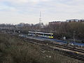 Rail and tram lines near Manchester Victoria (1).jpg 4,320 × 3,240; 3.49 MB
-
 Rail and tram lines near Manchester Victoria (2).jpg 4,320 × 3,240; 3.84 MB
-
 Rail lines at Horbury Junction - geograph.org.uk - 808251.jpg 640 × 480; 71 KB
-
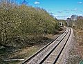
 Railway at Wortley - geograph.org.uk - 2164660.jpg 640 × 480; 69 KB
-
 Railway Bridge from Addingford Steps - geograph.org.uk - 845735.jpg 640 × 480; 149 KB
-

-

-
 Railway bridge number, Thornhill - geograph.org.uk - 966792.jpg 640 × 638; 83 KB
-

-

-
 Railway towards Cottingley Station (geograph 6392400).jpg 800 × 630; 140 KB
-
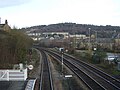 Railway towards Leeds - geograph.org.uk - 4309246.jpg 640 × 480; 72 KB
-
 Single-track (3407762908).jpg 2,467 × 1,915; 5.73 MB
-

-
 The railway line between Mossley and Stalybridge - geograph.org.uk - 1997313.jpg 3,872 × 2,592; 5.72 MB
-

-
 Towards Batley station - geograph.org.uk - 6261703.jpg 1,024 × 768; 155 KB
-
 Trans-Pennine Routes.svg 2,793 × 1,577; 4.72 MB
-
 Tunnel End, Marsden - geograph.org.uk - 949452.jpg 640 × 480; 122 KB
-
 View from Bridge - Millfield Road - geograph.org.uk - 4516860.jpg 640 × 480; 96 KB
-
 View from Bridge - Millfield Road - geograph.org.uk - 4516863.jpg 640 × 480; 117 KB
-

-

-
-

-


,_Steanard_Lane,_Hopton_-_geograph.org.uk_-_725918.jpg)


.jpg)
.jpg)


.jpg)

.jpg)


