Category:Huerfano County, Colorado
Counties of Colorado: Adams · Alamosa · Arapahoe · Archuleta · Baca · Bent · Boulder · Chaffee · Cheyenne · Clear Creek · Conejos · Costilla · Crowley · Custer · Delta · Dolores · Douglas · Eagle · El Paso · Elbert · Fremont · Garfield · Gilpin · Grand · Gunnison · Hinsdale · Huerfano · Jackson · Jefferson · Kiowa · Kit Carson · Lake · La Plata · Larimer · Las Animas · Lincoln · Logan · Mesa · Mineral · Moffat · Montezuma · Montrose · Morgan · Otero · Ouray · Park · Phillips · Pitkin · Prowers · Pueblo · Rio Blanco · Rio Grande · Routt · Saguache · San Juan · San Miguel · Sedgwick · Summit · Teller · Washington · Weld · Yuma
City-counties: Broomfield · Denver
City-counties: Broomfield · Denver
county in Colorado, United States    | |||||
| Upload media | |||||
| Instance of | |||||
|---|---|---|---|---|---|
| Named after | |||||
| Location | Colorado | ||||
| Capital | |||||
| Inception |
| ||||
| Population |
| ||||
| Area |
| ||||
| official website | |||||
 | |||||
Huerfano County is a county in Colorado, United States.
Subcategories
This category has the following 10 subcategories, out of 10 total.
Media in category "Huerfano County, Colorado"
The following 44 files are in this category, out of 44 total.
-
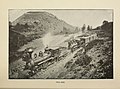 "Around the circle. (1892) (14760680382).jpg 3,440 × 2,541; 2.14 MB
-
 HEAP(1854) p038 PLATE II. SPANISH PEAKS.jpg 2,152 × 1,406; 2.03 MB
-
 HEAP(1854) p041 PLATE III. HUERFANO CANON.jpg 2,122 × 1,394; 1.98 MB
-

-
 BNSF Spanish Peaks Subdivision 1.JPG 6,000 × 3,000; 12.9 MB
-
 BNSF Spanish Peaks Subdivision 2.JPG 6,000 × 2,926; 11.21 MB
-
 Carbon dioxide pipeline warning sign.JPG 5,303 × 3,603; 6.91 MB
-
 Devil’s Stairsteps.JPG 5,631 × 3,775; 14.89 MB
-
 Gosshomesteadbarn.jpg 792 × 428; 87 KB
-
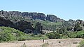
 Greenhorn Mountain.JPG 4,951 × 2,662; 11.36 MB
-
 Huerfano County Fire Protection District Station 2.JPG 6,000 × 3,729; 13.44 MB
-
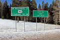
 Huerfano County sign.JPG 4,384 × 2,648; 8.35 MB
-
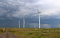 Huerfano River Wind Farm.JPG 5,724 × 3,609; 11.56 MB
-
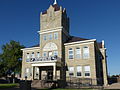 HuerfanoCoCourthLudlowMassacre day.JPG 1,985 × 1,489; 1,009 KB
-
 HuerfanoCoCourthLudlowMassacre night.JPG 1,756 × 1,317; 445 KB
-
 La Veta Pass.JPG 5,184 × 3,456; 16.06 MB
-
-
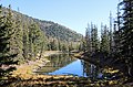 Lower Blue Lake (Huerfano County, Colorado).JPG 5,504 × 3,623; 15.05 MB
-
 Navajo Western Water District office.JPG 5,087 × 3,464; 10.83 MB
-
 North and South Rattlesnake Buttes.JPG 5,218 × 2,960; 8.38 MB
-

-
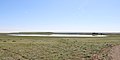 Orlando Reservoir Number 2.JPG 5,378 × 2,685; 8.25 MB
-
 Parallel magmatic dikes.JPG 4,576 × 2,592; 12.36 MB
-
 Pass Creek Pass.JPG 5,218 × 3,475; 13.2 MB
-
 Promontory Divide.JPG 4,991 × 3,516; 8.74 MB
-
 Sangre de Cristo Pass.JPG 4,772 × 2,668; 10.39 MB
-
 Silver Mountain (Huerfano County, Colorado).JPG 5,925 × 3,464; 22.09 MB
-
 Silver Mountain Dike.JPG 5,943 × 3,389; 17.75 MB
-

-
 Spanish Peaks Airfield.JPG 5,637 × 3,781; 15.26 MB
-
 Spanish Peaks Country sign.JPG 2,220 × 1,283; 2.12 MB
-
 Spring Creek Fire burn scar.JPG 5,937 × 2,817; 10.34 MB
-
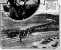 Strikers March on Mine in Huerfano County (1927).png 798 × 650; 619 KB
-
 Taos Trail.JPG 4,209 × 3,228; 12.25 MB
-
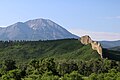
 Trinchera Peak.jpg 4,272 × 1,991; 4.33 MB
-
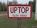 Uptop Elev. 9382.jpg 2,848 × 2,136; 1.95 MB
-
 USA Huerfano County, Colorado age pyramid.svg 520 × 600; 7 KB
-
 Variable-message road sign in Huerfano County.JPG 3,650 × 1,924; 3.64 MB
-
-
 West Spanish Peak and a dike.JPG 6,000 × 4,000; 13.69 MB
-
 West Spanish Peak, Colorado.jpeg 1,200 × 1,600; 635 KB
-
 West Spanish Peaks radial dikes.JPG 5,088 × 2,485; 12.96 MB
-
 Wildflower along US160 between Walsenburg and Fort Garland in Colorado.jpg 2,048 × 1,360; 2.08 MB
-
 Wolf Springs Ranch.JPG 5,747 × 2,993; 10.3 MB
_(14760680382).jpg)
_p038_PLATE_II._SPANISH_PEAKS.jpg)
_p041_PLATE_III._HUERFANO_CANON.jpg)


.JPG)


.JPG)


.png)


