Category:Pueblo County, Colorado
Counties of Colorado: Adams · Alamosa · Arapahoe · Archuleta · Baca · Bent · Boulder · Chaffee · Cheyenne · Clear Creek · Conejos · Costilla · Crowley · Custer · Delta · Dolores · Douglas · Eagle · El Paso · Elbert · Fremont · Garfield · Gilpin · Grand · Gunnison · Hinsdale · Huerfano · Jackson · Jefferson · Kiowa · Kit Carson · Lake · La Plata · Larimer · Las Animas · Lincoln · Logan · Mesa · Mineral · Moffat · Montezuma · Montrose · Morgan · Otero · Ouray · Park · Phillips · Pitkin · Prowers · Pueblo · Rio Blanco · Rio Grande · Routt · Saguache · San Juan · San Miguel · Sedgwick · Summit · Teller · Washington · Weld · Yuma
City-counties: Broomfield · Denver
City-counties: Broomfield · Denver
county in Colorado, United States   | |||||
| Upload media | |||||
| Instance of | |||||
|---|---|---|---|---|---|
| Named after | |||||
| Location | Colorado | ||||
| Capital | |||||
| Inception |
| ||||
| Population |
| ||||
| Area |
| ||||
| official website | |||||
 | |||||
Pueblo County is a county in Colorado, United States.
Subcategories
This category has the following 15 subcategories, out of 15 total.
B
C
- Chico Cemetery (Colorado) (10 F)
E
F
G
H
M
P
- Pueblo County High School (10 F)
S
- Signs in Pueblo County, Colorado (28 F)
T
Media in category "Pueblo County, Colorado"
The following 38 files are in this category, out of 38 total.
-

-
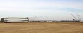
 A long, passing freight train near Avondale in rural Pueblo County, Colorado LCCN2015632762.tif 7,360 × 4,912; 206.9 MB
-
 A long, passing freight train near Avondale in rural Pueblo County, Colorado LCCN2015632763.tif 7,360 × 4,912; 206.9 MB
-
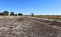
 A winding dirt road near Boone in rural Pueblo County, Colorado LCCN2015632775.tif 7,360 × 4,912; 206.9 MB
-
 Autobees, Colorado.JPG 5,709 × 3,446; 15.38 MB
-
 Colorado Bureau of Investigation.JPG 3,688 × 2,500; 6.98 MB
-
 Comanche Generating Station.JPG 3,366 × 2,190; 3.84 MB
-
 Comanche Solar Layout.jpg 1,018 × 701; 130 KB
-
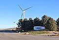
 Comanche Solar Project.JPG 6,000 × 3,472; 13.7 MB
-
 Comisario de Pueblo Amuzgo Tierra Colorada.jpg 543 × 960; 125 KB
-
 Confluence of the Arkansas River and Fountain Creek.JPG 6,000 × 3,504; 11.97 MB
-
 County cornerstone.jpg 3,304 × 2,034; 2.96 MB
-
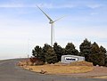
 CS Wind entrance in Pueblo County, Colorado.JPG 4,634 × 3,182; 8.53 MB
-
 Fort Reynolds (Colorado) historical marker erected in 1932 - (cropped).JPG 1,146 × 1,527; 1.66 MB
-
 Fort Reynolds (Colorado) historical marker.JPG 4,868 × 3,754; 15.84 MB
-
 Greenhorn Mountain.JPG 4,951 × 2,662; 11.36 MB
-
 Greenhorn Valley.JPG 5,955 × 3,117; 13.33 MB
-
 Huerfano River.JPG 4,050 × 3,411; 13.18 MB
-
 I-25 Speedway Pit Entrance sign, Pueblo County, Colorado.jpg 2,848 × 2,136; 2 MB
-
 I-25SBMM80CO.jpg 2,845 × 1,896; 1,019 KB
-
 Interstate 25 in southern Pueblo County.JPG 5,093 × 2,889; 13.04 MB
-
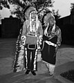 IronEyesCody.jpg 3,566 × 3,988; 7.27 MB
-
 KOA sign, Pueblo County, CO.jpg 2,848 × 2,136; 1.66 MB
-
 Meadow and mountain view near Rye in Pueblo County, Colorado LCCN2015632553.tif 7,360 × 4,912; 206.9 MB
-
 Old county entrance.jpg 3,930 × 2,258; 1.48 MB
-
 Pueblo Reservoir State Wildlife Area sign.JPG 3,531 × 2,414; 6.45 MB
-
 Pueblo, Colorado weather radar.JPG 4,166 × 2,235; 4.98 MB
-
 Saint Charles Reservoir (Colorado).JPG 5,337 × 2,587; 6.69 MB
-
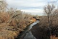 Saint Charles River (Colorado).JPG 5,184 × 3,456; 14.08 MB
-
 Saint Vrain Cemetery.JPG 5,819 × 3,080; 12.77 MB
-
 SEBS.jpg 3,008 × 2,000; 2.54 MB
-

-
 Stem Beach, Colorado.JPG 6,000 × 4,000; 14.28 MB
-
 USA Pueblo County, Colorado age pyramid.svg 520 × 600; 7 KB
-
 Vestas factory (Pueblo, Colorado).JPG 4,547 × 1,819; 4.7 MB
-
 Vestas Wind Systems entrance in Pueblo County, Colorado.JPG 4,097 × 3,095; 7.29 MB
-
 Wall of sebs.jpg 4,032 × 3,024; 1.74 MB
-
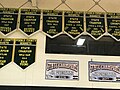 Wrestling banners.jpg 4,032 × 3,024; 2.64 MB


_historical_marker_erected_in_1932_-_(cropped).JPG)
_historical_marker.JPG)


.JPG)
.JPG)


.JPG)