Category:Ine, Kyoto
Kyoto prefecture | ||
|---|---|---|
| 11 wards of Kyoto | Nishikyō-ku ・ Ukyō-ku ・ Kita-ku ・ Sakyō-ku ・ Kamigyō-ku ・ Nakagyō-ku ・ Shimogyō-ku ・ Minami-ku ・ Higashiyama-ku ・ Yamashina-ku ・ Fushimi-ku |  |
| other cities | ||
| towns | ||
| village | ||
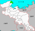
town in Yosa district, Kyoto prefecture, Japan     | |||||
| Upload media | |||||
| Instance of | |||||
|---|---|---|---|---|---|
| Location | Yosa district, Kyoto Prefecture, Japan | ||||
| Located in or next to body of water | |||||
| Legal form |
| ||||
| Inception |
| ||||
| Population |
| ||||
| Area |
| ||||
| Replaces |
| ||||
| official website | |||||
 | |||||
English: Ine town in Kyoto prefecture, Japan.
日本語: 日本の京都府与謝郡にある伊根町。
Subcategories
This category has the following 5 subcategories, out of 5 total.
B
C
E
G
T
Media in category "Ine, Kyoto"
The following 12 files are in this category, out of 12 total.
-
 Emblem of Ine, Kyoto.jpg 107 × 113; 2 KB
-
 Emblem of Ine, Kyoto.svg 106 × 111; 2 KB
-
 Flag of Ine, Kyoto.jpg 364 × 231; 8 KB
-
 Flag of Ine, Kyoto.svg 324 × 216; 2 KB
-
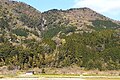 Ine Nunobiki Waterfall 2021-04 ac.jpg 1,597 × 1,064; 733 KB
-
 Ine.PNG 432 × 390; 11 KB
-
 Wakasa bay around Ine town (29654487396).jpg 5,934 × 3,956; 11.5 MB
-
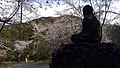
 丹後大仏と桜.jpg 3,264 × 1,836; 4.64 MB
-
 丹後大仏と桜2.jpg 3,264 × 1,836; 4.37 MB
-
 丹後大仏と桜3.jpg 3,264 × 1,836; 4 MB
-
 丹後大仏と桜4.jpg 3,264 × 1,836; 4.99 MB
-
 伊根ブリ丼 Buri Don.jpg 3,648 × 2,736; 2.59 MB


.jpg)


