Category:Ingestre
English: Ingestre is a village civil parish in Staffordshire, England. It is four miles to the north-east of the county town of Stafford.
village and civil parish in Staffordshire, UK | |||||
| Upload media | |||||
| Instance of | |||||
|---|---|---|---|---|---|
| Location | Stafford, Staffordshire, West Midlands, England | ||||
| Said to be the same as | Ingestre (Wikimedia duplicated page, civil parish) | ||||
 | |||||
Subcategories
This category has the following 2 subcategories, out of 2 total.
H
M
Media in category "Ingestre"
The following 42 files are in this category, out of 42 total.
-
 Birch Hall Farm - geograph.org.uk - 3110655.jpg 3,872 × 2,592; 3.49 MB
-

-

-

-
 Farley Farm - geograph.org.uk - 385315.jpg 640 × 375; 55 KB
-
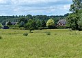
 Farm Buildings, Home Farm.jpg 640 × 428; 91 KB
-
 Farm Track to Birch Hall Farm - geograph.org.uk - 598732.jpg 640 × 427; 53 KB
-
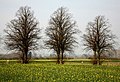
 Field by Little Ingestre - geograph.org.uk - 3110917.jpg 3,872 × 2,592; 4.83 MB
-
 Field full of Rapeseed - geograph.org.uk - 385759.jpg 640 × 439; 103 KB
-
 Hoomill Cottages along the River Trent - geograph.org.uk - 4562046.jpg 1,024 × 720; 248 KB
-
 Ingestre Hall, Staffordshire - wall corner - geograph.org.uk - 2003288.jpg 1,600 × 1,200; 597 KB
-
 Ingestre Scene - geograph.org.uk - 3843271.jpg 800 × 600; 94 KB
-
 Ingestre View - geograph.org.uk - 3843266.jpg 800 × 600; 181 KB
-
 Ingestre village - geograph.org.uk - 3110783.jpg 3,872 × 2,592; 4.97 MB
-
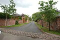
 Lion Lodges Gates - geograph.org.uk - 3110927.jpg 3,872 × 2,592; 4.97 MB
-
 Little Ingestre, Great Haywood - geograph.org.uk - 2471665.jpg 640 × 428; 80 KB
-
 Manor Road - geograph.org.uk - 3110800.jpg 3,872 × 2,592; 4.67 MB
-
 Part of the ha-ha of Ingestre Hall - geograph.org.uk - 3110661.jpg 3,872 × 2,592; 5.9 MB
-

-
 Rectory View - geograph.org.uk - 3843259.jpg 800 × 600; 203 KB
-
 St Mary's Church, Ingestre (interior) - geograph.org.uk - 4461438.jpg 640 × 427; 359 KB
-
 St Mary's Church, Ingestre - geograph.org.uk - 4461457.jpg 640 × 512; 466 KB
-
 St Mary's Church, Ingestre - geograph.org.uk - 4461461.jpg 406 × 640; 451 KB
-

-

-

-

-

-

-

-
 Track to Ingestre - geograph.org.uk - 598745.jpg 640 × 427; 62 KB
-
 Track to Shirleywich from Ingestre - geograph.org.uk - 598737.jpg 640 × 427; 88 KB
-
 Trent and Mersey Canal - geograph.org.uk - 385765.jpg 640 × 496; 69 KB
-
 Trent and Mersey Canal at Pasturefields - geograph.org.uk - 385771.jpg 640 × 480; 107 KB
-
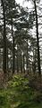
 Woodland At Hanyards - geograph.org.uk - 385692.jpg 640 × 427; 66 KB
-
 Woodland At Hanyards - geograph.org.uk - 385703.jpg 253 × 640; 67 KB
-
 Dwelling near to Pasturefields. - geograph.org.uk - 385338.jpg 640 × 306; 46 KB
-
 Fields at Tixall Farm - geograph.org.uk - 60489.jpg 610 × 458; 35 KB
-
 Hanyards Farms Sign - geograph.org.uk - 385696.jpg 606 × 640; 91 KB
-
 Little Ingestre - geograph.org.uk - 60508.jpg 581 × 411; 101 KB
-
 Railway bridge - geograph.org.uk - 385333.jpg 640 × 425; 72 KB
-
 Railway Bridge No. 138 - geograph.org.uk - 385321.jpg 640 × 494; 71 KB


_-_geograph.org.uk_-_4461438.jpg)


_-_geograph.org.uk_-_4461431.jpg)

_-_geograph.org.uk_-_4461405.jpg)
_-_geograph.org.uk_-_4461410.jpg)


