Category:Inn River in Landkreis Rosenheim
Urban districts (cities): Passau · Rosenheim ·
Subcategories
This category has the following 9 subcategories, out of 9 total.
Media in category "Inn River in Landkreis Rosenheim"
The following 49 files are in this category, out of 49 total.
-
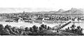 Rosenheim 1860 A.jpg 627 × 273; 100 KB
-
 Rosenheim 1860.jpg 627 × 408; 102 KB
-
 2019 Kraftwerk Rosenheim.jpg 4,608 × 2,592; 2.67 MB
-
 Aerials Bavaria 16.06.2006 09-09-42.jpg 2,048 × 1,536; 2.82 MB
-
 Aerials Bavaria 16.06.2006 09-10-00.jpg 2,048 × 1,536; 2.91 MB
-
 Aerials Bavaria 16.06.2006 09-10-06.jpg 2,048 × 1,476; 2.66 MB
-
 Aerials Bavaria 16.06.2006 11-46-01.jpg 2,048 × 1,288; 2.64 MB
-
 Aerials Bavaria 16.06.2006 11-46-08.jpg 1,787 × 1,339; 1.78 MB
-
 Aerials Bavaria 16.06.2006 11-46-48.jpg 2,048 × 1,536; 3.12 MB
-
 Auerbach - Mündung in den Inn.jpg 2,592 × 1,944; 1.35 MB
-
 Biberschaden (13031744614).jpg 4,096 × 2,731; 2.04 MB
-
 Biberschaden, Biberverbiss (13031512175) (2).jpg 4,096 × 2,731; 1.69 MB
-
 Biberschaden, Biberverbiss (13031533015).jpg 4,096 × 2,731; 3.12 MB
-
 Der Inn ... bei Rosenheim (8346241207).jpg 1,024 × 681; 274 KB
-
 Der Inn bei Wasserburg - geo.hlipp.de - 42657.jpg 640 × 480; 139 KB
-
 Der Inn bei Wasserburg - geo.hlipp.de - 42658.jpg 640 × 480; 111 KB
-
 Hannover Rom -Luftaufnahmen- 2014 by-RaBoe 056.jpg 2,500 × 1,661; 1,006 KB
-
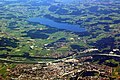
 Heuberg vom Farrenpoint-1.jpg 2,400 × 1,700; 513 KB
-
 Hochries1.jpg 922 × 615; 81 KB
-
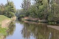
 Inn 01.JPG 3,648 × 2,736; 3.96 MB
-
 Inn 02 Attel.JPG 3,648 × 2,736; 4.36 MB
-
 Inn bei Pfraundorf Raubling-1.jpg 5,395 × 3,220; 4.04 MB
-
 Inn bei Pfraundorf Raubling-2.jpg 3,648 × 5,472; 4.8 MB
-
 Inn in Neubeuern.png 800 × 450; 335 KB
-
 Inn Richtung Süden.jpeg 4,928 × 3,264; 5.34 MB
-
 Inn Rosenheim GO-1.jpg 2,592 × 1,944; 1.28 MB
-
 Inn Thansau Rohrdorf-1.jpg 5,260 × 3,420; 2.92 MB
-
 Inn Thansau Rohrdorf-2.jpg 5,470 × 3,475; 4.3 MB
-
 Inn Thansau Rohrdorf-3.jpg 5,295 × 3,525; 4.77 MB
-
 Inn valley through Rosenheim as far as Wasserburg am Inn - radar image by TerraSAR-X.jpg 2,204 × 1,570; 4.87 MB
-
 Innbruecke koenigswart mit VT628.jpg 2,288 × 1,712; 2.59 MB
-
 Inndamm bei Pfraundorf Raubling-1.jpg 5,472 × 3,648; 4.23 MB
-
 Inntal Panorama bei Nußdorf am Inn.jpg 12,544 × 2,176; 5.91 MB
-
 Kaisergebirge Inn Reisach Oberaudorf-1.jpg 5,472 × 3,648; 3.53 MB
-
 Kilometertafel am Inn bei Pfraundorf Raubling-1.jpg 3,248 × 5,110; 3.56 MB
-
 Kranzhorn Inn bei Nussdorf-1.jpg 5,472 × 3,648; 5.06 MB
-
 Kranzhorn Inn Erl-1.jpg 5,395 × 3,205; 2.61 MB
-
 Kranzhorn Inndamm bei Fischbach Nussdorf-1.jpg 5,472 × 3,648; 2.84 MB
-
 Lwk-teufelsbruck.jpg 800 × 443; 177 KB
-
 Milestone Inn 164.2.jpg 2,560 × 1,920; 2.22 MB
-
 Muendung Kirchbach in den Inn Raubling-1.jpg 5,472 × 3,648; 3.55 MB
-
 Muendung Kirchbach in den Inn Raubling-2.jpg 5,472 × 3,648; 4.62 MB
-
 Riesenkopf, Aussicht Heuberg.jpg 2,592 × 1,944; 1,001 KB
-
 Riesenkopf, Flintsbach, Brannenburg.jpg 2,592 × 1,944; 1,015 KB
-
 Rosenheim, X, aufgehellt.jpeg 3,000 × 2,000; 1.7 MB
-
 Rosenheim.JPG 3,000 × 2,000; 1,023 KB
-
 Stephanskirchen, Mündung Rohrdorfer Aachen, 1.jpeg 3,600 × 2,368; 5.25 MB
-
 Stephanskirchen, Mündung Rohrdorfer Achen v SO, 2.jpeg 5,056 × 3,792; 9.57 MB
-
 UnterinntalObb InnOberaudorf.jpg 1,226 × 920; 348 KB


.jpg)
_(2).jpg)
.jpg)
.jpg)


