Category:January 2007 in Kent
Deutsch: Bilder, die im Januar 2007 in Kent aufgenommen worden sind. Bitte beachten Sie, dass dies weder das Datum des Uploads noch das Datum des Scannens eines Fotos ist.
English: Images/pictures taken in Kent during January 2007. Note this is not the date of the upload, nor the date a photo was scanned.
Español: Fotografías o imágenes tomadas en Kent durante enero 2007. No es la fecha de subida ni escaneo, sino la fecha en que las fotografías o imágenes se crearon.
Esperanto: Bildoj faritaj en Kent en januaro 2007. Tio ne estas la dato, kiam la bildoj estis alŝutitaj aŭ skanitaj.
Français : Photographies ou images prises en Kent durant janvier 2007. Ce n'est pas la date du téléchargement ou du scan.
Galego: Fotografías ou imaxes tomadas en Kent durante xaneiro 2007. Non é a data de subida nin escaneamento, senón a data na que se crearon as fotografías ou imaxes.
Italiano: Fotografie o immagini scattate a Kent nel gennaio 2007. Nota bene: la data non si riferisce né a quella di upload né a quella in cui la foto è stata digitalizzata.
Norsk bokmål: Bilder tatt i Kent i løpet av januar 2007. Merk at dette ikke er datoen for opplasting, eller når et bilde har blitt skannet.
Norsk nynorsk: Bilete teke i Kent i løpet av januar 2007. Merk at dette ikkje er datoen for opplasting, eller når eit bilete har vorte skanna.
Русский: Изображения, сделанные в Kent в течение январь 2007 (не дата загрузки изображения).
Українська: Зображення, зроблені в Kent протягом січень 2007. Зауважте, що це не дата завантаження чи дата сканування фотографії.
| January 2006 | ← | January 2007 | → | January 2008 | |||||||
| Jan | Feb | Mar | Apr | May | Jun | Jul | Aug | Sep | Oct | Nov | Dec |
| 52 | 92 | 126 | 165 | 55 | 76 | 58 | 39 | 61 | 99 | 45 | 94 |
|---|---|---|---|---|---|---|---|---|---|---|---|
Subcategories
This category has the following 2 subcategories, out of 2 total.
2
C
Media in category "January 2007 in Kent"
The following 50 files are in this category, out of 50 total.
-
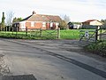 'Corby Farm' Ratling. - geograph.org.uk - 311432.jpg 640 × 480; 100 KB
-
 375812 A Ashford International.JPG 2,048 × 1,536; 1.04 MB
-

-
 Barn full of straw, Knowlton. - geograph.org.uk - 304161.jpg 640 × 480; 161 KB
-
 Birchington-on-Sea railway station 1.jpg 427 × 640; 60 KB
-

-
 Detail on 'The Ratling Club' - geograph.org.uk - 311411.jpg 640 × 480; 118 KB
-
 Detail on the Blue Plaque, Duck Inn. - geograph.org.uk - 323637.jpg 640 × 480; 182 KB
-
 Dover Priory station - geograph.org.uk - 1580507.jpg 640 × 481; 48 KB
-
 Dry ford and river bed, Bridge. - geograph.org.uk - 323691.jpg 640 × 480; 247 KB
-
 Edwards Bar and Brasserie - geograph.org.uk - 324073.jpg 640 × 428; 124 KB
-
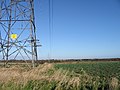
 Electricity Pylons - geograph.org.uk - 324251.jpg 640 × 428; 67 KB
-
 Electricity Pylons, Cobhambury - geograph.org.uk - 323244.jpg 640 × 480; 53 KB
-
 Entrance to Walmestone nursery. - geograph.org.uk - 317179.jpg 640 × 480; 164 KB
-
 Gorsehill Nursery on the A20 - geograph.org.uk - 324213.jpg 640 × 428; 87 KB
-
 Higham Railway Station.jpg 640 × 480; 61 KB
-
 Home comforts - geograph.org.uk - 374878.jpg 640 × 480; 103 KB
-
 Kent (943632746).jpg 3,264 × 2,448; 4.77 MB
-
 Knowlton Church. - geograph.org.uk - 304159.jpg 640 × 480; 274 KB
-

-
 Lower Weddington Farm Road - geograph.org.uk - 308039.jpg 640 × 480; 154 KB
-
 Marleybrooks Farm (nursery) Preston. - geograph.org.uk - 316017.jpg 640 × 480; 277 KB
-
 On the Knowlton estate. - geograph.org.uk - 304160.jpg 640 × 480; 227 KB
-
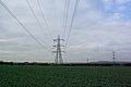
 Pylons across farmland. - geograph.org.uk - 304398.jpg 640 × 480; 117 KB
-
 Pylons across farmland. - geograph.org.uk - 304717.jpg 640 × 480; 194 KB
-

-
 Road leading to Nonington Court. - geograph.org.uk - 310701.jpg 640 × 480; 219 KB
-
 Roundabout where the A257 and A256 meet. - geograph.org.uk - 307663.jpg 633 × 427; 143 KB
-
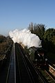
 Sole Street Railway Station.jpg 640 × 480; 48 KB
-
 Crixhall Court. - geograph.org.uk - 304512.jpg 640 × 480; 144 KB
-
 Tenterden Town Signal Box.jpg 1,752 × 1,517; 1.22 MB
-
 Tenterden Town Station Building.jpg 2,018 × 1,488; 1.18 MB
-
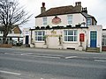
 The Duck Inn, Pett Bottom.jpg 640 × 480; 243 KB
-

-
 The Rose Inn, Wickhambreaux..jpg 640 × 480; 141 KB
-
 Transformers - geograph.org.uk - 325683.jpg 640 × 480; 139 KB
-
 Trinity House, Ware - geograph.org.uk - 315555.jpg 640 × 480; 186 KB
-
 View from the Common - geograph.org.uk - 2084138.jpg 8,364 × 2,061; 6.28 MB
-
 When is a byway not a byway? - geograph.org.uk - 326510.jpg 640 × 480; 148 KB
-
 Your Mini Adventure Starts Here - geograph.org.uk - 323053.jpg 640 × 428; 70 KB
-

-
 Grazing cattle from Woodgate. - geograph.org.uk - 323581.jpg 640 × 480; 226 KB
-

-
 Junction of minor road with Ratling Road. - geograph.org.uk - 311423.jpg 640 × 480; 125 KB
-
 Knatts Valley - geograph.org.uk - 323196.jpg 640 × 428; 96 KB
-
 Maydensole Farm entrance, looking NE. - geograph.org.uk - 315729.jpg 640 × 480; 197 KB
-
 Petrol station on the A20 - geograph.org.uk - 326921.jpg 640 × 480; 96 KB
-
-
 Unusual Cattle for Kent - geograph.org.uk - 323042.jpg 640 × 428; 99 KB
-
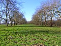
 View of dyke and farmland looking west. - geograph.org.uk - 307951.jpg 640 × 480; 211 KB


.jpg)


_Preston._-_geograph.org.uk_-_316017.jpg)


_-_geograph.org.uk_-_307682.jpg)


