Category:January 2006 in Kent
Ceremonial counties of England: Bedfordshire · Berkshire · Buckinghamshire · Cambridgeshire · Cheshire · Cornwall · Cumbria · Derbyshire · Devon · Dorset · Durham · East Riding of Yorkshire · East Sussex · Essex · Gloucestershire · Greater London · Greater Manchester · Hampshire · Herefordshire · Hertfordshire · Isle of Wight · Kent · Lancashire · Leicestershire · Lincolnshire · Merseyside · Norfolk · North Yorkshire · Northamptonshire · Northumberland · Nottinghamshire · Oxfordshire · Rutland · Shropshire · Somerset · South Yorkshire · Staffordshire · Suffolk · Surrey · Tyne and Wear · Warwickshire · West Midlands · West Sussex · West Yorkshire · Wiltshire · Worcestershire
City-counties: Bristol ·
Former historic counties:
Other former counties:
City-counties: Bristol ·
Former historic counties:
Other former counties:
Deutsch: Bilder, die im Januar 2006 in Kent aufgenommen worden sind. Bitte beachten Sie, dass dies weder das Datum des Uploads noch das Datum des Scannens eines Fotos ist.
English: Images/pictures taken in Kent during January 2006. Note this is not the date of the upload, nor the date a photo was scanned.
Español: Fotografías o imágenes tomadas en Kent durante enero 2006. No es la fecha de subida ni escaneo, sino la fecha en que las fotografías o imágenes se crearon.
Esperanto: Bildoj faritaj en Kent en januaro 2006. Tio ne estas la dato, kiam la bildoj estis alŝutitaj aŭ skanitaj.
Français : Photographies ou images prises en Kent durant janvier 2006. Ce n'est pas la date du téléchargement ou du scan.
Galego: Fotografías ou imaxes tomadas en Kent durante xaneiro 2006. Non é a data de subida nin escaneamento, senón a data na que se crearon as fotografías ou imaxes.
Italiano: Fotografie o immagini scattate a Kent nel gennaio 2006. Nota bene: la data non si riferisce né a quella di upload né a quella in cui la foto è stata digitalizzata.
Norsk bokmål: Bilder tatt i Kent i løpet av januar 2006. Merk at dette ikke er datoen for opplasting, eller når et bilde har blitt skannet.
Norsk nynorsk: Bilete teke i Kent i løpet av januar 2006. Merk at dette ikkje er datoen for opplasting, eller når eit bilete har vorte skanna.
Русский: Изображения, сделанные в Kent в течение январь 2006 (не дата загрузки изображения).
Українська: Зображення, зроблені в Kent протягом січень 2006. Зауважте, що це не дата завантаження чи дата сканування фотографії.
| January 2005 | ← | January 2006 | → | January 2007 | |||||||
| Jan | Feb | Mar | Apr | May | Jun | Jul | Aug | Sep | Oct | Nov | Dec |
| 39 | 30 | 25 | 49 | 28 | 70 | 103 | 44 | 32 | 43 | 12 | 17 |
|---|---|---|---|---|---|---|---|---|---|---|---|
Media in category "January 2006 in Kent"
The following 39 files are in this category, out of 39 total.
-
 Kemsley Down Railway Station - geograph.org.uk - 1114045.jpg 640 × 481; 87 KB
-
 Kemsley Down Station on Milton Creek - geograph.org.uk - 1114028.jpg 640 × 481; 80 KB
-
 A229 Chatham Road - geograph.org.uk - 102010.jpg 640 × 480; 75 KB
-
 Buckland Fleet in Whalebone Marshes - geograph.org.uk - 1116637.jpg 640 × 481; 98 KB
-
 Centre Bastion, Sheerness dockyard - geograph.org.uk - 110437.jpg 640 × 607; 84 KB
-
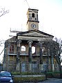
 Dockyard Church, Bluetown, Sheerness - geograph.org.uk - 109691.jpg 477 × 640; 130 KB
-

-
 Footbridge over Buckland Fleet - geograph.org.uk - 1116628.jpg 640 × 481; 82 KB
-
 Footpath junction on Saxon Shore Way - geograph.org.uk - 1112263.jpg 640 × 481; 65 KB
-
 Footpath junction on Saxon Shore Way - geograph.org.uk - 1116848.jpg 481 × 640; 100 KB
-
 Footpath on School Lane - geograph.org.uk - 1112289.jpg 481 × 640; 88 KB
-
 Footpath onto Sea Wall - geograph.org.uk - 1113989.jpg 640 × 481; 99 KB
-
 Footpath towards Swigshole - geograph.org.uk - 1116758.jpg 640 × 481; 78 KB
-
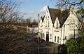
 Hempstead Valley shopping centre - geograph.org.uk - 100414.jpg 640 × 480; 118 KB
-
 Moat at Sheerness Dockyard - geograph.org.uk - 110229.jpg 640 × 480; 74 KB
-
 Naval Terrace, Bluetown, Sheerness - geograph.org.uk - 110446.jpg 640 × 479; 111 KB
-
 Queenborough Railway Station.jpg 640 × 408; 121 KB
-
 Sandling village sign - geograph.org.uk - 101692.jpg 640 × 595; 102 KB
-
 Sea Wall on St Mary's Bay - geograph.org.uk - 1116670.jpg 640 × 481; 81 KB
-
 Dockyard Church, Bluetown, Sheerness - geograph.org.uk - 110458.jpg 480 × 640; 96 KB
-
 St Mary's Beach - geograph.org.uk - 1116706.jpg 481 × 640; 71 KB
-
 Thamesport - geograph.org.uk - 110026.jpg 640 × 432; 62 KB
-
 Waterfront, Queenborough - geograph.org.uk - 110012.jpg 640 × 456; 79 KB
-
 Well at the gate of The Hermitage - geograph.org.uk - 101871.jpg 480 × 640; 141 KB
-
 Westgate Bay - geograph.org.uk - 322217.jpg 640 × 480; 95 KB
-
 Bomb damage, Queenborough, Sheppey - geograph.org.uk - 111449.jpg 640 × 480; 88 KB
-
 Grain Power Station from Queenborough - geograph.org.uk - 110155.jpg 477 × 640; 117 KB
-
 Industrial plant, Queenborough - geograph.org.uk - 110173.jpg 640 × 437; 84 KB
-
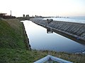
 Inside the sea wall, Queenborough - geograph.org.uk - 110165.jpg 640 × 480; 94 KB
-
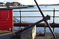
 King's School boathouse - geograph.org.uk - 111462.jpg 640 × 480; 125 KB
-
 Low sun over West Swale - geograph.org.uk - 110195.jpg 640 × 480; 75 KB
-
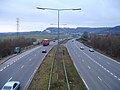
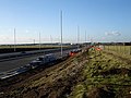 New road to Queenborough - geograph.org.uk - 109983.jpg 640 × 480; 93 KB
-
 New roundabout on Sheppey - geograph.org.uk - 109956.jpg 640 × 480; 85 KB
-
 New VWs at West Minster, Sheppey - geograph.org.uk - 109685.jpg 640 × 422; 54 KB
-
 Pasture east of the B2007 - geograph.org.uk - 110391.jpg 640 × 480; 75 KB
-
 Saxon Shore Way near Twinney - geograph.org.uk - 115427.jpg 640 × 493; 107 KB
-
 Sheerness Dockyard - geograph.org.uk - 110475.jpg 640 × 480; 67 KB
-
 Tesco, Sheerness - geograph.org.uk - 110401.jpg 640 × 480; 78 KB
-
 The Hard, Queenborough - geograph.org.uk - 111452.jpg 640 × 428; 102 KB


