Category:January 2006 in Surrey
Ceremonial counties of England: Bedfordshire · Berkshire · Buckinghamshire · Cambridgeshire · Cheshire · Cornwall · Cumbria · Derbyshire · Devon · Dorset · Durham · East Riding of Yorkshire · East Sussex · Essex · Gloucestershire · Greater London · Greater Manchester · Hampshire · Herefordshire · Hertfordshire · Isle of Wight · Kent · Lancashire · Leicestershire · Lincolnshire · Merseyside · Norfolk · North Yorkshire · Northamptonshire · Northumberland · Nottinghamshire · Oxfordshire · Rutland · Shropshire · Somerset · South Yorkshire · Staffordshire · Suffolk · Surrey · Tyne and Wear · Warwickshire · West Midlands · West Sussex · West Yorkshire · Wiltshire · Worcestershire
City-counties: Bristol ·
Former historic counties:
Other former counties:
City-counties: Bristol ·
Former historic counties:
Other former counties:
Deutsch: Bilder, die im Januar 2006 in Surrey aufgenommen worden sind. Bitte beachten Sie, dass dies weder das Datum des Uploads noch das Datum des Scannens eines Fotos ist.
English: Images/pictures taken in Surrey during January 2006. Note this is not the date of the upload, nor the date a photo was scanned.
Español: Fotografías o imágenes tomadas en Surrey durante enero 2006. No es la fecha de subida ni escaneo, sino la fecha en que las fotografías o imágenes se crearon.
Esperanto: Bildoj faritaj en Surrey en januaro 2006. Tio ne estas la dato, kiam la bildoj estis alŝutitaj aŭ skanitaj.
Français : Photographies ou images prises en Surrey durant janvier 2006. Ce n'est pas la date du téléchargement ou du scan.
Galego: Fotografías ou imaxes tomadas en Surrey durante xaneiro 2006. Non é a data de subida nin escaneamento, senón a data na que se crearon as fotografías ou imaxes.
Italiano: Fotografie o immagini scattate a Surrey nel gennaio 2006. Nota bene: la data non si riferisce né a quella di upload né a quella in cui la foto è stata digitalizzata.
Norsk bokmål: Bilder tatt i Surrey i løpet av januar 2006. Merk at dette ikke er datoen for opplasting, eller når et bilde har blitt skannet.
Norsk nynorsk: Bilete teke i Surrey i løpet av januar 2006. Merk at dette ikkje er datoen for opplasting, eller når eit bilete har vorte skanna.
Русский: Изображения, сделанные в Surrey в течение январь 2006 (не дата загрузки изображения).
Українська: Зображення, зроблені в Surrey протягом січень 2006. Зауважте, що це не дата завантаження чи дата сканування фотографії.
| January 2005 | ← | January 2006 | → | January 2007 | |||||||
| Jan | Feb | Mar | Apr | May | Jun | Jul | Aug | Sep | Oct | Nov | Dec |
| 28 | 8 | 9 | 20 | 19 | 21 | 10 | 9 | 17 | 2 | 10 | 5 |
|---|---|---|---|---|---|---|---|---|---|---|---|

Media in category "January 2006 in Surrey"
The following 28 files are in this category, out of 28 total.
-
 All Saints' Church, Lightwater - geograph.org.uk - 106948.jpg 640 × 480; 84 KB
-
 Basingstoke Canal near The Swan, Ash Vale - geograph.org.uk - 101966.jpg 640 × 480; 160 KB
-
 Baynards. - geograph.org.uk - 116596.jpg 640 × 445; 186 KB
-
 Community Centre Near Frimley - geograph.org.uk - 101530.jpg 640 × 480; 125 KB
-

-
 Disused Railway looking east, Ash, Surrey - geograph.org.uk - 115191.jpg 640 × 474; 150 KB
-
 Disused Railway looking west, Ash, Surrey - geograph.org.uk - 115226.jpg 640 × 480; 147 KB
-
 Footpath, Bagshot Heath - geograph.org.uk - 114971.jpg 480 × 640; 91 KB
-
 Frimley High Street - geograph.org.uk - 100316.jpg 640 × 480; 77 KB
-
 Frimley High Street - geograph.org.uk - 494977.jpg 640 × 480; 78 KB
-
 FrimleyHighStreetLookingEast.jpg 1,998 × 1,101; 883 KB
-
 FrimleyHighStreetLookingWest.jpg 2,048 × 1,536; 1.11 MB
-
 Hawthorn's Garage, Farnham - geograph.org.uk - 101999.jpg 640 × 480; 88 KB
-
 Nutfield Railway Station.jpg 640 × 480; 118 KB
-
 Office blocks near Frimley - geograph.org.uk - 100323.jpg 640 × 480; 87 KB
-
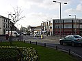
 Park Road, Camberley - geograph.org.uk - 101069.jpg 640 × 480; 127 KB
-
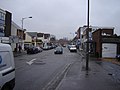
 Pedestrianised Shopping Street - geograph.org.uk - 106918.jpg 640 × 480; 133 KB
-
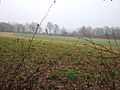
 Playing fields near Frimley - geograph.org.uk - 101573.jpg 640 × 480; 97 KB
-
 Railway from Tilehurst Lane - geograph.org.uk - 103259.jpg 640 × 480; 86 KB
-
 Railway Tunnel under Betchworth Park - geograph.org.uk - 103271.jpg 640 × 480; 68 KB
-
 St Andrew's Church, Frimley Green - geograph.org.uk - 101532.jpg 640 × 480; 141 KB
-

-
 Stile and pond, Ash, Surrey - geograph.org.uk - 111930.jpg 640 × 480; 170 KB
-
 Unguarded Railway Crossing - geograph.org.uk - 120132.jpg 640 × 480; 182 KB
-
 View of Leyland's Farm - geograph.org.uk - 111584.jpg 480 × 353; 120 KB
-
 WhiteHartPublicHouseFrimley.jpg 2,010 × 1,077; 877 KB
-
 Woods Next to St Catherines Road, Frimley - geograph.org.uk - 101531.jpg 480 × 640; 148 KB
-
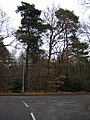
 Woods on Jackpond Hill, Near Frimley - geograph.org.uk - 101103.jpg 480 × 640; 152 KB


