Category:January 2006 in Cornwall
Ceremonial counties of England: Bedfordshire · Berkshire · Buckinghamshire · Cambridgeshire · Cheshire · Cornwall · Cumbria · Derbyshire · Devon · Dorset · Durham · East Riding of Yorkshire · East Sussex · Essex · Gloucestershire · Greater London · Greater Manchester · Hampshire · Herefordshire · Hertfordshire · Isle of Wight · Kent · Lancashire · Leicestershire · Lincolnshire · Merseyside · Norfolk · North Yorkshire · Northamptonshire · Northumberland · Nottinghamshire · Oxfordshire · Rutland · Shropshire · Somerset · South Yorkshire · Staffordshire · Suffolk · Surrey · Tyne and Wear · Warwickshire · West Midlands · West Sussex · West Yorkshire · Wiltshire · Worcestershire
City-counties: Bristol ·
Former historic counties:
Other former counties:
City-counties: Bristol ·
Former historic counties:
Other former counties:
Deutsch: Bilder, die im Januar 2006 in Cornwall aufgenommen worden sind. Bitte beachten Sie, dass dies weder das Datum des Uploads noch das Datum des Scannens eines Fotos ist.
English: Images/pictures taken in Cornwall during January 2006. Note this is not the date of the upload, nor the date a photo was scanned.
Español: Fotografías o imágenes tomadas en Cornwall durante enero 2006. No es la fecha de subida ni escaneo, sino la fecha en que las fotografías o imágenes se crearon.
Esperanto: Bildoj faritaj en Cornwall en januaro 2006. Tio ne estas la dato, kiam la bildoj estis alŝutitaj aŭ skanitaj.
Français : Photographies ou images prises en Cornwall durant janvier 2006. Ce n'est pas la date du téléchargement ou du scan.
Galego: Fotografías ou imaxes tomadas en Cornwall durante xaneiro 2006. Non é a data de subida nin escaneamento, senón a data na que se crearon as fotografías ou imaxes.
Italiano: Fotografie o immagini scattate a Cornwall nel gennaio 2006. Nota bene: la data non si riferisce né a quella di upload né a quella in cui la foto è stata digitalizzata.
Norsk bokmål: Bilder tatt i Cornwall i løpet av januar 2006. Merk at dette ikke er datoen for opplasting, eller når et bilde har blitt skannet.
Norsk nynorsk: Bilete teke i Cornwall i løpet av januar 2006. Merk at dette ikkje er datoen for opplasting, eller når eit bilete har vorte skanna.
Русский: Изображения, сделанные в Cornwall в течение январь 2006 (не дата загрузки изображения).
Українська: Зображення, зроблені в Cornwall протягом січень 2006. Зауважте, що це не дата завантаження чи дата сканування фотографії.
| January 2005 | ← | January 2006 | → | January 2007 | |||||||
| Jan | Feb | Mar | Apr | May | Jun | Jul | Aug | Sep | Oct | Nov | Dec |
| 58 | 24 | 28 | 67 | 132 | 123 | 124 | 228 | 44 | 44 | 23 | 32 |
|---|---|---|---|---|---|---|---|---|---|---|---|
Media in category "January 2006 in Cornwall"
The following 58 files are in this category, out of 58 total.
-
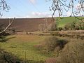
 A Drag on the Hillside - geograph.org.uk - 109502.jpg 640 × 443; 75 KB
-
 A Glimpse through the Hedge - geograph.org.uk - 99783.jpg 640 × 480; 156 KB
-
 A Stone Cattle Grid - geograph.org.uk - 107041.jpg 640 × 480; 156 KB
-
 A38 Tideford, looking eastward - geograph.org.uk - 98967.jpg 640 × 427; 191 KB
-
 A38 Tideford, looking westward - geograph.org.uk - 98971.jpg 640 × 427; 193 KB
-
 Across Milltown Valley - geograph.org.uk - 109440.jpg 640 × 480; 105 KB
-
 Another Hurler - geograph.org.uk - 100496.jpg 640 × 480; 116 KB
-
 Apartments on The Truro River - geograph.org.uk - 100351.jpg 640 × 453; 84 KB
-
-
 Barn conversion - geograph.org.uk - 112238.jpg 640 × 480; 87 KB
-
 Barns at Kelynack - geograph.org.uk - 104094.jpg 640 × 445; 146 KB
-
 Barnyard near Elm Gate, Saltash - geograph.org.uk - 99016.jpg 640 × 427; 231 KB
-
 Beach at Long Rock - geograph.org.uk - 104432.jpg 640 × 480; 103 KB
-
 Beach at Perranuthnoe, New Year 2006 - geograph.org.uk - 98608.jpg 640 × 480; 116 KB
-
 Beach near Black Cliff - geograph.org.uk - 107867.jpg 640 × 480; 77 KB
-
 Beach near Upton Towans - geograph.org.uk - 107863.jpg 640 × 480; 107 KB
-
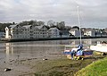
 Boats Moored on the Truro River - geograph.org.uk - 100360.jpg 640 × 480; 110 KB
-
 Bowl Rock - geograph.org.uk - 107859.jpg 480 × 640; 209 KB
-
 Bridleway - geograph.org.uk - 112206.jpg 572 × 640; 89 KB
-
 Cabbage Field - Recently Harvested - geograph.org.uk - 105445.jpg 492 × 640; 151 KB
-
 Cathedral Spires over Walsingham Place.jpg 640 × 480; 85 KB
-
 Cauliflower field - geograph.org.uk - 104126.jpg 640 × 480; 198 KB
-
 Cottages near St Hilary Church - geograph.org.uk - 105532.jpg 640 × 443; 97 KB
-
 Cows near Halsetown - geograph.org.uk - 107851.jpg 640 × 480; 154 KB
-
 Farmland at Penair - geograph.org.uk - 99776.jpg 640 × 436; 78 KB
-
 Freight Train through Golant - geograph.org.uk - 109867.jpg 640 × 481; 91 KB
-
 Garris Farm - geograph.org.uk - 112246.jpg 640 × 480; 34 KB
-
 Hayle viaduct cornwall.jpg 640 × 448; 98 KB
-
 January Frost - geograph.org.uk - 111719.jpg 640 × 465; 193 KB
-
 Lemon Quay, Truro - geograph.org.uk - 99693.jpg 640 × 432; 77 KB
-
 Millennium Cross, Landrake - geograph.org.uk - 99003.jpg 427 × 640; 288 KB
-
 New Housing Development - geograph.org.uk - 99779.jpg 640 × 480; 80 KB
-
 New Quayside Buildings - geograph.org.uk - 100341.jpg 640 × 556; 100 KB
-
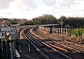
 Next Stop Bodmin Parkway - geograph.org.uk - 731277.jpg 640 × 423; 84 KB
-
 Old cross in hedge near Lesingey Lane - geograph.org.uk - 101418.jpg 640 × 480; 211 KB
-

-
 Penair School - geograph.org.uk - 718452.jpg 640 × 480; 89 KB
-
 Phoenix House, in Parade Street - geograph.org.uk - 713264.jpg 640 × 427; 76 KB
-
 Primitive Methodist Church - geograph.org.uk - 113215.jpg 640 × 420; 75 KB
-
 Relubbus - geograph.org.uk - 107012.jpg 640 × 486; 78 KB
-
 Roadside Cottage on Relubbus Hill - geograph.org.uk - 720032.jpg 640 × 480; 109 KB
-
 Roadside Houses on Relubbus Lane - geograph.org.uk - 720064.jpg 640 × 480; 102 KB
-
 Seals in Mutton Cove - geograph.org.uk - 661643.jpg 640 × 480; 82 KB
-
 Sportsman's Inn, Heamoor - geograph.org.uk - 101424.jpg 640 × 452; 97 KB
-
 St Hilary Church - geograph.org.uk - 720083.jpg 640 × 461; 143 KB
-
 St Mark's Mission Church, Sticker - geograph.org.uk - 113340.jpg 640 × 464; 133 KB
-
 Thatched cottage - geograph.org.uk - 112281.jpg 640 × 480; 75 KB
-
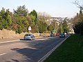
 The A30 - geograph.org.uk - 106964.jpg 640 × 436; 68 KB
-
 The Tidal Tresillian River - geograph.org.uk - 99759.jpg 640 × 480; 83 KB
-
 Post Box, Tideford - geograph.org.uk - 98977.jpg 427 × 640; 272 KB
-
 Bird Sanctuary, Marazion Marsh - geograph.org.uk - 98620.jpg 640 × 480; 133 KB
-
 Dennis Place - geograph.org.uk - 101415.jpg 640 × 480; 113 KB
-
 Goldsithney Village - geograph.org.uk - 105550.jpg 640 × 480; 98 KB
-
 Houses at Polgooth - geograph.org.uk - 113352.jpg 640 × 480; 103 KB
-
 Little Polgooth - geograph.org.uk - 113224.jpg 640 × 424; 68 KB
-
 Little Polgooth - geograph.org.uk - 113239.jpg 640 × 480; 81 KB
-
 Pool on the Porthgwarra moors - geograph.org.uk - 660284.jpg 640 × 480; 75 KB
-
 Sewage Works near Tregorrick - geograph.org.uk - 113135.jpg 640 × 445; 89 KB


