Category:January 2006 in Lincolnshire
Ceremonial counties of England: Bedfordshire · Berkshire · Buckinghamshire · Cambridgeshire · Cheshire · Cornwall · Cumbria · Derbyshire · Devon · Dorset · Durham · East Riding of Yorkshire · East Sussex · Essex · Gloucestershire · Greater London · Greater Manchester · Hampshire · Herefordshire · Hertfordshire · Isle of Wight · Kent · Lancashire · Leicestershire · Lincolnshire · Merseyside · Norfolk · North Yorkshire · Northamptonshire · Northumberland · Nottinghamshire · Oxfordshire · Rutland · Shropshire · Somerset · South Yorkshire · Staffordshire · Suffolk · Surrey · Tyne and Wear · Warwickshire · West Midlands · West Sussex · West Yorkshire · Wiltshire · Worcestershire
City-counties: Bristol ·
Former historic counties:
Other former counties:
City-counties: Bristol ·
Former historic counties:
Other former counties:
Deutsch: Bilder, die im Januar 2006 in Lincolnshire aufgenommen worden sind. Bitte beachten Sie, dass dies weder das Datum des Uploads noch das Datum des Scannens eines Fotos ist.
English: Images/pictures taken in Lincolnshire during January 2006. Note this is not the date of the upload, nor the date a photo was scanned.
Español: Fotografías o imágenes tomadas en Lincolnshire durante enero 2006. No es la fecha de subida ni escaneo, sino la fecha en que las fotografías o imágenes se crearon.
Esperanto: Bildoj faritaj en Lincolnshire en januaro 2006. Tio ne estas la dato, kiam la bildoj estis alŝutitaj aŭ skanitaj.
Français : Photographies ou images prises en Lincolnshire durant janvier 2006. Ce n'est pas la date du téléchargement ou du scan.
Galego: Fotografías ou imaxes tomadas en Lincolnshire durante xaneiro 2006. Non é a data de subida nin escaneamento, senón a data na que se crearon as fotografías ou imaxes.
Italiano: Fotografie o immagini scattate a Lincolnshire nel gennaio 2006. Nota bene: la data non si riferisce né a quella di upload né a quella in cui la foto è stata digitalizzata.
Norsk bokmål: Bilder tatt i Lincolnshire i løpet av januar 2006. Merk at dette ikke er datoen for opplasting, eller når et bilde har blitt skannet.
Norsk nynorsk: Bilete teke i Lincolnshire i løpet av januar 2006. Merk at dette ikkje er datoen for opplasting, eller når eit bilete har vorte skanna.
Русский: Изображения, сделанные в Lincolnshire в течение январь 2006 (не дата загрузки изображения).
Українська: Зображення, зроблені в Lincolnshire протягом січень 2006. Зауважте, що це не дата завантаження чи дата сканування фотографії.
| January 2005 | ← | January 2006 | → | January 2007 | |||||||
| Jan | Feb | Mar | Apr | May | Jun | Jul | Aug | Sep | Oct | Nov | Dec |
| 72 | 62 | 99 | 194 | 106 | 106 | 155 | 156 | 151 | 123 | 129 | 56 |
|---|---|---|---|---|---|---|---|---|---|---|---|
Subcategories
This category has the following 14 subcategories, out of 14 total.
0
1
2
3
Media in category "January 2006 in Lincolnshire"
The following 58 files are in this category, out of 58 total.
-
 Disused railway at Leadenham - geograph.org.uk - 101669.jpg 640 × 427; 120 KB
-
 Castle Hotel - geograph.org.uk - 103986.jpg 640 × 427; 67 KB
-

-
 South Bank with Fish Eye Lens - geograph.org.uk - 716941.jpg 640 × 448; 59 KB
-
 Looking towards Brough - geograph.org.uk - 103931.jpg 640 × 426; 138 KB
-
 Unclassified Road^ - geograph.org.uk - 104032.jpg 640 × 426; 91 KB
-
 Winteringham Haven - geograph.org.uk - 103894.jpg 640 × 426; 100 KB
-
 On Barrowby Road, Grantham - geograph.org.uk - 104692.jpg 640 × 427; 150 KB
-
 Griffin Inn Irnham-by-Tim-Heaton.jpg 640 × 480; 65 KB
-
 Irnham-Hall-by-Tim-Heaton.jpg 640 × 480; 62 KB
-
 Church of St Mary, Swinstead - geograph.org.uk - 106117.jpg 640 × 480; 64 KB
-
 Bridge House, Lincoln (94109646).jpg 800 × 532; 177 KB
-
 The Adam and Eve - geograph.org.uk - 108483.jpg 640 × 427; 100 KB
-

-
 Branston Fen - geograph.org.uk - 111326.jpg 640 × 480; 371 KB
-
 Branston Fen - geograph.org.uk - 111330.jpg 640 × 480; 351 KB
-
 Grimsby Old Hospital - geograph.org.uk - 111420.jpg 640 × 427; 122 KB
-
 The Glory Hole - geograph.org.uk - 111931.jpg 640 × 427; 112 KB
-
 The High Bridge - geograph.org.uk - 111926.jpg 640 × 427; 118 KB
-
 Castle Hill Club - geograph.org.uk - 114025.jpg 640 × 427; 90 KB
-
 Looking towards Burnham Grange - geograph.org.uk - 112229.jpg 640 × 426; 143 KB
-

-
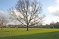
 The Tree - geograph.org.uk - 115174.jpg 640 × 427; 175 KB
-
 Jobcentre Plus - Barton-Upon-Humber - geograph.org.uk - 143512.jpg 640 × 480; 118 KB
-
 Old Coach Houses in Soutergate - geograph.org.uk - 143519.jpg 640 × 480; 119 KB
-
 Bridge and ford on B1176 - geograph.org.uk - 114481.jpg 640 × 480; 96 KB
-
 Croxton Pump - geograph.org.uk - 171896.jpg 640 × 426; 171 KB
-
 Mobile Library - geograph.org.uk - 302397.jpg 640 × 426; 117 KB
-

-
 Thornton Curtis - Church of St. Lawrence - geograph.org.uk - 114899.jpg 426 × 640; 125 KB
-
 Thornton Curtis - geograph.org.uk - 114905.jpg 640 × 426; 103 KB
-
 Bridge over Winteringham Haven - geograph.org.uk - 99545.jpg 640 × 426; 124 KB
-
 College Bridge near Thornton Abbey - geograph.org.uk - 109103.jpg 640 × 426; 98 KB
-
 Croxton - geograph.org.uk - 171899.jpg 640 × 426; 119 KB
-
 Dogdyke - geograph.org.uk - 109241.jpg 640 × 480; 525 KB
-
 Dogdyke - geograph.org.uk - 109248.jpg 480 × 640; 424 KB
-
 Farmland at Stroxton - geograph.org.uk - 113587.jpg 640 × 427; 171 KB
-
 Ford and bridge, entrance to Bulby - geograph.org.uk - 106131.jpg 640 × 480; 111 KB
-
 Grantham Canal near Harlaxton - geograph.org.uk - 104615.jpg 640 × 427; 225 KB
-
-
-
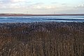 Humber Reed Bed - geograph.org.uk - 104025.jpg 640 × 426; 122 KB
-
 Lincsroad.jpg 640 × 480; 48 KB
-

-
 Marwood House Farm - geograph.org.uk - 106140.jpg 640 × 480; 121 KB
-

-

-
 St.Mary's church, Harrington, Lincs. - geograph.org.uk - 112373.jpg 640 × 427; 109 KB
-
 Straight and Narrow - geograph.org.uk - 109661.jpg 640 × 480; 561 KB
-
 The Grantham Canal looking West - geograph.org.uk - 104618.jpg 640 × 427; 231 KB
-
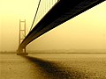
 The Humber Bridge - geograph.org.uk - 106432.jpg 640 × 263; 60 KB
-
 The Lawn - geograph.org.uk - 104995.jpg 640 × 427; 95 KB
-
 Tumby Woodside - geograph.org.uk - 109175.jpg 640 × 480; 629 KB
-
 Barrowby, near Grantham Lincolnshire - geograph.org.uk - 104677.jpg 640 × 427; 143 KB
-
 Between Wootton and Croxton - geograph.org.uk - 114921.jpg 640 × 480; 115 KB
-

-
 Supermarket at North Hykeham - geograph.org.uk - 112837.jpg 640 × 480; 75 KB
-
 Winteringham - Low Burgage - geograph.org.uk - 103944.jpg 426 × 640; 88 KB


.jpg)


