Category:July 2007 in Somerset
Deutsch: Bilder, die im Juli 2007 in Somerset aufgenommen worden sind. Bitte beachten Sie, dass dies weder das Datum des Uploads noch das Datum des Scannens eines Fotos ist.
English: Images/pictures taken in Somerset during July 2007. Note this is not the date of the upload, nor the date a photo was scanned.
Español: Fotografías o imágenes tomadas en Somerset durante julio 2007. No es la fecha de subida ni escaneo, sino la fecha en que las fotografías o imágenes se crearon.
Esperanto: Bildoj faritaj en Somerset en julio 2007. Tio ne estas la dato, kiam la bildoj estis alŝutitaj aŭ skanitaj.
Français : Photographies ou images prises en Somerset durant juillet 2007. Ce n'est pas la date du téléchargement ou du scan.
Galego: Fotografías ou imaxes tomadas en Somerset durante xullo 2007. Non é a data de subida nin escaneamento, senón a data na que se crearon as fotografías ou imaxes.
Italiano: Fotografie o immagini scattate a Somerset nel luglio 2007. Nota bene: la data non si riferisce né a quella di upload né a quella in cui la foto è stata digitalizzata.
Norsk bokmål: Bilder tatt i Somerset i løpet av juli 2007. Merk at dette ikke er datoen for opplasting, eller når et bilde har blitt skannet.
Norsk nynorsk: Bilete teke i Somerset i løpet av juli 2007. Merk at dette ikkje er datoen for opplasting, eller når eit bilete har vorte skanna.
Русский: Изображения, сделанные в Somerset в течение июль 2007 (не дата загрузки изображения).
Українська: Зображення, зроблені в Somerset протягом липень 2007. Зауважте, що це не дата завантаження чи дата сканування фотографії.
| July 2006 | ← | July 2007 | → | July 2008 | |||||||
| Jan | Feb | Mar | Apr | May | Jun | Jul | Aug | Sep | Oct | Nov | Dec |
| 25 | 20 | 57 | 22 | 36 | 33 | 69 | 67 | 38 | 28 | 16 | 13 |
|---|---|---|---|---|---|---|---|---|---|---|---|
Media in category "July 2007 in Somerset"
The following 69 files are in this category, out of 69 total.
-
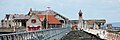
 2007 at Birnbeck Pier - north landing jetty.jpg 1,366 × 1,024; 365 KB
-
 2007 at Birnbeck Pier - toll house.jpg 1,024 × 1,366; 448 KB
-
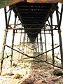 2007 at Birnbeck Pier - underneath.jpg 1,024 × 1,366; 489 KB
-
 2007 at Birnbeck Pier - view along the deck.jpg 2,736 × 910; 647 KB
-
 2007 at Wells Tucker Street station site - goods shed.jpg 1,370 × 822; 311 KB
-
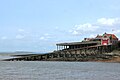 Birnbeck Pier Lifeboat Station.jpg 2,736 × 1,824; 889 KB
-
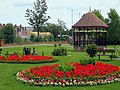 Blake Gardens, Bridgwater - geograph.org.uk - 1006610.jpg 640 × 480; 303 KB
-
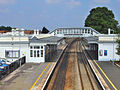
 Bridgwater Railway Station (1841) - geograph.org.uk - 930306.jpg 640 × 480; 185 KB
-
 Bridgwater railway station in 2007.jpg 640 × 480; 252 KB
-
 Bridgwater Town Bridge.jpg 640 × 480; 253 KB
-
 Bridgwater West Quay - geograph.org.uk - 923655.jpg 640 × 480; 254 KB
-
 Bristol Road Baptist Church.jpg 1,366 × 1,366; 432 KB
-
 Cattle in a field near Breach - geograph.org.uk - 484482.jpg 640 × 480; 156 KB
-
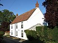 Cottage at Wash Cross - geograph.org.uk - 513386.jpg 640 × 471; 90 KB
-
 Derelict canal bridge - geograph.org.uk - 508189.jpg 640 × 560; 143 KB
-
 Dry stone wall by a road - geograph.org.uk - 501798.jpg 640 × 427; 84 KB
-
 Eastquay, Bridgwater - geograph.org.uk - 940142.jpg 640 × 480; 277 KB
-
 Field by the railway - geograph.org.uk - 1408465.jpg 640 × 480; 97 KB
-
 Fore Street, Bridgwater - geograph.org.uk - 1006595.jpg 640 × 480; 253 KB
-
 Fore Street, Bridgwater - geograph.org.uk - 1006598.jpg 640 × 480; 243 KB
-
 Former Midland Railway Station at Weston, Bath,UK 2006.jpg 1,024 × 768; 477 KB
-
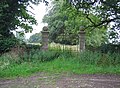 Gates to Shanks House - geograph.org.uk - 496191.jpg 640 × 472; 124 KB
-
 Hans Price Close.jpg 1,366 × 1,024; 449 KB
-
 Hans Price House.jpg 1,024 × 1,366; 387 KB
-
 Kelston View, Whiteway, Bath - geograph.org.uk - 897087.jpg 640 × 414; 69 KB
-
 Locking Road School - boys entrance.jpg 1,024 × 1,366; 402 KB
-
 Locking Road School.jpg 1,024 × 1,366; 456 KB
-
 North Somerset Museum - Claras Cottage.jpg 1,212 × 1,366; 539 KB
-
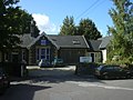
 North Somerset Museum - frontage.jpg 1,366 × 1,024; 370 KB
-
 North Somerset Museum entrance.jpg 1,192 × 1,366; 465 KB
-
 Not much use as a parking space - geograph.org.uk - 494515.jpg 480 × 640; 54 KB
-
 Railway Line - geograph.org.uk - 494697.jpg 640 × 480; 131 KB
-
 Railway Line With Train - geograph.org.uk - 494694.jpg 640 × 480; 135 KB
-
 Rear of Thomas Street (west side) - geograph.org.uk - 616008.jpg 480 × 640; 76 KB
-
 Route 664 Yeovil - Babcary 2.JPG 2,848 × 2,136; 1.42 MB
-
 Somerfield Distribution Depot - geograph.org.uk - 512867.jpg 640 × 480; 60 KB
-
 St Nicholas' Church, Uphill, Somerset.jpg 1,366 × 1,024; 475 KB
-
 The Choughs, Chard - geograph.org.uk - 523533.jpg 640 × 480; 107 KB
-

-
 The Halfway House - geograph.org.uk - 494703.jpg 640 × 480; 84 KB
-
 The Lawns, 24 Brinsea Road - geograph.org.uk - 526017.jpg 640 × 480; 105 KB
-
 The Windwhistle Inn - geograph.org.uk - 507952.jpg 640 × 397; 100 KB
-
-
 Wadham Street Baptist Church.jpg 1,024 × 1,366; 437 KB
-
 Weston College Logo.jpg 600 × 612; 123 KB
-
 Weston College University Campus.jpg 1,366 × 910; 315 KB
-
 Weston College Westcliff Campus.jpg 1,366 × 1,024; 316 KB
-
 Weston College.jpg 1,024 × 1,366; 339 KB
-
 Weston Mercury Office.jpg 1,024 × 1,366; 349 KB
-
 Weston-super-Mare Ashcombe Road - Finger Post Sign.jpg 1,024 × 1,366; 623 KB
-
 Weston-super-Mare Church Institute.jpg 1,024 × 1,366; 469 KB
-
 Weston-super-Mare Constitutional Club.jpg 1,024 × 1,366; 310 KB
-
 Weston-super-Mare Jills Garden.jpg 1,024 × 1,366; 592 KB
-
 Weston-super-Mare Library Muses.jpg 1,024 × 1,366; 300 KB
-
 Weston-super-Mare Library.jpg 1,366 × 1,366; 601 KB
-
 Weston-super-Mare Odeon.jpg 1,024 × 1,366; 376 KB
-
 Weston-super-Mare Queens Road.jpg 1,024 × 1,366; 439 KB
-
 Weston-super-Mare Royal Court.jpg 1,024 × 1,366; 521 KB
-
 Weston-super-Mare School of Art.jpg 1,024 × 1,366; 550 KB
-
 Weston-super-Mare Somerset House.jpg 1,024 × 1,366; 360 KB
-
 Weston-super-Mare Town Hall.jpg 1,024 × 1,366; 385 KB
-
 Weston-super-Mare Walliscote School.jpg 1,024 × 1,366; 424 KB
-
 Weston-super-Mare Wooler Road.jpg 1,024 × 1,366; 358 KB
-
 Allowenshay - geograph.org.uk - 491961.jpg 640 × 480; 101 KB
-
 Approaching Allowenshay - geograph.org.uk - 492464.jpg 640 × 480; 118 KB
-
 Higher Dairy House, Allowenshay - geograph.org.uk - 492457.jpg 640 × 480; 114 KB
-
 Holbridge Coppice - geograph.org.uk - 494492.jpg 480 × 640; 141 KB
-
 Knowle Hill North Perrott - geograph.org.uk - 502431.jpg 640 × 480; 92 KB
-
 Lane to Allowenshay - geograph.org.uk - 491651.jpg 640 × 480; 122 KB


_-_geograph.org.uk_-_930306.jpg)


_-_geograph.org.uk_-_616008.jpg)


