Category:July 2008 in Somerset
Deutsch: Bilder, die im Juli 2008 in Somerset aufgenommen worden sind. Bitte beachten Sie, dass dies weder das Datum des Uploads noch das Datum des Scannens eines Fotos ist.
English: Images/pictures taken in Somerset during July 2008. Note this is not the date of the upload, nor the date a photo was scanned.
Español: Fotografías o imágenes tomadas en Somerset durante julio 2008. No es la fecha de subida ni escaneo, sino la fecha en que las fotografías o imágenes se crearon.
Esperanto: Bildoj faritaj en Somerset en julio 2008. Tio ne estas la dato, kiam la bildoj estis alŝutitaj aŭ skanitaj.
Français : Photographies ou images prises en Somerset durant juillet 2008. Ce n'est pas la date du téléchargement ou du scan.
Galego: Fotografías ou imaxes tomadas en Somerset durante xullo 2008. Non é a data de subida nin escaneamento, senón a data na que se crearon as fotografías ou imaxes.
Italiano: Fotografie o immagini scattate a Somerset nel luglio 2008. Nota bene: la data non si riferisce né a quella di upload né a quella in cui la foto è stata digitalizzata.
Norsk bokmål: Bilder tatt i Somerset i løpet av juli 2008. Merk at dette ikke er datoen for opplasting, eller når et bilde har blitt skannet.
Norsk nynorsk: Bilete teke i Somerset i løpet av juli 2008. Merk at dette ikkje er datoen for opplasting, eller når eit bilete har vorte skanna.
Русский: Изображения, сделанные в Somerset в течение июль 2008 (не дата загрузки изображения).
Українська: Зображення, зроблені в Somerset протягом липень 2008. Зауважте, що це не дата завантаження чи дата сканування фотографії.
| July 2007 | ← | July 2008 | → | July 2009 | |||||||
| Jan | Feb | Mar | Apr | May | Jun | Jul | Aug | Sep | Oct | Nov | Dec |
| 39 | 46 | 11 | 37 | 29 | 32 | 62 | 61 | 54 | 46 | 51 | 39 |
|---|---|---|---|---|---|---|---|---|---|---|---|
Subcategories
This category has the following 2 subcategories, out of 2 total.
1
W
Media in category "July 2008 in Somerset"
The following 60 files are in this category, out of 60 total.
-
 "Concrete Castle" in Queen Street - geograph.org.uk - 939686.jpg 414 × 640; 63 KB
-
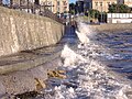
 Minehead , The Esplanade - geograph.org.uk - 1212533.jpg 640 × 480; 55 KB
-
 Clevedon MMB 01.jpg 2,304 × 1,728; 1.45 MB
-
 Clevedon MMB 02 Pier.jpg 2,304 × 1,728; 1.7 MB
-
 Clevedon MMB 03 The Beach.jpg 2,304 × 1,728; 1.07 MB
-
 Clevedon MMB 04 The Beach.jpg 2,304 × 1,728; 1.03 MB
-
 Clevedon MMB 05 The Beach.jpg 2,304 × 1,728; 1.37 MB
-
 Clevedon MMB 06.jpg 2,304 × 1,728; 1.39 MB
-
 Clevedon MMB 07.jpg 2,304 × 1,728; 1.84 MB
-
 Clevedon MMB 08 Elton Road.jpg 2,400 × 1,600; 2.41 MB
-
 Clevedon MMB 09 Millennium obelisk.jpg 2,400 × 1,600; 1.56 MB
-
 Clevedon MMB 10 Millennium obelisk.jpg 1,600 × 2,400; 1.38 MB
-
 Clevedon MMB 11.jpg 1,600 × 2,400; 2.23 MB
-
 Clevedon MMB 12 Marine Lake.jpg 2,400 × 1,600; 1.56 MB
-
 Gatehouse to Bishop's Palace at Wells - geograph.org.uk - 916441.jpg 640 × 480; 107 KB
-
 Bishop's Palace at Wells - geograph.org.uk - 916432.jpg 640 × 287; 55 KB
-
 Bath Spa railway station from above - geograph.org.uk - 962024.jpg 640 × 480; 141 KB
-
 Bathampton Swing Bridge - geograph.org.uk - 948923.jpg 640 × 414; 80 KB
-
 Blue Plaque on Bond Street - geograph.org.uk - 939718.jpg 640 × 419; 104 KB
-
-

-
 Clevedon Marine Lake 1.JPG 2,400 × 1,600; 1.43 MB
-
 Clevedon Marine Lake 3.JPG 2,400 × 1,600; 2.01 MB
-
 Corner of Eastover and East Quay - geograph.org.uk - 939690.jpg 640 × 480; 66 KB
-
 Crane on West Quay - geograph.org.uk - 939751.jpg 407 × 640; 66 KB
-
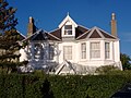
 Detail of house, Castle Street - geograph.org.uk - 939726.jpg 397 × 640; 83 KB
-

-
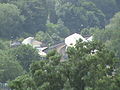
 Goose Slade Farm - geograph.org.uk - 917614.jpg 640 × 480; 129 KB
-
-

-

-
 Looking East down Chandos Street - geograph.org.uk - 939704.jpg 418 × 640; 66 KB
-
-
 Minehead , Boats in Minehead Harbour - geograph.org.uk - 1212511.jpg 640 × 480; 84 KB
-
 Minehead , Minehead Harbour - geograph.org.uk - 1212386.jpg 640 × 198; 30 KB
-
 Minehead , Minehead Harbour - geograph.org.uk - 1212447.jpg 640 × 149; 40 KB
-
 Minehead , Minehead Harbour - geograph.org.uk - 1212471.jpg 640 × 480; 91 KB
-
 Minehead , Minehead Harbour - geograph.org.uk - 1212501.jpg 480 × 640; 83 KB
-
 Minehead , Minehead Harbour - geograph.org.uk - 1212515.jpg 640 × 480; 40 KB
-
 Minehead , Minehead Harbour and Quay - geograph.org.uk - 1212817.jpg 640 × 192; 25 KB
-
 Minehead , Minehead Quay and Harbour - geograph.org.uk - 1212464.jpg 640 × 158; 28 KB
-
 Minehead , Minehead Quay and Harbour - geograph.org.uk - 1212801.jpg 640 × 163; 21 KB
-
 Old Yard detail on West Quay - geograph.org.uk - 939749.jpg 447 × 640; 129 KB
-
 Pack horse bridge Allerford - geograph.org.uk - 888134.jpg 640 × 480; 122 KB
-
 Pack horse bridge Allerford - geograph.org.uk - 888140.jpg 480 × 640; 117 KB
-
 Pack horse bridge Allerford - geograph.org.uk - 888146.jpg 640 × 480; 114 KB
-

-

-

-

-
 St Michael's Church - East Coker - geograph.org.uk - 897123.jpg 640 × 454; 330 KB
-
 The Water Gate - geograph.org.uk - 939730.jpg 418 × 640; 75 KB
-
 Twerton Park -geograph-888372.jpg 640 × 438; 116 KB
-
 Uphill St Nicholas church.jpg 1,366 × 1,024; 295 KB
-
 Village sign, Farleigh Hungerford - geograph.org.uk - 1004105.jpg 1,024 × 683; 272 KB
-
 Walborough from sea wall.jpg 1,366 × 820; 321 KB
-
 Warriors Rest Sutton Bingham - geograph.org.uk - 893956.jpg 640 × 480; 91 KB
-
 WeirNextToPulteneyBridge.JPG 1,632 × 1,224; 367 KB
-
 West Quay Business Centre - geograph.org.uk - 939743.jpg 640 × 434; 69 KB
-
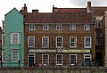
 Yeovil shops.jpg 640 × 425; 62 KB


