Category:July 2008 in Buckinghamshire
Ceremonial counties of England: Bedfordshire · Berkshire · Buckinghamshire · Cambridgeshire · Cheshire · Cornwall · Cumbria · Derbyshire · Devon · Dorset · Durham · East Riding of Yorkshire · East Sussex · Essex · Gloucestershire · Greater London · Greater Manchester · Hampshire · Herefordshire · Hertfordshire · Kent · Lancashire · Leicestershire · Lincolnshire · Merseyside · Norfolk · North Yorkshire · Northamptonshire · Northumberland · Nottinghamshire · Oxfordshire · Shropshire · Somerset · South Yorkshire · Staffordshire · Suffolk · Surrey · Tyne and Wear · Warwickshire · West Midlands · West Sussex · West Yorkshire · Wiltshire · Worcestershire
City-counties: Bristol ·
Former historic counties:
Other former counties:
City-counties: Bristol ·
Former historic counties:
Other former counties:
Deutsch: Bilder, die im Juli 2008 in Buckinghamshire aufgenommen worden sind. Bitte beachten Sie, dass dies weder das Datum des Uploads noch das Datum des Scannens eines Fotos ist.
English: Images/pictures taken in Buckinghamshire during July 2008. Note this is not the date of the upload, nor the date a photo was scanned.
Español: Fotografías o imágenes tomadas en Buckinghamshire durante julio 2008. No es la fecha de subida ni escaneo, sino la fecha en que las fotografías o imágenes se crearon.
Esperanto: Bildoj faritaj en Buckinghamshire en julio 2008. Tio ne estas la dato, kiam la bildoj estis alŝutitaj aŭ skanitaj.
Français : Photographies ou images prises en Buckinghamshire durant juillet 2008. Ce n'est pas la date du téléchargement ou du scan.
Galego: Fotografías ou imaxes tomadas en Buckinghamshire durante xullo 2008. Non é a data de subida nin escaneamento, senón a data na que se crearon as fotografías ou imaxes.
Italiano: Fotografie o immagini scattate a Buckinghamshire nel luglio 2008. Nota bene: la data non si riferisce né a quella di upload né a quella in cui la foto è stata digitalizzata.
Norsk bokmål: Bilder tatt i Buckinghamshire i løpet av juli 2008. Merk at dette ikke er datoen for opplasting, eller når et bilde har blitt skannet.
Norsk nynorsk: Bilete teke i Buckinghamshire i løpet av juli 2008. Merk at dette ikkje er datoen for opplasting, eller når eit bilete har vorte skanna.
Русский: Изображения, сделанные в Buckinghamshire в течение июль 2008 (не дата загрузки изображения).
Українська: Зображення, зроблені в Buckinghamshire протягом липень 2008. Зауважте, що це не дата завантаження чи дата сканування фотографії.
| July 2007 | ← | July 2008 | → | July 2009 | |||||||
| Jan | Feb | Mar | Apr | May | Jun | Jul | Aug | Sep | Oct | Nov | Dec |
| 3 | 10 | 26 | 6 | 6 | 10 | 76 | 39 | 16 | 28 | 65 | 27 |
|---|---|---|---|---|---|---|---|---|---|---|---|
Media in category "July 2008 in Buckinghamshire"
The following 76 files are in this category, out of 76 total.
-
 All Saints Church, Wing - geograph.org.uk - 1480810.jpg 640 × 426; 316 KB
-
 An unusual war memorial - geograph.org.uk - 1198302.jpg 480 × 640; 95 KB
-
 Arriva The Shires 3703 KE55 CKP.JPG 3,712 × 2,088; 3.17 MB
-
 Aylesbury to Princes Risborough railway - geograph.org.uk - 898830.jpg 640 × 480; 100 KB
-

-
 Aylesbury, County Hall, Walton Street - geograph.org.uk - 897532.jpg 640 × 480; 79 KB
-
 Aylesbury, Friars Square car park - geograph.org.uk - 897821.jpg 640 × 480; 70 KB
-

-
 Aylesbury, St Mary's Church - geograph.org.uk - 897286.jpg 640 × 480; 87 KB
-

-
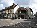 Aylesbury, The Harrow public house - geograph.org.uk - 897246.jpg 640 × 480; 69 KB
-

-

-
 Beside Crowell Wood - geograph.org.uk - 883962.jpg 640 × 480; 114 KB
-
 Bierton, Former Wesleyan Chapel - geograph.org.uk - 889908.jpg 640 × 480; 73 KB
-
 Bradenham village.jpg 640 × 427; 135 KB
-

-
 British Grand Prix 2008 - geograph.org.uk - 942476.jpg 640 × 480; 55 KB
-
 Broughton Crossing, The Dog House - geograph.org.uk - 889885.jpg 640 × 480; 61 KB
-
 Buckinghamshire Farmland - geograph.org.uk - 895155.jpg 640 × 208; 130 KB
-
 Burnham Abbey - Corn store - geograph.org.uk - 901596.jpg 640 × 426; 108 KB
-
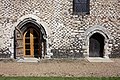 Burnham Abbey - detail of doorways - geograph.org.uk - 901583.jpg 640 × 426; 131 KB
-
 Burnham Abbey - Garden - geograph.org.uk - 901593.jpg 640 × 426; 116 KB
-
 Burnham Abbey - Garden - geograph.org.uk - 901606.jpg 640 × 426; 122 KB
-
 Burnham Abbey - geograph.org.uk - 901581.jpg 640 × 426; 90 KB
-
 Burnham Abbey - geograph.org.uk - 901602.jpg 640 × 441; 105 KB
-
 Burnham Abbey - House - geograph.org.uk - 901605.jpg 426 × 640; 106 KB
-
-
 Burnham Abbey - Refectory - geograph.org.uk - 901588.jpg 418 × 640; 89 KB
-
 Burnham Abbey - Sacristy - geograph.org.uk - 901591.jpg 640 × 426; 77 KB
-
 Burnham Abbey - Sacristy window - geograph.org.uk - 901589.jpg 402 × 640; 70 KB
-
 Cobbled Paving in Weston Underwood - geograph.org.uk - 1535224.jpg 640 × 449; 254 KB
-
 Collier's Lane, Stokenchurch - geograph.org.uk - 883551.jpg 640 × 480; 121 KB
-
 Collier's Lane, Stokenchurch - geograph.org.uk - 883634.jpg 640 × 480; 147 KB
-

-
 Danger Keep Out - private drive - geograph.org.uk - 895224.jpg 640 × 480; 193 KB
-
 Farmland, Chinnor - Radnage - geograph.org.uk - 883938.jpg 640 × 480; 137 KB
-
 Farmland, Flackwell Heath - geograph.org.uk - 902402.jpg 640 × 480; 135 KB
-
 Farmland, Radnage - geograph.org.uk - 883930.jpg 640 × 480; 136 KB
-
 Farmland, Radnage-Chinnor - geograph.org.uk - 884892.jpg 640 × 480; 141 KB
-
 Farmland, Radnage-Chinnor - geograph.org.uk - 884895.jpg 640 × 480; 143 KB
-
 Fawley Hill Railway - geograph.org.uk - 881761.jpg 640 × 427; 87 KB
-
 Fawley Hill Railway - geograph.org.uk - 881805.jpg 640 × 427; 88 KB
-
 Flint Road, Haddenham - geograph.org.uk - 883130.jpg 640 × 430; 100 KB
-

-
 Footpath through wheat, Radnage - geograph.org.uk - 883928.jpg 640 × 480; 142 KB
-
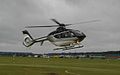 G-HOLM - geograph.org.uk - 942484.jpg 640 × 399; 33 KB
-
 Gates to Bulstrode Park - geograph.org.uk - 910115.jpg 640 × 480; 68 KB
-
 Haddenham, Church End - geograph.org.uk - 883119.jpg 640 × 430; 89 KB
-
 Haddenham, Towards Church End - geograph.org.uk - 883142.jpg 640 × 430; 86 KB
-
 St Mary's Hardwick - geograph.org.uk - 904434.jpg 640 × 426; 62 KB
-
 Hillside below Bledlow Ridge - geograph.org.uk - 883926.jpg 640 × 480; 125 KB
-

-
 Holy Cross, Hoggeston - geograph.org.uk - 891278.jpg 640 × 480; 78 KB
-
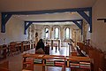
 Interior of Hardwick church. - geograph.org.uk - 904455.jpg 426 × 640; 71 KB
-
 Latimer village green - geograph.org.uk - 951267.jpg 640 × 480; 92 KB
-
 Lewis Hamilton - geograph.org.uk - 942518.jpg 640 × 454; 58 KB
-
 Nashdom Lane - geograph.org.uk - 900021.jpg 640 × 426; 91 KB
-
 Pann Mill, High Wycombe - geograph.org.uk - 881652.jpg 427 × 640; 123 KB
-
 Pitstone Windmill - geograph.org.uk - 1480797.jpg 630 × 439; 307 KB
-

-

-
 Slip road closed - geograph.org.uk - 878481.jpg 640 × 480; 104 KB
-
 St Mary the Virgin, Padbury - geograph.org.uk - 884893.jpg 640 × 480; 68 KB
-
 St. Martin's Church, Dunton - geograph.org.uk - 891059.jpg 640 × 480; 66 KB
-

-
 The Fawley Mountaineer - geograph.org.uk - 881792.jpg 427 × 640; 93 KB
-
 Tombstone for 247 persons. - geograph.org.uk - 904452.jpg 640 × 426; 112 KB
-
 Village Post Office, Weston Underwood - geograph.org.uk - 1535207.jpg 449 × 640; 171 KB
-
 Watermead Aylesbury - geograph.org.uk - 904485.jpg 640 × 426; 50 KB
-
 Watermead residents. - geograph.org.uk - 904487.jpg 640 × 426; 79 KB
-
 West Wycombe Combined School - geograph.org.uk - 888654.jpg 640 × 480; 89 KB
-
 West Wycombe, The Swan Inn - geograph.org.uk - 888606.jpg 640 × 480; 68 KB
-
 Wilton Farm, Little Marlow - geograph.org.uk - 902507.jpg 640 × 480; 119 KB
-
 All Saints Church, Wing - geograph.org.uk - 1480813.jpg 640 × 449; 215 KB
-


