Category:June 2009 in Highland (council area)
Council areas (municipalities) of Scotland: Aberdeen · Aberdeenshire · Angus · Argyll and Bute · Edinburgh · Fife · Glasgow · Highland · Inverclyde · Moray · North Ayrshire · Perth and Kinross · Renfrewshire · Scottish Borders · South Lanarkshire · Stirling ·
Deutsch: Bilder, die im Juni 2009 in Highland (council area) aufgenommen worden sind. Bitte beachten Sie, dass dies weder das Datum des Uploads noch das Datum des Scannens eines Fotos ist.
English: Images/pictures taken in Highland (council area) during June 2009. Note this is not the date of the upload, nor the date a photo was scanned.
Español: Fotografías o imágenes tomadas en Highland (council area) durante junio 2009. No es la fecha de subida ni escaneo, sino la fecha en que las fotografías o imágenes se crearon.
Esperanto: Bildoj faritaj en Highland (council area) en junio 2009. Tio ne estas la dato, kiam la bildoj estis alŝutitaj aŭ skanitaj.
Français : Photographies ou images prises en Highland (council area) durant juin 2009. Ce n'est pas la date du téléchargement ou du scan.
Galego: Fotografías ou imaxes tomadas en Highland (council area) durante xuño 2009. Non é a data de subida nin escaneamento, senón a data na que se crearon as fotografías ou imaxes.
Italiano: Fotografie o immagini scattate a Highland (council area) nel giugno 2009. Nota bene: la data non si riferisce né a quella di upload né a quella in cui la foto è stata digitalizzata.
Norsk bokmål: Bilder tatt i Highland (council area) i løpet av juni 2009. Merk at dette ikke er datoen for opplasting, eller når et bilde har blitt skannet.
Norsk nynorsk: Bilete teke i Highland (council area) i løpet av juni 2009. Merk at dette ikkje er datoen for opplasting, eller når eit bilete har vorte skanna.
Русский: Изображения, сделанные в Highland (council area) в течение июнь 2009 (не дата загрузки изображения).
Українська: Зображення, зроблені в Highland (council area) протягом червень 2009. Зауважте, що це не дата завантаження чи дата сканування фотографії.
| June 2008 | ← | June 2009 | → | June 2010 | |||||||
| Jan | Feb | Mar | Apr | May | Jun | Jul | Aug | Sep | Oct | Nov | Dec |
| 77 | 71 | 70 | 53 | 59 | 91 | 119 | 38 | 67 | 58 | 72 | 33 |
|---|---|---|---|---|---|---|---|---|---|---|---|
Subcategories
This category has the following 2 subcategories, out of 2 total.
G
- June 2009 in Glenfinnan (8 F)
I
- June 2009 in Inverness (5 F)
Media in category "June 2009 in Highland (council area)"
The following 89 files are in this category, out of 89 total.
-
 A deer in the Kingshouse Hotel campsite.jpg 3,648 × 2,736; 4.86 MB
-
 A view on Skye from Eas a' Bhradain - geograph.org.uk - 1353573.jpg 640 × 480; 53 KB
-
 A82 bridge by the Kingshouse Hotel - geograph.org.uk - 1533676.jpg 640 × 480; 87 KB
-
 A82 in Rannoch Moor - geograph.org.uk - 1351517.jpg 640 × 575; 76 KB
-
 Achanalt Railway Station - geograph.org.uk - 1380867.jpg 640 × 480; 83 KB
-
 Aim for it - geograph.org.uk - 1364987.jpg 640 × 480; 94 KB
-
 Ardnamurchan Point.jpg 2,272 × 1,704; 1.42 MB
-
 Ballindalloch Station - geograph.org.uk - 1372611.jpg 640 × 427; 82 KB
-
 Bernera Barracks 20090612.jpg 800 × 535; 274 KB
-
 Boathouse at Achranich - geograph.org.uk - 1379871.jpg 640 × 427; 39 KB
-
 Braemore Junction - geograph.org.uk - 1583942.jpg 640 × 480; 58 KB
-
 Bridge over the Allt Daim - geograph.org.uk - 1378772.jpg 800 × 600; 325 KB
-
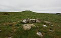
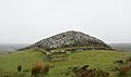 Camster Long Cairn 20090613 from north.jpg 800 × 475; 133 KB
-
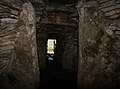 Camster Long Cairn 20090613 northern chamber.jpg 800 × 593; 194 KB
-
 Camster Long Cairn 20090613 southern chamber.jpg 800 × 588; 248 KB
-
 Camster Long Cairn 20090613.jpg 800 × 376; 104 KB
-
 Camster Round Cairn 20090613 interior.jpg 549 × 800; 210 KB
-
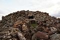
 Camster Round Cairn 20090613.jpg 800 × 549; 277 KB
-
 Car park and viewpoint, A832 - geograph.org.uk - 1583965.jpg 640 × 342; 65 KB
-
 Clachtoll Broch 20090612 01.jpg 800 × 536; 180 KB
-
 Clachtoll Broch 20090612 02.jpg 800 × 534; 205 KB
-
 Clachtoll Broch 20090612 03.jpg 800 × 522; 229 KB
-
 Clachtoll Broch 20090612 04.jpg 800 × 539; 337 KB
-
 Cnoc Freiceadain 20090614 North Cairn.jpg 800 × 588; 330 KB
-
 Cnoc Freiceadain 20090614 South Cairn.jpg 800 × 498; 184 KB
-
 Coast line near Kyleakin - geograph.org.uk - 1582488.jpg 640 × 480; 115 KB
-
 Crosskirk Broch Memorial Cairn 20090614.jpg 800 × 594; 336 KB
-
 Dochgarroch Lock - kingsley - 30-JUN-09.JPG 2,560 × 1,920; 1.03 MB
-
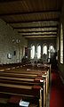
 Dornoch Cathedral 20090615 choir.jpg 800 × 624; 219 KB
-
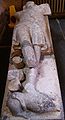 Dornoch Cathedral 20090615 effigy Richard de Moravia.jpg 435 × 800; 161 KB
-
 Dornoch Cathedral 20090615 stained glass Gilbert de Moravia.jpg 239 × 800; 172 KB
-
 Dornoch Cathedral 20090615.jpg 800 × 551; 210 KB
-
 Dun Grugaig 20090612 from south.jpg 800 × 542; 259 KB
-
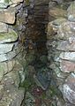
 Dun Grugaig 20090612 interior looking east.jpg 800 × 517; 264 KB
-
 Dun Grugaig 20090612 interior south wall gallery.jpg 565 × 800; 321 KB
-
 Dun Grugaig 20090612 south gallery.jpg 800 × 520; 348 KB
-
 Duntulm Castle 20090612 from the south.jpg 800 × 520; 158 KB
-
 Duntulm Castle 20090612 interior looking north.jpg 800 × 507; 244 KB
-
 Duntulm Castle 20090612 interior looking south east.jpg 800 × 572; 187 KB
-
 Dunvegan Castle - geograph.org.uk - 1374972.jpg 640 × 480; 180 KB
-
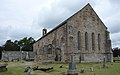 Fearn Abbey 20090615 from south east.jpg 800 × 502; 260 KB
-
 Fearn Abbey 20090615 interior.jpg 481 × 800; 163 KB
-
 Fearn Abbey 20090615 mausoleum on north side.jpg 800 × 571; 240 KB
-
 Fearn Abbey 20090615 tomb abbot Finlay McFaed.jpg 800 × 658; 356 KB
-
 Foot path to Loch Ossian Youth Hostel - geograph.org.uk - 1346541.jpg 640 × 480; 129 KB
-
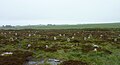
 Grazing north of Callakille - geograph.org.uk - 1380211.jpg 1,024 × 685; 1.14 MB
-
 Healabhal Bheag - geograph.org.uk - 1370892.jpg 640 × 480; 159 KB
-
 Healabhal Bheag summit - geograph.org.uk - 1370908.jpg 640 × 480; 173 KB
-
 Hill o' Many Stanes 20090613 01.jpg 800 × 431; 218 KB
-
 Hill o' Many Stanes 20090613 02.jpg 800 × 550; 185 KB
-
 Hilton of Cadboll Chapel 20090615.jpg 800 × 392; 188 KB
-
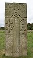 Hilton of Cadboll Stone replica 20090615 cross side.jpg 457 × 800; 200 KB
-
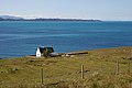 House north of Lonbain - geograph.org.uk - 1380237.jpg 1,000 × 669; 251 KB
-
 Houses at Callakille - geograph.org.uk - 1380227.jpg 1,000 × 669; 211 KB
-
 Hut Circle near Carn nam Muc - geograph.org.uk - 1360695.jpg 640 × 480; 60 KB
-
 Invasion of the rose snatchers - geograph.org.uk - 1348762.jpg 640 × 480; 89 KB
-
 Kilchoan Bay.jpg 2,272 × 1,704; 1.44 MB
-
 Loch Teacuis, Àrd an Tiobairt - geograph.org.uk - 1343860.jpg 640 × 480; 104 KB
-
 Looking down to Loch Carron - geograph.org.uk - 1569661.jpg 640 × 480; 143 KB
-

-
 North Channel - geograph.org.uk - 1503702.jpg 640 × 480; 68 KB
-
 Nybster Broch 20090614 from northeast.jpg 800 × 458; 212 KB
-
 Nybster Broch 20090614 from west.jpg 800 × 560; 330 KB
-
 Nybster Broch 20090614 stairs blockhouse.jpg 800 × 581; 349 KB
-
 Osdale River - geograph.org.uk - 1370805.jpg 640 × 480; 197 KB
-
 Pap of Glencoe 20090602.jpg 3,088 × 2,056; 2.43 MB
-
 Saltings, Kinlochteacuis - geograph.org.uk - 1343832.jpg 640 × 480; 89 KB
-
 Saltings, Loch Teacuis - geograph.org.uk - 1343822.jpg 640 × 480; 88 KB
-
 Sheepfold east of Marishader - geograph.org.uk - 1361763.jpg 640 × 480; 192 KB
-
 Shores of Loch Teacuis - geograph.org.uk - 1343840.jpg 640 × 360; 88 KB
-
 Skerry and buoy - geograph.org.uk - 1378622.jpg 640 × 405; 61 KB
-
 St Mary's Church (Crosskirk) 20090614 01.jpg 800 × 541; 264 KB
-
 St Mary's Church (Crosskirk) 20090614 02.jpg 800 × 530; 319 KB
-
 Submerged rock - geograph.org.uk - 1383353.jpg 640 × 485; 51 KB
-
 The Abhainn Chuaig - geograph.org.uk - 1380200.jpg 1,000 × 669; 278 KB
-
 The beach at Nairn - geograph.org.uk - 1344591.jpg 640 × 480; 89 KB
-
 The Old Forge, Inverie, Knoydart - geograph.org.uk - 1381034.jpg 640 × 480; 104 KB
-
 The old station house at Achanalt - geograph.org.uk - 1380872.jpg 640 × 480; 110 KB
-
 Thurso Castle 20090614 01.jpg 800 × 532; 169 KB
-
 Thurso Castle 20090614 02.jpg 800 × 507; 275 KB
-
 Tidal rock - geograph.org.uk - 1399720.jpg 640 × 433; 50 KB
-
 Toposcope Face - geograph.org.uk - 1334849.jpg 640 × 427; 108 KB
-
 Uig Tower 20090608.jpg 2,271 × 1,335; 1.16 MB
-
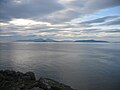
 View across the Inner Sound - geograph.org.uk - 1379757.jpg 1,000 × 667; 265 KB
-
 View north west over the Inner Sound - geograph.org.uk - 1380347.jpg 1,000 × 669; 253 KB
-
 View over the Inner Sound - geograph.org.uk - 1380206.jpg 1,000 × 657; 271 KB
-
 View towards Callakille - geograph.org.uk - 1380223.jpg 1,000 × 654; 180 KB
-
 View towards Lonbain - geograph.org.uk - 1380243.jpg 1,000 × 669; 260 KB
-
 Wool shop north of Cuaig - geograph.org.uk - 1380195.jpg 640 × 428; 95 KB


_20090614_01.jpg)
_20090614_02.jpg)


