Category:May 2009 in Highland (council area)
Council areas (municipalities) of Scotland: Aberdeenshire · Argyll and Bute · Dumfries and Galloway · Edinburgh · Fife · Glasgow · Highland · Moray · Scottish Borders · Stirling · West Lothian
Deutsch: Bilder, die im Mai 2009 in Highland (council area) aufgenommen worden sind. Bitte beachten Sie, dass dies weder das Datum des Uploads noch das Datum des Scannens eines Fotos ist.
English: Images/pictures taken in Highland (council area) during May 2009. Note this is not the date of the upload, nor the date a photo was scanned.
Español: Fotografías o imágenes tomadas en Highland (council area) durante mayo 2009. No es la fecha de subida ni escaneo, sino la fecha en que las fotografías o imágenes se crearon.
Esperanto: Bildoj faritaj en Highland (council area) en majo 2009. Tio ne estas la dato, kiam la bildoj estis alŝutitaj aŭ skanitaj.
Français : Photographies ou images prises en Highland (council area) durant mai 2009. Ce n'est pas la date du téléchargement ou du scan.
Galego: Fotografías ou imaxes tomadas en Highland (council area) durante maio 2009. Non é a data de subida nin escaneamento, senón a data na que se crearon as fotografías ou imaxes.
Italiano: Fotografie o immagini scattate a Highland (council area) nel maggio 2009. Nota bene: la data non si riferisce né a quella di upload né a quella in cui la foto è stata digitalizzata.
Norsk bokmål: Bilder tatt i Highland (council area) i løpet av mai 2009. Merk at dette ikke er datoen for opplasting, eller når et bilde har blitt skannet.
Norsk nynorsk: Bilete teke i Highland (council area) i løpet av mai 2009. Merk at dette ikkje er datoen for opplasting, eller når eit bilete har vorte skanna.
Русский: Изображения, сделанные в Highland (council area) в течение май 2009 (не дата загрузки изображения).
Українська: Зображення, зроблені в Highland (council area) протягом травень 2009. Зауважте, що це не дата завантаження чи дата сканування фотографії.
| May 2008 | ← | May 2009 | → | May 2010 | |||||||
| Jan | Feb | Mar | Apr | May | Jun | Jul | Aug | Sep | Oct | Nov | Dec |
| 77 | 71 | 69 | 53 | 59 | 91 | 117 | 38 | 67 | 58 | 72 | 33 |
|---|---|---|---|---|---|---|---|---|---|---|---|
Media in category "May 2009 in Highland (council area)"
The following 58 files are in this category, out of 58 total.
-
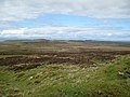 A wide boggy expanse - geograph.org.uk - 1347428.jpg 640 × 480; 106 KB
-
 Achnahaird Bay at (very) low tide - geograph.org.uk - 1329955.jpg 640 × 480; 64 KB
-
 Allt an Reidhe Ruaidh - geograph.org.uk - 1340464.jpg 640 × 480; 171 KB
-
 Allt an Reidhe Ruaidh - geograph.org.uk - 1340478.jpg 640 × 480; 144 KB
-
-
 Arnisort Church of Scotland - geograph.org.uk - 1308347.jpg 640 × 480; 41 KB
-
 Arnisort Church of Scotland sign - geograph.org.uk - 1308351.jpg 640 × 480; 62 KB
-
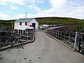 Badentarbet Pier - geograph.org.uk - 1330288.jpg 640 × 480; 79 KB
-
 Below Cnoc na Coileach - geograph.org.uk - 1310130.jpg 640 × 480; 100 KB
-
 Bluebells by the Bishop's Walk, Nigg. - geograph.org.uk - 1292700.jpg 640 × 480; 305 KB
-
 Bridge in upper Glen Golly - geograph.org.uk - 1559639.jpg 640 × 480; 102 KB
-
 Burn above Loch Meadie - geograph.org.uk - 1311078.jpg 640 × 480; 87 KB
-
 Changeable weather on the Sleat coast - geograph.org.uk - 1318851.jpg 640 × 480; 102 KB
-

-
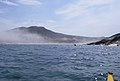
 Crowlin Isles from above Culduie - geograph.org.uk - 1313450.jpg 640 × 277; 28 KB
-
 Culbin Forest, Scotland.jpg 3,008 × 2,000; 2.51 MB
-
 Dry harbour - geograph.org.uk - 1292759.jpg 640 × 480; 85 KB
-
 Dun Maraig - geograph.org.uk - 1308126.jpg 640 × 427; 176 KB
-
 Dunfermline Building Society - geograph.org.uk - 1289230.jpg 640 × 479; 73 KB
-
 Dunvegan Castle - geograph.org.uk - 1340894.jpg 640 × 480; 90 KB
-
 Edinbane Power Station - geograph.org.uk - 1297264.jpg 640 × 480; 79 KB
-
 Edinbane Power Station construction - geograph.org.uk - 1297246.jpg 640 × 480; 145 KB
-
 Edinbane Power Station site office - geograph.org.uk - 1297194.jpg 640 × 480; 149 KB
-
 Entering Strathan - geograph.org.uk - 1700333.jpg 2,770 × 1,869; 1.44 MB
-
 Farmland above Nigg. - geograph.org.uk - 1295940.jpg 640 × 480; 199 KB
-
 GlencoeVillage.jpg 4,288 × 2,848; 2.13 MB
-
-
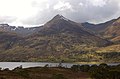
 Hillside on Beinn Eirisalain - geograph.org.uk - 1313332.jpg 640 × 480; 99 KB
-
 I can see a windmill - geograph.org.uk - 1339841.jpg 640 × 480; 97 KB
-
 Land Rover, Cape Wrath Range - geograph.org.uk - 1700262.jpg 2,639 × 1,578; 1.82 MB
-
 Loch Bad an t-Seabhaig - geograph.org.uk - 1304427.jpg 640 × 480; 106 KB
-
 Loch Bad an t-Seabhaig - geograph.org.uk - 1304432.jpg 640 × 480; 84 KB
-
 Loch Cluanie at sunset.jpg 2,568 × 3,856; 2.29 MB
-
 Loch Farr - geograph.org.uk - 1319040.jpg 640 × 480; 198 KB
-
 Looking down Glen Golly - geograph.org.uk - 1559606.jpg 640 × 480; 88 KB
-
 Looking down Glen Golly - geograph.org.uk - 1561179.jpg 640 × 480; 83 KB
-
 Looking down Glen Golly - geograph.org.uk - 1561201.jpg 640 × 480; 75 KB
-
 Low tide at Brora - geograph.org.uk - 1327984.jpg 640 × 480; 81 KB
-
 Lower Glen Golly - geograph.org.uk - 1561157.jpg 640 × 480; 114 KB
-
 Lower Glen Golly - geograph.org.uk - 1561221.jpg 640 × 480; 81 KB
-

-
 Plockton Shores - geograph.org.uk - 1355577.jpg 640 × 427; 75 KB
-
 Port Odhar, Cape Wrath Bombing Range - geograph.org.uk - 1700258.jpg 3,004 × 1,415; 1.02 MB
-
 Power station access road - geograph.org.uk - 1297296.jpg 640 × 480; 177 KB
-
 Railway points controls - geograph.org.uk - 1340031.jpg 640 × 480; 124 KB
-
 Remains of old Sheepfold - geograph.org.uk - 1311279.jpg 640 × 426; 217 KB
-

-
 Sheepfold on An Fharaid - geograph.org.uk - 1341964.jpg 640 × 480; 140 KB
-
 Sheepfold to east of mouth of Annat Burn - geograph.org.uk - 1301134.jpg 640 × 480; 277 KB
-
 Shore of Loch Greshornish - geograph.org.uk - 1313434.jpg 640 × 480; 102 KB
-
 Shrunken Lochan on Mountain Top - geograph.org.uk - 1302431.jpg 640 × 480; 58 KB
-
 Substantial fank - geograph.org.uk - 1337403.jpg 640 × 480; 118 KB
-
 Substantial fank - geograph.org.uk - 1337408.jpg 640 × 480; 116 KB
-
 Towards Cnoc an Fhreiceadain - geograph.org.uk - 1338548.jpg 640 × 480; 146 KB
-
 Towards River Strathy - geograph.org.uk - 1340405.jpg 640 × 480; 165 KB
-
 Track to Shenavall - geograph.org.uk - 1309253.jpg 640 × 426; 373 KB
-

-
 Wooded Glen - geograph.org.uk - 1343416.jpg 640 × 425; 92 KB

_low_tide_-_geograph.org.uk_-_1329955.jpg)


,_near_Nigg._-_geograph.org.uk_-_1292713.jpg)


