Category:Kallenhardt
human settlement in Germany   | |||||
| Upload media | |||||
| Instance of |
| ||||
|---|---|---|---|---|---|
| Location | Rüthen, Soest, Arnsberg Government Region, North Rhine-Westphalia, Germany | ||||
| Elevation above sea level |
| ||||
 | |||||
Subcategories
This category has the following 7 subcategories, out of 7 total.
A
- Altes Rathaus (Kallenhardt) (3 F)
C
- St. Clemens (Kallenhardt) (18 F)
H
- Hoher Stein (Kallenhardt) (7 F)
- Hohler Stein (Kallenhardt) (14 F)
S
- Schloss Körtlinghausen (42 F)
- Siechenkapelle (Kallenhardt) (4 F)
Media in category "Kallenhardt"
The following 39 files are in this category, out of 39 total.
-
 588 Kallenhardt.JPG 1,600 × 1,200; 568 KB
-
 Bikepark Warstein.jpg 1,600 × 1,200; 712 KB
-
 Kallenhardt - 1.jpg 5,428 × 2,129; 3.13 MB
-
 Kallenhardt - 2.jpg 5,472 × 3,648; 7.38 MB
-
 Kallenhardt - Bildstock Alte Kreisstraße - 1.jpg 2,472 × 4,992; 5.36 MB
-
 Kallenhardt - Bildstock Alte Kreisstraße - 2.jpg 2,120 × 3,520; 3.57 MB
-
 Kallenhardt - Bildstock Untere Steinpforte.jpg 2,664 × 5,160; 5.53 MB
-
 Kallenhardt - Brücke nähe Klausemühle.jpg 5,472 × 3,648; 9 MB
-
 Kallenhardt - Kattensiepen 101 - 1.jpg 4,180 × 3,101; 6.58 MB
-
 Kallenhardt - Kattensiepen 101 - 2.jpg 4,180 × 3,064; 6.21 MB
-
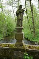 Kallenhardt - Nepomuk-Statue - 1.jpg 3,648 × 5,472; 8.3 MB
-
 Kallenhardt - Nepomuk-Statue - 2.jpg 3,648 × 5,472; 8.44 MB
-
 Kallenhardt - Untere Steinpforte 3.jpg 3,157 × 2,832; 3.06 MB
-
 Kallenhardt 02 1.jpg 800 × 531; 179 KB
-
 Kallenhardt Panorama (14126002895).jpg 8,671 × 2,592; 19.62 MB
-
 Kallenhardt-Knippschild1-Asio.JPG 2,503 × 1,584; 1.07 MB
-
 Lörmecke Hohler Stein.jpg 2,048 × 1,536; 1.05 MB
-
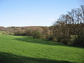 Lörmecketal.jpg 2,048 × 1,536; 842 KB
-
 NSG Lörmecketal fd (18).JPG 5,184 × 3,888; 6.44 MB
-
 NSG Lörmecketal.jpg 2,048 × 1,536; 733 KB
-
 Rüthen Kallenhardt Bildstock01.jpg 3,456 × 5,184; 4.32 MB
-
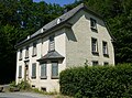
 Rüthen Kallenhardt Burgtorstr 13.jpg 3,456 × 5,184; 4.74 MB
-
 Rüthen Kallenhardt FFSN-1999.jpg 4,928 × 3,280; 16.26 MB
-
 Rüthen Kallenhardt Kirchstr 28.jpg 3,456 × 5,184; 4.14 MB
-
 Rüthen Kallenhardt Kirchstr 29.jpg 3,456 × 5,184; 4.05 MB
-
 Rüthen-Kallenhardt FFSN-7386.jpg 4,033 × 2,682; 10.83 MB
-
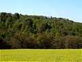
 Rüthen-Kallenhardt Kulturlandschaft fd (1).jpg 5,184 × 3,888; 6.74 MB
-
 Rüthen-Kallenhardt Steinbruch FFSN-7375.jpg 4,256 × 2,832; 16.02 MB
-
 Rüthen-Kallenhardt Steinbruch FFSN-7380.jpg 4,256 × 2,832; 15.15 MB
-
 Rüthen-Kallenhardt Steinbruch FFSN-7381.jpg 3,588 × 2,387; 10.04 MB
-
 Rüthen-Kallenhardt Steinbruch FFSN-7382.jpg 4,256 × 2,832; 15.27 MB
-
 Rüthen-Kallenhardt Steinbruchrand fd (1).jpg 5,184 × 3,888; 6.25 MB
-
 Rüthen-Kallenhardt Steinbruchrand fd (2).jpg 5,184 × 3,888; 5.96 MB
-
 Rüthen-Kallenhardt, Kriegerdenkmal.jpg 4,176 × 2,784; 5.2 MB
-
 Schild Lörmecketal.jpg 1,200 × 1,600; 768 KB
-
 St. Clemens Kallenhardt Fernansicht 2012.jpg 2,473 × 2,093; 3.19 MB
-
 Wappen Kallenhardt.png 229 × 288; 33 KB
-
 Wappen Kallenhardt.svg 719 × 826; 7 KB
-
 Warsteiner Bikepark.jpg 1,600 × 1,200; 770 KB


.JPG)


.jpg)


.jpg)
.jpg)


.jpg)