Category:Kansas gubernatorial election maps (set)
States of the United States: Alabama · Alaska · Arizona · Arkansas · California · Colorado · Connecticut · Delaware · Florida · Georgia · Hawaii · Idaho · Illinois · Indiana · Iowa · Kansas · Kentucky · Louisiana · Maine · Maryland · Massachusetts · Michigan · Minnesota · Mississippi · Missouri · Montana · Nebraska · Nevada · New Hampshire · New Jersey · New Mexico · New York · North Carolina · North Dakota · Ohio · Oklahoma · Oregon · Pennsylvania · Rhode Island · South Carolina · South Dakota · Tennessee · Texas · Utah · Vermont · Virginia · Washington · West Virginia · Wisconsin · Wyoming
Guam
Guam
This category is an image set. It should contain only images that have the same style, and should have a parent category that is purely topical.
Subcategories
This category has only the following subcategory.
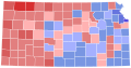
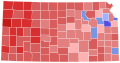
Media in category "Kansas gubernatorial election maps (set)"
The following 59 files are in this category, out of 59 total.
-
 1862 Kansas gubernatorial election results map by county.svg 800 × 412; 193 KB
-
 1872 Kansas gubernatorial election results map by county.svg 800 × 412; 310 KB
-
 1878 Kansas gubernatorial election results map by county.svg 800 × 412; 348 KB
-
 1888 Kansas gubernatorial election results map by county.svg 810 × 424; 34 KB
-
 1890 Kansas gubernatorial election results map by county.svg 810 × 424; 34 KB
-
 1892 Kansas gubernatorial election results map by county.svg 810 × 424; 34 KB
-
 1894 Kansas gubernatorial election results map by county.svg 810 × 424; 34 KB
-
 1896 Kansas gubernatorial election results map by county.svg 810 × 424; 34 KB
-
 1898 Kansas gubernatorial election results map by county.svg 810 × 424; 34 KB
-
 1900 Kansas gubernatorial election results map by county.svg 810 × 424; 34 KB
-
 1902 Kansas gubernatorial election results map by county.svg 810 × 424; 34 KB
-
 1904 Kansas gubernatorial election results map by county.svg 810 × 424; 34 KB
-
 1906 Kansas gubernatorial election results map by county.svg 810 × 424; 34 KB
-
 1908 Kansas gubernatorial election results map by county.svg 744 × 400; 215 KB
-
 1910 Kansas gubernatorial election results map by county.svg 744 × 400; 215 KB
-
 1912 Kansas gubernatorial election results map by county.svg 744 × 400; 215 KB
-
 1914 Kansas gubernatorial election results map by county.svg 744 × 400; 215 KB
-
 1916 Kansas gubernatorial election results map by county.svg 744 × 400; 215 KB
-
 1918 Kansas gubernatorial election results map by county.svg 810 × 424; 34 KB
-
 1920 Kansas gubernatorial election results map by county.svg 810 × 424; 34 KB
-
 1922 Kansas gubernatorial election results map by county.svg 810 × 424; 34 KB
-
 1924 Kansas gubernatorial election results map by county.svg 810 × 424; 34 KB
-
 1926 Kansas gubernatorial election results map by county.svg 810 × 424; 34 KB
-
 1928 Kansas gubernatorial election results map by county.svg 810 × 424; 34 KB
-
 1930 Kansas gubernatorial election results map by county.svg 744 × 400; 215 KB
-
 1932 Kansas gubernatorial election results map by county.svg 810 × 424; 34 KB
-
 1934 Kansas gubernatorial election results map by county.svg 810 × 424; 34 KB
-
 1936 Kansas gubernatorial election results map by county.svg 810 × 424; 34 KB
-
 1938 Kansas gubernatorial election results map by county.svg 810 × 424; 34 KB
-
 1940 Kansas gubernatorial election results map by county.svg 810 × 424; 34 KB
-
 1942 Kansas gubernatorial election results map by county.svg 810 × 424; 34 KB
-
 1944 Kansas gubernatorial election results map by county.svg 810 × 424; 34 KB
-
 1946 Kansas gubernatorial election results map by county.svg 810 × 424; 34 KB
-
 1948 Kansas gubernatorial election results map by county.svg 810 × 424; 34 KB
-
 1950 Kansas gubernatorial election results map by county.svg 810 × 424; 34 KB
-
 1952 Kansas gubernatorial election results map by county.svg 810 × 424; 34 KB
-
 1954 Kansas gubernatorial election results map by county.svg 810 × 424; 34 KB
-
 1956 Kansas gubernatorial election results map by county.svg 810 × 424; 34 KB
-
 1958 Kansas gubernatorial election results map by county.svg 810 × 424; 34 KB
-
 1960 Kansas gubernatorial election results map by county.svg 810 × 424; 34 KB
-
 1962 Kansas gubernatorial election results map by county.svg 810 × 424; 34 KB
-
 1964 Kansas gubernatorial election results map by county.svg 810 × 424; 34 KB
-
 1966 Kansas gubernatorial election results map by county.svg 810 × 424; 34 KB
-
 1968 Kansas gubernatorial election results map by county.svg 810 × 424; 34 KB
-
 1970 Kansas gubernatorial election results map by county.svg 810 × 424; 34 KB
-
 1972 Kansas gubernatorial election results map by county.svg 810 × 424; 34 KB
-
 1974 Kansas gubernatorial election results map by county.svg 810 × 424; 34 KB
-
 1978 Kansas gubernatorial election results map by county.svg 810 × 424; 34 KB
-
 1982 Kansas gubernatorial election results map by county.svg 810 × 424; 34 KB
-
 1986 Kansas gubernatorial election results map by county.svg 810 × 424; 34 KB
-
 1990 Kansas gubernatorial election results map by county.svg 810 × 424; 34 KB
-
 1994 Kansas gubernatorial election results map by county.svg 810 × 424; 34 KB
-
 1998 Kansas gubernatorial election results map by county.svg 810 × 424; 34 KB
-
 2002 Kansas gubernatorial election results map by county.svg 810 × 424; 34 KB
-
 2006 Kansas gubernatorial election results map by county.svg 810 × 424; 34 KB
-
 2010 Kansas gubernatorial election results map by county.svg 810 × 424; 34 KB
-
 2014 Kansas gubernatorial election results map by county.svg 810 × 424; 34 KB
-
 2018 Kansas gubernatorial election results map by county.svg 810 × 424; 34 KB
-
 2022 Kansas gubernatorial election results map by county.svg 810 × 424; 34 KB


