Category:Kenton, Suffolk
village in Suffolk, UK  | |||||
| Upload media | |||||
| Instance of | |||||
|---|---|---|---|---|---|
| Location | Kenton, Mid Suffolk, Suffolk, East of England, England | ||||
 | |||||
Subcategories
This category has the following 4 subcategories, out of 4 total.
Media in category "Kenton, Suffolk"
The following 70 files are in this category, out of 70 total.
-
 Anchor Storage - geograph.org.uk - 1364644.jpg 640 × 480; 89 KB
-
 Applegate House ^ footpath - geograph.org.uk - 4658424.jpg 3,072 × 2,304; 1.89 MB
-
 Beehives - geograph.org.uk - 1367711.jpg 640 × 480; 121 KB
-
 Blackcurrants - geograph.org.uk - 1367707.jpg 640 × 480; 93 KB
-
 Church Lane Kenton - geograph.org.uk - 4658412.jpg 3,072 × 2,304; 3.28 MB
-
 Church Lane sign - geograph.org.uk - 4595326.jpg 2,970 × 2,225; 4.32 MB
-
 Church Lane ^ Bridleway - geograph.org.uk - 4658429.jpg 3,072 × 2,304; 1.87 MB
-
 Church Lane ^ Bridleway - geograph.org.uk - 4658452.jpg 3,072 × 2,304; 1.97 MB
-
 Church Lane ^ footpath - geograph.org.uk - 4658388.jpg 3,072 × 2,304; 1.78 MB
-
 Church Lane, Kenton - geograph.org.uk - 1909448.jpg 3,072 × 2,304; 1.49 MB
-
 Church Lane, Kenton - geograph.org.uk - 1909450.jpg 3,072 × 2,304; 1.33 MB
-
 Church Lane, Kenton - geograph.org.uk - 4595324.jpg 3,072 × 2,304; 1.93 MB
-
 Church Lane, Kenton - geograph.org.uk - 4658326.jpg 3,072 × 2,304; 3.42 MB
-
 Church Lane, Kenton - geograph.org.uk - 4658409.jpg 3,072 × 2,304; 1.76 MB
-
 Clear Footpath - geograph.org.uk - 2362664.jpg 1,200 × 1,600; 625 KB
-
 Contractors in Kenton Hall driveway - geograph.org.uk - 4381969.jpg 1,024 × 768; 295 KB
-
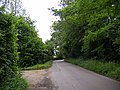
 Entering Kenton on Low Road - geograph.org.uk - 4595298.jpg 3,072 × 2,304; 1.99 MB
-
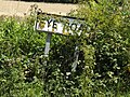 Eye Road sign - geograph.org.uk - 4595322.jpg 3,072 × 2,304; 1.99 MB
-
 Eye Road ^ Telephone Box - geograph.org.uk - 4605452.jpg 3,072 × 2,304; 1.86 MB
-
 Eye Road, Kenton - geograph.org.uk - 4595315.jpg 3,072 × 2,304; 2.08 MB
-
 Eye Road, Kenton - geograph.org.uk - 4635923.jpg 3,052 × 2,122; 2.39 MB
-
 Eye Road, Kenton - geograph.org.uk - 4658284.jpg 3,072 × 2,199; 3.2 MB
-
 Footpath - geograph.org.uk - 2362663.jpg 1,600 × 1,200; 547 KB
-
 Footpath - geograph.org.uk - 4370847.jpg 1,024 × 768; 346 KB
-
 Footpath off Church Lane - geograph.org.uk - 4658415.jpg 3,072 × 2,304; 1.88 MB
-
 Footpath off Church Lane - geograph.org.uk - 4658427.jpg 2,304 × 3,072; 2.97 MB
-
 Footpath off Low Road - geograph.org.uk - 2362661.jpg 1,600 × 1,200; 531 KB
-
 Footpath to Low Road - geograph.org.uk - 4635989.jpg 3,072 × 2,304; 1.81 MB
-
 Footpath to Low Road - geograph.org.uk - 4635994.jpg 3,072 × 2,304; 1.98 MB
-
 Gates to Kenton Lodge - geograph.org.uk - 4370843.jpg 1,024 × 768; 516 KB
-
 Green Fields - geograph.org.uk - 2362762.jpg 1,600 × 1,200; 486 KB
-
 Hall Cottages through the trees - geograph.org.uk - 4381971.jpg 1,024 × 768; 316 KB
-
 Houses in Kenton - geograph.org.uk - 4381993.jpg 1,024 × 768; 282 KB
-
 Kenton Hall Postbox - geograph.org.uk - 4636050.jpg 2,304 × 2,458; 3.02 MB
-
 Kenton Hall Postbox - geograph.org.uk - 4636066.jpg 3,072 × 2,304; 1.9 MB
-
 Kenton Hall sign - geograph.org.uk - 4636058.jpg 2,946 × 2,207; 3.31 MB
-
 Kenton Road, Kenton - geograph.org.uk - 4595311.jpg 3,047 × 2,257; 3.13 MB
-
 Kenton Road, Kenton - geograph.org.uk - 4635940.jpg 3,072 × 2,304; 1.83 MB
-
 Kenton Road, Kenton - geograph.org.uk - 4636021.jpg 3,072 × 2,304; 1.84 MB
-
 Kenton Road, Kenton - geograph.org.uk - 4636062.jpg 3,072 × 2,304; 1.81 MB
-
 Kenton Road, Kenton - geograph.org.uk - 4636067.jpg 2,792 × 2,142; 2.21 MB
-
 Kenton Village Name sign on Low Road - geograph.org.uk - 4595275.jpg 3,072 × 2,304; 1.97 MB
-
 Kenton Village Name sign on Low Road - geograph.org.uk - 4595300.jpg 2,935 × 2,199; 3.55 MB
-
 Low Road - geograph.org.uk - 2362659.jpg 1,200 × 1,600; 721 KB
-
 Low Road sign - geograph.org.uk - 4595284.jpg 3,072 × 2,304; 1.96 MB
-
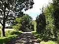
 Low Road, Kenton - geograph.org.uk - 4595281.jpg 2,970 × 2,135; 2.58 MB
-
 Old farm trailer and sheds - geograph.org.uk - 4381960.jpg 1,024 × 768; 563 KB
-
 Ploughed field with headland and drainage ditch - geograph.org.uk - 4370809.jpg 1,024 × 768; 478 KB
-
 Post Office Kenton Forge Postbox - geograph.org.uk - 2570765.jpg 3,072 × 2,304; 1.44 MB
-
 Post Office Kenton Forge Postbox - geograph.org.uk - 2570767.jpg 3,072 × 2,304; 1.45 MB
-
 Post Office Kenton Forge Postbox - geograph.org.uk - 2570768.jpg 2,304 × 3,072; 1.6 MB
-
 Post Office Kenton Forge Postbox - geograph.org.uk - 2570772.jpg 3,072 × 2,304; 1.31 MB
-
 Recently ploughed field from the headland - geograph.org.uk - 4370805.jpg 1,024 × 768; 479 KB
-
 Road at the junction with Low Road - geograph.org.uk - 4595288.jpg 3,072 × 2,304; 1.83 MB
-
 Road by Suddon Hall - geograph.org.uk - 4370816.jpg 1,024 × 768; 384 KB
-
 Roadsign on Eye Road - geograph.org.uk - 4595319.jpg 2,181 × 2,900; 2.97 MB
-
 Roadsign on Eye Road - geograph.org.uk - 4658318.jpg 2,039 × 2,711; 2.17 MB
-
 Roadsign on Low Road - geograph.org.uk - 4595287.jpg 2,159 × 2,871; 3.91 MB
-
 Telephone box near Sycamore Farm - geograph.org.uk - 4381990.jpg 1,024 × 768; 426 KB
-
 Telephone Box off Eye Road - geograph.org.uk - 4605457.jpg 2,304 × 3,072; 2.55 MB
-
 Track From Blood Hall - geograph.org.uk - 1364684.jpg 640 × 480; 110 KB
-
 Tree - geograph.org.uk - 2362771.jpg 1,200 × 1,600; 535 KB
-
 Wheat growing near Kenton - geograph.org.uk - 192096.jpg 611 × 455; 361 KB
-
 Bridleway to Blood Hall - geograph.org.uk - 325551.jpg 640 × 480; 81 KB
-
 Bridleway, just west of Kenton - geograph.org.uk - 348439.jpg 640 × 480; 96 KB
-
 Cottages by Fleming's Hall - geograph.org.uk - 325578.jpg 640 × 420; 65 KB
-
 Farmhouse at Red House Farm - geograph.org.uk - 348418.jpg 640 × 425; 116 KB
-
 Footpath at Kenton - geograph.org.uk - 325565.jpg 640 × 480; 96 KB
-
 Part of Sycamore Farm - geograph.org.uk - 325560.jpg 640 × 480; 58 KB
-


