Category:Mid Suffolk District
local government district in Suffolk, England  | |||||
| Upload media | |||||
| Instance of | |||||
|---|---|---|---|---|---|
| Location | Suffolk, East of England, England | ||||
| Capital | |||||
| Legislative body |
| ||||
| Inception |
| ||||
| Population |
| ||||
| Area |
| ||||
| official website | |||||
 | |||||
English: Mid Suffolk is a district in the county of Suffolk, England.
Subcategories
This category has the following 125 subcategories, out of 125 total.
- Maps of Mid Suffolk District (6 F)
A
B
C
D
E
F
G
H
K
L
M
N
O
P
R
S
T
W
- Whitton, Mid Suffolk (19 F)
Y
Media in category "Mid Suffolk District"
The following 60 files are in this category, out of 60 total.
-
 A1088 at the junction with Kiln Lane - geograph.org.uk - 4795258.jpg 3,072 × 2,304; 1.9 MB
-
 A1088 heading east - geograph.org.uk - 4704656.jpg 640 × 480; 59 KB
-
 A1088 ^ roadsign - geograph.org.uk - 4988158.jpg 3,072 × 2,304; 2.52 MB
-
 A14 from the overbridge at Woolpit - geograph.org.uk - 4500061.jpg 1,024 × 768; 385 KB
-
 A14 westbound near Broadgrass Green - geograph.org.uk - 4704660.jpg 640 × 480; 66 KB
-
 B1088 at the junction with Church Road - geograph.org.uk - 4989440.jpg 3,072 × 2,304; 1.83 MB
-
 Bunkers Hill - geograph.org.uk - 2970394.jpg 640 × 461; 76 KB
-
 Cattle pasture north of Wortham Ling - geograph.org.uk - 1770299.jpg 640 × 480; 155 KB
-
 Church Lane ^ Bridge - geograph.org.uk - 4988915.jpg 3,072 × 2,277; 3.93 MB
-
 Church Road sign - geograph.org.uk - 4989701.jpg 3,072 × 2,304; 1.91 MB
-
 Church Road sign - geograph.org.uk - 4990035.jpg 3,072 × 2,304; 1.9 MB
-
 Church Road ^ The Rectory Postbox - geograph.org.uk - 4989917.jpg 3,072 × 2,304; 1.89 MB
-
 Church Road, Tostock - geograph.org.uk - 4989435.jpg 3,072 × 2,304; 1.72 MB
-
 Dog no to sel - panoramio.jpg 1,920 × 1,275; 487 KB
-
 DVSA (Driver and Vehicle Standards Agency) at Woolpit - geograph.org.uk - 4987631.jpg 3,072 × 2,304; 2.01 MB
-
 DVSA (Driver and Vehicle Standards Agency) at Woolpit - geograph.org.uk - 4987632.jpg 3,072 × 2,304; 1.84 MB
-
 Each Bicycle 18 Pounds - panoramio.jpg 1,920 × 1,275; 542 KB
-
 Ekfield sign - geograph.org.uk - 4990017.jpg 3,011 × 2,262; 3.98 MB
-
 Entrance to Mulleyswood Farm - geograph.org.uk - 4293743.jpg 3,072 × 2,207; 3.09 MB
-
 Entrance to Mulleyswood Farm - geograph.org.uk - 4293760.jpg 2,756 × 2,065; 3.45 MB
-
 Entrance to St.John the Divine Church - geograph.org.uk - 4989732.jpg 2,304 × 3,072; 4 MB
-
 Farmland west of Elmswell - geograph.org.uk - 4664967.jpg 640 × 480; 60 KB
-
 Farmland, Button Haugh Green - geograph.org.uk - 2940920.jpg 640 × 480; 72 KB
-
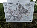 Footpath Map off Church Road - geograph.org.uk - 4989747.jpg 3,072 × 2,304; 1.93 MB
-
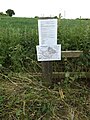 Footpath Notice off Church Road - geograph.org.uk - 4989745.jpg 2,304 × 3,072; 4.32 MB
-
 Footpath off Wetherden Road - geograph.org.uk - 2940950.jpg 640 × 480; 50 KB
-
 Footpath running alongside rail lines - geograph.org.uk - 3073031.jpg 2,448 × 3,264; 2.15 MB
-
 Footpath to Wetherden Road - geograph.org.uk - 4001466.jpg 1,557 × 2,341; 829 KB
-
 Grave at St.John the Divine Church - geograph.org.uk - 4989749.jpg 2,216 × 2,947; 4.69 MB
-
 Jubilee Terrace sign - geograph.org.uk - 4990101.jpg 3,072 × 2,304; 1.87 MB
-
 Mid Suffolk District Council.svg 360 × 185; 3 KB
-
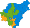 Mid Suffolk UK ward map 2019.svg 685 × 642; 466 KB
-
 Mid Suffolk UK ward map 2023.svg 685 × 642; 466 KB
-
 Mid Suffolk wards 2003.svg 1,390 × 1,266; 693 KB
-
 Mid Suffolk wards 2007.svg 1,390 × 1,266; 691 KB
-
 Mulleyswood Farm sign - geograph.org.uk - 4293747.jpg 2,849 × 2,132; 1.79 MB
-
 Pond, Willow Farm - geograph.org.uk - 2940923.jpg 640 × 480; 133 KB
-
 Railway Lines at Station Road Level Crossing - geograph.org.uk - 4990199.jpg 3,072 × 2,304; 1.91 MB
-
 Roadsign on Church Road - geograph.org.uk - 4989484.jpg 2,995 × 2,244; 3.36 MB
-
 Roadsign on the A1088 - geograph.org.uk - 4988163.jpg 3,072 × 2,304; 1.78 MB
-
 Rural Suffolk - geograph.org.uk - 2970390.jpg 640 × 419; 68 KB
-
 St.John the Divine Church car park entrance - geograph.org.uk - 4989737.jpg 3,072 × 2,304; 1.87 MB
-
 St.John the Divine Church Notice Board - geograph.org.uk - 4989713.jpg 2,265 × 3,011; 4.6 MB
-
 St.John the Divine Church Path - geograph.org.uk - 4989736.jpg 2,304 × 3,072; 4.09 MB
-
 Steps to Church Road - geograph.org.uk - 4989725.jpg 2,304 × 3,072; 4.37 MB
-
 The Fox Public House sign - geograph.org.uk - 4990182.jpg 2,291 × 3,046; 2.01 MB
-
 The Rectory Postbox - geograph.org.uk - 4989926.jpg 3,072 × 2,304; 1.93 MB
-
 The Rectory Postbox - geograph.org.uk - 4989942.jpg 2,253 × 2,995; 5 MB
-
 The Rectory Postbox - geograph.org.uk - 4989944.jpg 2,304 × 3,072; 3.24 MB
-
 The Rectory Postbox - geograph.org.uk - 4989946.jpg 3,072 × 2,304; 1.9 MB
-
 Water tower near Button Haugh Green - geograph.org.uk - 4016979.jpg 4,320 × 3,240; 4.4 MB
-
 Water tower near Button Haugh Green - geograph.org.uk - 4016990.jpg 4,320 × 3,240; 3.14 MB
-
 Water tower, Button Haugh Green - geograph.org.uk - 2940919.jpg 640 × 480; 55 KB
-
 Wetherden Road heading east - geograph.org.uk - 2940947.jpg 640 × 480; 75 KB
-
 Wetherden Road Postbox - geograph.org.uk - 4990113.jpg 3,072 × 2,304; 1.91 MB
-
 Wetherden Road Postbox - geograph.org.uk - 4990116.jpg 3,072 × 2,304; 1.89 MB
-
 Wetherden Road Postbox - geograph.org.uk - 4990120.jpg 1,675 × 2,950; 4.39 MB
-
 Wetherden Road Postbox - geograph.org.uk - 4990122.jpg 2,304 × 3,072; 3.88 MB
-
 Wetherden Road sign - geograph.org.uk - 4990127.jpg 3,072 × 2,304; 1.79 MB
-
 Willow Farm - geograph.org.uk - 2940924.jpg 640 × 480; 107 KB


_at_Woolpit_-_geograph.org.uk_-_4987631.jpg)
_at_Woolpit_-_geograph.org.uk_-_4987632.jpg)


