Category:Thwaite, Suffolk
English: Thwaite is a rural village in England.
village and civil parish in Suffolk, United Kingdom  | |||||
| Upload media | |||||
| Instance of | |||||
|---|---|---|---|---|---|
| Location | Mid Suffolk, Suffolk, East of England, England | ||||
 | |||||
Subcategories
This category has the following 2 subcategories, out of 2 total.
B
- Bucks Head, Thwaite (3 F)
G
Media in category "Thwaite, Suffolk"
The following 88 files are in this category, out of 88 total.
-
 A140 Ipswich Road,Thwaite - geograph.org.uk - 4671824.jpg 3,072 × 2,304; 1.83 MB
-
 A140 near Stoke Ash School - geograph.org.uk - 4256338.jpg 640 × 400; 50 KB
-
 A140 The Street, Brockford Street - geograph.org.uk - 4671803.jpg 3,072 × 2,304; 1.74 MB
-
 A140 towards Norwich - geograph.org.uk - 4666956.jpg 640 × 480; 83 KB
-
 A140, northbound - geograph.org.uk - 4256327.jpg 640 × 381; 57 KB
-
 Brockford Grarage, Brockford Street - geograph.org.uk - 4671785.jpg 3,072 × 2,304; 1.88 MB
-
 Brockford Street Village Name sign - geograph.org.uk - 4671802.jpg 2,253 × 2,995; 2.23 MB
-
 Brookside by the A140 - geograph.org.uk - 4256325.jpg 640 × 408; 26 KB
-
 Brookside, Thwaite - geograph.org.uk - 5876872.jpg 1,024 × 684; 224 KB
-
 Bucks Head Inn Public House sign - geograph.org.uk - 4676469.jpg 2,240 × 2,978; 2.36 MB
-
 Bucks Head Inn Public House sign - geograph.org.uk - 4676476.jpg 2,240 × 2,978; 1.21 MB
-
 Bucks Head Inn Public House. Thwaite - geograph.org.uk - 4676439.jpg 3,072 × 2,304; 1.7 MB
-
 Bucks Head Inn Public House. Thwaite - geograph.org.uk - 4676479.jpg 3,072 × 2,304; 1.95 MB
-
 Bucks Head Inn, Thwaite - geograph.org.uk - 4256329.jpg 640 × 430; 51 KB
-
 By the A140 - geograph.org.uk - 4256333.jpg 640 × 374; 54 KB
-
 Church Lane sign - geograph.org.uk - 4671932.jpg 3,072 × 2,304; 1.99 MB
-
 Church Lane, Thwaite - geograph.org.uk - 4671865.jpg 3,072 × 2,304; 1.85 MB
-
 Church Lane, Thwaite - geograph.org.uk - 4671962.jpg 3,072 × 2,304; 1.88 MB
-
 Church Lane, Thwaite - geograph.org.uk - 4671963.jpg 3,072 × 2,304; 1.89 MB
-
 Church Lane, Thwaite - geograph.org.uk - 4671964.jpg 3,072 × 2,304; 1.67 MB
-
 Collingsford Road, Brockford Street - geograph.org.uk - 4671838.jpg 3,072 × 2,304; 1.77 MB
-
 Cottage in Thwaite - geograph.org.uk - 2116002.jpg 640 × 480; 172 KB
-
 Cottages in Thwaite - geograph.org.uk - 2116009.jpg 640 × 480; 127 KB
-
 Daffodils beside the road near Hill House - geograph.org.uk - 4381647.jpg 1,024 × 768; 544 KB
-
 Entering Brockford Street on the A140 The Street - geograph.org.uk - 4671801.jpg 3,072 × 2,304; 1.93 MB
-
 Farm driveway - geograph.org.uk - 4381621.jpg 640 × 480; 124 KB
-
 Farmland and woodland near Thwaite - geograph.org.uk - 4666955.jpg 640 × 480; 44 KB
-

-
 Farmland near Hill House - geograph.org.uk - 4711027.jpg 640 × 480; 69 KB
-
 Footbridge to St. Georges Church (geograph 4671959).jpg 2,304 × 3,072; 3.75 MB
-
 Footpath around the headland - geograph.org.uk - 4381617.jpg 1,024 × 768; 588 KB
-
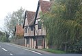 Half timbered houses, Thwaite - geograph.org.uk - 4256331.jpg 640 × 430; 75 KB
-
 High Lane, Thwaite - geograph.org.uk - 4602141.jpg 3,072 × 2,304; 2.03 MB
-
 High Lane, Thwaite - geograph.org.uk - 4602166.jpg 3,072 × 2,304; 1.74 MB
-
 Live Fence Sign - geograph.org.uk - 376908.jpg 480 × 640; 93 KB
-
 Mill Lane turning, A140 - geograph.org.uk - 4256343.jpg 640 × 412; 53 KB
-
 Minor road towards Collingford - geograph.org.uk - 4711028.jpg 640 × 480; 44 KB
-
 Minor road, Collingsford Bridge - geograph.org.uk - 4666974.jpg 640 × 480; 102 KB
-
 Northbound A140 - geograph.org.uk - 5876886.jpg 1,024 × 684; 289 KB
-
 Old Milestone - geograph.org.uk - 1206003.jpg 480 × 640; 159 KB
-
 One After Another - geograph.org.uk - 376854.jpg 640 × 480; 78 KB
-
 Path to St. George's Church - geograph.org.uk - 4671961.jpg 3,072 × 2,304; 1.93 MB
-
 Post Office Lambert Road Postbox - geograph.org.uk - 4671945.jpg 3,072 × 2,304; 1.93 MB
-
 Post Office Lambert Road Postbox - geograph.org.uk - 4671947.jpg 2,304 × 3,072; 3.78 MB
-
 Post Office Lambert Road Postbox - geograph.org.uk - 4671948.jpg 2,304 × 3,072; 2.6 MB
-
 Power Across The Land - geograph.org.uk - 369756.jpg 640 × 480; 102 KB
-
 Service station on The Street (A140) - geograph.org.uk - 4666946.jpg 640 × 480; 53 KB
-
 St. George's Church ^ Village Notice Boards - geograph.org.uk - 4671954.jpg 2,164 × 2,881; 2.83 MB
-
 Stoke Ash, A140 - geograph.org.uk - 4256340.jpg 640 × 614; 124 KB
-
 Stubble field and woodland - geograph.org.uk - 4666942.jpg 640 × 480; 66 KB
-
 Stubble field off The Street (A140) - geograph.org.uk - 4666950.jpg 640 × 480; 64 KB
-
 The Buck's Head, on the A140 at Thwaite - geograph.org.uk - 4381638.jpg 1,024 × 768; 334 KB
-
 The Old School Room - geograph.org.uk - 4671951.jpg 3,072 × 2,304; 1.86 MB
-
 The old school room in Thwaite (geograph 2116005).jpg 640 × 480; 139 KB
-
 The Old School Room, Thwaite - geograph.org.uk - 4671956.jpg 2,304 × 3,072; 3.23 MB
-
 The Old School Room, Thwaite - geograph.org.uk - 4671957.jpg 3,072 × 2,304; 1.84 MB
-
 The sign of the Buck's Head at Thwaite - geograph.org.uk - 4381640.jpg 1,024 × 768; 263 KB
-
 The Street (A140) - geograph.org.uk - 4666948.jpg 640 × 480; 39 KB
-
 This year's crop emerging from a dry soil - geograph.org.uk - 4381650.jpg 1,024 × 768; 458 KB
-
 Thwaite Road, Thwaite - geograph.org.uk - 4602161.jpg 3,072 × 2,304; 1.81 MB
-
 Thwaite Road, Thwaite - geograph.org.uk - 4602182.jpg 3,072 × 2,304; 1.96 MB
-
 Thwaite Road, Thwaite - geograph.org.uk - 4602186.jpg 3,072 × 2,304; 1.84 MB
-
 Thwaite village sign (detail) - geograph.org.uk - 4381634.jpg 768 × 1,024; 521 KB
-
 Thwaite Village sign (geograph 4671929).jpg 2,304 × 3,072; 2.1 MB
-
 Thwaite Village sign (geograph 4671933).jpg 2,304 × 3,072; 3.24 MB
-
 Thwaite village sign - geograph.org.uk - 4381632.jpg 768 × 1,024; 531 KB
-
 Thwaite Village sign - geograph.org.uk - 4671927.jpg 2,304 × 3,072; 2.98 MB
-
 Thwaite Village sign - geograph.org.uk - 4671965.jpg 3,072 × 2,304; 1.89 MB
-
 To Norwich 27 - geograph.org.uk - 1205999.jpg 640 × 480; 134 KB
-
 Trees in bud and green grass, summer's coming - geograph.org.uk - 4381620.jpg 1,024 × 768; 525 KB
-
 Wickham Road ^ Post Office Lambert Road Postbox - geograph.org.uk - 4671943.jpg 3,072 × 2,304; 1.9 MB
-
 Wickham Road ^ Post Office Lambert Road Postbox - geograph.org.uk - 4671949.jpg 3,072 × 2,304; 1.89 MB
-
 Wickham Road ^ The Old School Room - geograph.org.uk - 4671950.jpg 3,072 × 2,304; 1.89 MB
-
 Wickham Road, Thwaite - geograph.org.uk - 4381609.jpg 1,024 × 768; 474 KB
-
 Wickham Road, Thwaite - geograph.org.uk - 4381611.jpg 1,024 × 768; 454 KB
-
 Wickham Road, Thwaite - geograph.org.uk - 4381615.jpg 1,024 × 768; 323 KB
-
 Wickham Road, Thwaite - geograph.org.uk - 4671859.jpg 3,072 × 2,304; 1.91 MB
-
 Willow Hall, Thwaite (geograph 7551351).jpg 1,600 × 900; 691 KB
-
 Baptist Church, Chapel Lane - geograph.org.uk - 367170.jpg 640 × 480; 131 KB
-
 Country Road - geograph.org.uk - 369868.jpg 640 × 480; 143 KB
-
 Five Cross Ways - geograph.org.uk - 369852.jpg 640 × 480; 144 KB
-
 Footpath Sign - geograph.org.uk - 376918.jpg 480 × 640; 97 KB
-
 Giant Haystacks - geograph.org.uk - 369889.jpg 640 × 480; 76 KB
-
 Hill Farm - geograph.org.uk - 292966.jpg 640 × 480; 112 KB
-
 Just Another Road - geograph.org.uk - 369915.jpg 640 × 480; 61 KB
-
 Public Footpath - geograph.org.uk - 369772.jpg 640 × 480; 100 KB
-
 Stoke Ash Primary School - geograph.org.uk - 353777.jpg 640 × 442; 78 KB
-
 Wickham Road - geograph.org.uk - 369765.jpg 640 × 480; 148 KB


.jpg)


_-_geograph.org.uk_-_4666946.jpg)


_-_geograph.org.uk_-_4666950.jpg)


.jpg)


_-_geograph.org.uk_-_4666948.jpg)


_-_geograph.org.uk_-_4381634.jpg)
.jpg)
.jpg)


.jpg)


