Category:Kerk van Oosterleek
| Object location | | View all coordinates using: OpenStreetMap |
|---|
church building in Drechterland, Netherlands  | |||||
| Upload media | |||||
| Instance of | |||||
|---|---|---|---|---|---|
| Location | Oosterleek, Drechterland, North Holland, Netherlands | ||||
| Street address |
| ||||
| Located on street |
| ||||
| Heritage designation |
| ||||
| Inception |
| ||||
| Significant event |
| ||||
| Religion or worldview | |||||
 | |||||
|
This is a category about rijksmonument number 37136
|
| Address |
|
Media in category "Kerk van Oosterleek"
The following 13 files are in this category, out of 13 total.
-
 Doopbekken en houder - Oosterleek - 20175096 - RCE.jpg 1,200 × 957; 182 KB
-
 Dorpsgezicht - Oosterleek - 20175090 - RCE.jpg 1,200 × 770; 189 KB
-
 Hervormde kerk, Oosterleek.JPG 3,888 × 2,592; 3.44 MB
-
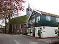 Kerk en herberg tIJsselmeer Oosterleek.jpg 4,896 × 3,672; 1.86 MB
-
 Kuip van de preekstoel - Oosterleek - 20175094 - RCE.jpg 956 × 1,200; 204 KB
-
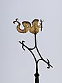 Neptunus kerk Oosterleek.jpg 3,672 × 4,896; 475 KB
-
 Noord-zijde - Oosterleek - 20175092 - RCE.jpg 1,200 × 812; 292 KB
-
 Orgelkas - Oosterleek - 20175097 - RCE.jpg 960 × 1,200; 158 KB
-
 Preekstoel en doophek - Oosterleek - 20175093 - RCE.jpg 1,200 × 953; 169 KB
-
 Toren hervormde kerk, Oosterleek.JPG 2,592 × 3,888; 4.04 MB
-
 Voorlezers lezenaar - Oosterleek - 20175095 - RCE.jpg 1,200 × 960; 213 KB
-
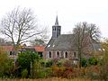 Zicht op Oosterleek.jpg 4,425 × 3,319; 1.43 MB
-
 Zuid-west zijde - Oosterleek - 20175091 - RCE.jpg 811 × 1,200; 249 KB


