Category:Kirche Horno
| Object location | | View all coordinates using: OpenStreetMap |
|---|
church building in Brandenburg state, Germany  | |||||
| Upload media | |||||
| Instance of | |||||
|---|---|---|---|---|---|
| Location | Horno, Forst, Spree-Neiße District, Brandenburg, Germany | ||||
| Inception |
| ||||
| Religion or worldview | |||||
 | |||||
Media in category "Kirche Horno"
The following 4 files are in this category, out of 4 total.
-
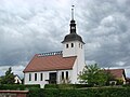 Horno Kirche.jpg 1,000 × 750; 514 KB
-
 Rogow Cyrkej 1.JPG 2,963 × 1,976; 2.4 MB
-
 Rogow Cyrkej 2.JPG 2,963 × 1,976; 2.49 MB
-
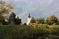 Rogow Wjesny Hat.JPG 2,963 × 1,976; 3.29 MB


