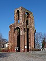
Category:Klosterkirche (Gramzow in der Uckermark)
| Object location | | View all coordinates using: OpenStreetMap |
|---|
 | |||||
| Upload media | |||||
| Instance of | |||||
|---|---|---|---|---|---|
| Location | Gramzow, Uckermark District, Brandenburg, Germany | ||||
| Architectural style | |||||
| Heritage designation | |||||
 | |||||
This is the category of the Brandenburger Baudenkmal (cultural heritage monument) with the ID 09130063 (Wikidata)
|
Media in category "Klosterkirche (Gramzow in der Uckermark)"
The following 13 files are in this category, out of 13 total.
-
 Gramzow Klosterruine.JPG 1,675 × 2,400; 923 KB
-
 GramzowKlosterruine08 09 17 jiw.jpg 1,938 × 2,953; 1.21 MB
-
 Klosterberg Gramzow 2018 SE.jpg 6,751 × 4,461; 11.62 MB
-
 Klosterkirche Gramzow.jpg 2,520 × 3,776; 3.98 MB
-
 Klosterruine Gramzow.jpg 2,520 × 3,776; 4.05 MB
-
 Prämonstratenserkloster I.JPG 768 × 1,024; 329 KB
-
 Prämonstratenserkloster II.JPG 768 × 1,024; 305 KB
-
 Prämonstratenserkloster III.JPG 1,024 × 768; 303 KB
-
 Prämonstratenserkloster IV.JPG 1,024 × 768; 168 KB
-
 Prämonstratenserkloster Tafel I.JPG 1,024 × 768; 258 KB
-
 Prämonstratenserkloster Tafel II.JPG 768 × 1,024; 237 KB
-
 Prämonstratenserkloster.JPG 768 × 1,024; 203 KB
-
 Ruine der Klosterkirche Gramzow 2018 SE.jpg 2,432 × 3,245; 3.85 MB


