Category:Kraftwerk Amsteg
| Object location | | View all coordinates using: OpenStreetMap |
|---|
high-pressure run-of-river power plant on the Reuss River in Silenen in the canton of Uri, Switzerland  | |||||
| Upload media | |||||
| Instance of | |||||
|---|---|---|---|---|---|
| Part of | |||||
| Location | Silenen, Uri, Switzerland | ||||
| Located in or next to body of water | |||||
| Street address |
| ||||
| Owned by | |||||
| Heritage designation | |||||
| Service entry |
| ||||
| Inception |
| ||||
| Nominal power capacity |
| ||||
| Length |
| ||||
| Elevation above sea level |
| ||||
| official website | |||||
 | |||||
Subcategories
This category has the following 2 subcategories, out of 2 total.
S
- Standseilbahn Amsteg - Bristen (14 F)
Media in category "Kraftwerk Amsteg"
The following 31 files are in this category, out of 31 total.
-
 2013-06-08 Maderaner-Valo (Foto Dietrich Michael Weidmann) 057.JPG 3,872 × 2,592; 3.82 MB
-
 Amsteg - Hydroelectric Plant SBB (30906976742).jpg 5,200 × 3,467; 8.39 MB
-
 Amsteg - Hydroelectric Plant SBB (30906980672).jpg 5,200 × 3,466; 14.03 MB
-
 Amsteg - Hydroelectric Plant SBB (30906985902).jpg 5,200 × 3,466; 8.23 MB
-
 Amsteg - Hydroelectric Plant SBB (30907112152).jpg 5,200 × 3,466; 8.71 MB
-
 Amsteg - Hydroelectric Plant SBB (30934994051).jpg 5,200 × 3,467; 8.73 MB
-
 Amsteg - Hydroelectric Plant SBB (31013485496).jpg 5,200 × 3,466; 7.32 MB
-
 Amsteg - Hydroelectric Plant SBB (31049088755).jpg 5,200 × 3,467; 6.6 MB
-
 Amsteg - Hydroelectric Plant SBB (31049232965).jpg 5,200 × 3,466; 10.15 MB
-
 Amsteg - Hydroelectric Plant SBB (31049351345).jpg 5,200 × 3,467; 7.53 MB
-
 Amsteg - Hydroelectric Plant SBB (31049353275).jpg 5,200 × 3,466; 7.35 MB
-
 Amsteg - Hydroelectric Plant SBB (31049358495).jpg 5,200 × 3,466; 9.83 MB
-
 Amsteg - Hydroelectric Plant SBB (31049361305).jpg 5,200 × 3,466; 10.41 MB
-
 Amsteg - Hydroelectric Power Plant (30853973251).jpg 5,200 × 3,467; 9.76 MB
-
 Amsteg - Hydroelectric Power Plant (30853977411).jpg 5,200 × 3,467; 11.8 MB
-
 Amsteg-generatorhalle-2.jpg 2,263 × 2,304; 1 MB
-
 Amsteg-generatorhalle.jpg 3,456 × 2,304; 1.41 MB
-
 Amsteg-laeuferversorgung.jpg 3,456 × 2,304; 1.22 MB
-
 Amsteg-schieber.jpg 3,456 × 2,304; 1.4 MB
-
 Amsteg-stillgelegte-generatorgruppe-erreger.jpg 3,456 × 2,304; 1.32 MB
-
 Amsteg-stillgelegte-generatorgruppe.jpg 3,279 × 1,803; 1.02 MB
-
 ETH-BIB-Amsteg, Baustelle SBB Kraftwerk, Turbinenkaverne-Com L43-0263-0001-0007.jpg 2,895 × 1,890; 3.57 MB
-
 Funicular Amsteg - Bristen Reactivated (33341478886).jpg 960 × 540; 278 KB
-
Funicular Amsteg - Bristen Reactivated.webm 3 min 0 s, 640 × 360; 23.04 MB
-
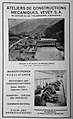 Inserat ACMV ca 1926.jpg 1,811 × 2,960; 1,017 KB
-
 Lagekarte Kraftwerk Amsteg.png 4,886 × 3,996; 4.46 MB
-
 Längsprofil des Kraftwerks Amsteg mit Horizontalschnitt des Zulaufstollens.jpg 1,263 × 560; 167 KB
-
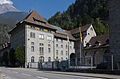 Silenen-Kraftwerk-SBB.jpg 2,020 × 1,333; 2.31 MB
-
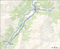
 Standseilbahn Amsteg-Bristen, map OSM 2023.png 1,046 × 1,534; 750 KB
-
 Staubecken Pfaffensprung, Umlauftunnel und Wasserfassung.jpg 902 × 627; 150 KB
-
 Zentrale Amsteg, Innenansicht des Maschinenhauses.jpg 633 × 756; 156 KB
_057.JPG)
.jpg)
.jpg)
.jpg)
.jpg)
.jpg)
.jpg)
.jpg)
.jpg)
.jpg)
.jpg)
.jpg)
.jpg)
.jpg)
.jpg)


.jpg)


