Category:Kullu district
district of Himachal Pradesh, India  .svg) | |||||
| Upload media | |||||
| Instance of | |||||
|---|---|---|---|---|---|
| Location |
| ||||
| Capital | |||||
| Population |
| ||||
| Area |
| ||||
| official website | |||||
 | |||||
There are 3 talukas of this district.
Subcategories
This category has the following 42 subcategories, out of 42 total.
!
- Quality images of Kullu (13 F)
A
- Ambika Temple, Nirmand (17 F)
B
- Balo Temple (3 F)
- Banjar, India (4 F)
- Bhrigu Lake (5 F)
- Bijli Mahadev (12 F)
C
- Chandrakhani (8 F)
D
- Dakshineshwar Temple, Nirmand (17 F)
G
- Gauri Shankar Temple, Dasal (3 F)
- Gauri Shankar Temple, Naggar (34 F)
J
K
- Khirganga (42 F)
- Kurpan Valley (3 F)
L
- Lug Valley (India) (2 F)
M
- Kullu Manali Circuit (1 P, 174 F)
- Marhi (28 F)
- Miniature Shiva temple (13 F)
N
P
- Pancha Pandava Temple, Nirmand (10 F)
- Parasuram Kothi Temple, Nirmand (25 F)
- Parbati Range (7 F)
S
- Sar Pass Trek (103 F)
- Saurkundi Pass Trek (54 F)
- Shillihar (empty)
Pages in category "Kullu district"
The following 2 pages are in this category, out of 2 total.
Media in category "Kullu district"
The following 188 files are in this category, out of 188 total.
-
 1 walking hiking trail Kullu Manali Himachal Pradesh.jpg 4,128 × 2,752; 6.74 MB
-
 20180215 125240 Jpg (248307411).jpeg 2,048 × 1,152; 1.27 MB
-
 20180217 082659 Jpg (248307419).jpeg 2,048 × 1,152; 606 KB
-
 A Panorama at Raison, Himachal Pradesh (The Rafting land) (10441716153).jpg 5,500 × 1,658; 1.92 MB
-
 A Tributary of Parvati river, Nov21.jpg 4,608 × 3,072; 3.03 MB
-
 A View From Somewhere Between Tosh And Kasol (197732781).jpeg 2,048 × 1,153; 910 KB
-
 Adherents of GOD.jpg 3,264 × 2,448; 3.4 MB
-
 Approach to Shamshari Mahadev temple.jpg 2,136 × 4,624; 2.58 MB
-
 Ascension (183944937).jpeg 2,048 × 1,365; 786 KB
-
 Autumn (183848585).jpeg 1,365 × 2,048; 763 KB
-
 Autumn Creeping (183848589).jpeg 2,048 × 1,366; 774 KB
-
 Beas river, With sand traps, Kullu District, Himachal Pradesh - 1.jpeg 3,200 × 2,400; 4.27 MB
-
 Beas Valley - Kothi - Kullu 2014-05-10 2295.JPG 4,000 × 6,016; 19.17 MB
-
 Beautiful Home in Nagdhar - Anni, Kullu.jpg 2,592 × 1,456; 648 KB
-
 Beyond the malice.jpg 719 × 539; 64 KB
-
 Blissful.jpg 3,024 × 4,032; 3.71 MB
-
 Blue trees (47583639782).jpg 1,843 × 1,037; 1.55 MB
-
 Bore -a fruit at beas river.jpg 3,024 × 4,032; 1.81 MB
-
 Bridge over River Beas - Leh–Manali Highway - Manali 2014-05-10 2259.JPG 6,016 × 4,000; 16.46 MB
-
 Bridge over River Beas - Leh–Manali Highway - Manali 2014-05-10 2260.JPG 6,016 × 4,000; 16.91 MB
-
 Bridge over River Beas - Solang Valley-Palchan - Kullu 2014-05-10 2513.JPG 5,540 × 4,000; 13.63 MB
-
 Buffalo calf Marhi Himachal Jul19 R16 01645.jpg 2,656 × 1,771; 3.16 MB
-
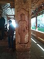
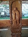
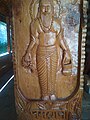
 Carved Wooden Pillar of Shamshari Mahadev temple 02.jpg 3,120 × 4,160; 747 KB
-
 Carved Wooden Pillar of Shamshari Mahadev temple 03.jpg 3,120 × 4,160; 531 KB
-
 Carved Wooden Pillar of Shamshari Mahadev temple 04.jpg 3,120 × 4,160; 811 KB
-
 Carved Wooden Pillar of Shamshari Mahadev temple 05.jpg 3,120 × 4,160; 749 KB
-
 Carved Wooden Pillar of Shamshari Mahadev temple 06.jpg 3,120 × 4,160; 1.02 MB
-
 Carved Wooden Pillar of Shamshari Mahadev temple 07.jpg 3,120 × 4,160; 1.39 MB
-
 Carved Wooden Pillar of Shamshari Mahadev temple 08.jpg 3,120 × 4,160; 674 KB
-
 Carved Wooden Pillar of Shamshari Mahadev temple 09.jpg 3,120 × 4,160; 462 KB
-
 Carved Wooden Pillar of Shamshari Mahadev temple 10.jpg 3,120 × 4,160; 943 KB
-
 Carved Wooden Pillar of Shamshari Mahadev temple 11.jpg 3,120 × 4,160; 954 KB
-
 Carved Wooden Pillars of Shamshari Mahadev temple 01.jpg 4,160 × 3,120; 380 KB
-
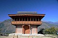
 Chehni Kothi.png 2,296 × 4,080; 12.78 MB
-
 Chilli (183937465).jpeg 2,048 × 1,366; 822 KB
-
 Cloudy weather in Himachal.jpg 4,032 × 3,024; 1.53 MB
-
 Common Blue Apollo Parnassius hardwickii I IMG 7202.jpg 781 × 600; 426 KB
-
 Deities of Kullu.jpg 1,024 × 769; 154 KB
-
 Factory Worker Making Clothes (Unsplash).jpg 6,000 × 4,000; 2.25 MB
-
 Fern (183848539).jpeg 2,048 × 1,365; 657 KB
-
 Fields & Beas River I2 IMG 3174.jpg 800 × 534; 144 KB
-
 Flowingpeace.jpg 4,320 × 3,240; 3.14 MB
-
 Food Products at Nagwain.jpg 5,184 × 3,456; 3.8 MB
-
 From bahu - panoramio.jpg 1,440 × 1,080; 1.17 MB
-
 Greens and blues.jpg 4,032 × 3,024; 2.59 MB
-
 Himalayas - Frozen River (9368455037).jpg 767 × 1,151; 798 KB
-
 Himalayas - Mountain river (9371230262).jpg 1,168 × 767; 1.09 MB
-
 Himalayas - Valley (9371218676).jpg 767 × 1,151; 752 KB
-
 Hit-the-stone.jpg 4,320 × 3,240; 2.86 MB
-
 Hourses.jpg 3,840 × 2,160; 2.58 MB
-
 Huefilms.jpg 2,448 × 3,264; 439 KB
-
 In Kullu distt, HP W IMG 7292.jpg 539 × 600; 155 KB
-
 Inner Seraj, Himachal Pradesh.jpg 480 × 640; 63 KB
-
 Jeebi se - panoramio.jpg 1,440 × 1,080; 967 KB
-
 Jibhi Banjar.jpg 1,836 × 3,264; 2.51 MB
-
 Jogini mataji - panoramio.jpg 1,440 × 1,080; 1.05 MB
-
 Juk aai badariya sawan ki - panoramio.jpg 3,488 × 2,616; 4.48 MB
-
 Just for fun.jpg 1,936 × 2,592; 751 KB
-
 Kais Dhar Medows.jpg 2,592 × 1,456; 1.37 MB
-
 Kais Dhar.jpg 4,160 × 3,120; 3.86 MB
-
 Kheer Ganga trek.jpg 2,448 × 2,448; 1.82 MB
-
 Kothi Himachal Pradesh.jpg 6,000 × 3,376; 15.26 MB
-
 Kullu Girl going along river Beas near Kullu , Himachal Pardes, India.JPG 4,608 × 3,456; 6.26 MB
-
 Kullu Scene 3.jpg 291 × 516; 46 KB
-
 Kullu Scene 4.jpg 240 × 320; 18 KB
-
 Kullu sightings.jpg 4,032 × 3,024; 1.65 MB
-
 Kullu, Himachal Pradesh, India - panoramio (1).jpg 2,592 × 1,944; 962 KB
-
 Kullu-Manali Scene.jpg 320 × 240; 21 KB
-
 Kulu tribal women in traditional dress, India (c. 1870).jpg 624 × 460; 108 KB
-
 Leh–Manali Highway - Kothi - Kullu 2014-05-10 2497.JPG 6,016 × 4,000; 14.34 MB
-
 Leh–Manali Highway - Kothi - Kullu 2014-05-10 2498.JPG 6,016 × 4,000; 14.09 MB
-
 Lisa Jane (63057849).jpeg 2,048 × 1,153; 450 KB
-
 Long tree's.jpg 2,304 × 4,096; 4.33 MB
-
 Loving the smiile.jpg 3,024 × 3,780; 3.89 MB
-
 Manali Trip 00.jpg 3,648 × 2,736; 3.94 MB
-
 Manali Trip 009.jpg 3,648 × 2,736; 3.76 MB
-
 Manali Trip 012.jpg 3,648 × 2,736; 3.78 MB
-
 Manali Trip 025.jpg 3,648 × 2,736; 3.77 MB
-
 Manali Trip 027.jpg 3,648 × 2,736; 2.78 MB
-
 Manali Trip 035.jpg 2,736 × 3,648; 1.92 MB
-
 Manali Trip 041.jpg 4,912 × 1,080; 2.11 MB
-
 Manu Temple Road, Manali, India (Unsplash e5gJPvSgvxk).jpg 6,000 × 4,000; 1.65 MB
-
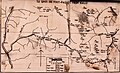 Map Passes Trails Kullu Spiti Himachal Jun18 D72 7078.jpg 5,121 × 3,102; 6.56 MB
-
 Masala tea.jpg 3,024 × 4,032; 1.58 MB
-
 Mountain Stream (69780001).jpeg 2,048 × 1,364; 1.3 MB
-
 Mountain sunrise (40669993613).jpg 1,907 × 1,120; 1.57 MB
-
 Mountainsviewkullu.jpg 2,592 × 1,080; 283 KB
-
 Nati dance of Himachal Pradesh.jpg 4,032 × 3,024; 3.03 MB
-
 Neel Kantha Mahadev (Nain ghar, Lahual Himachal Pradesh)-3.jpg 1,292 × 1,536; 1.27 MB
-
 Neel Kantha Mahadev (Nain ghar, Lahual Himachal Pradesh)-4.jpg 2,526 × 1,144; 809 KB
-
 NP Himachal Pradesh 21 (6348257616).jpg 1,280 × 850; 265 KB
-
 NP Himachal Pradesh 22 (6348257676).jpg 1,280 × 850; 255 KB
-
 NP Himachal Pradesh 24 (6347508115).jpg 1,280 × 850; 215 KB
-
 NP Himachal Pradesh 36 (6347508541).jpg 1,280 × 850; 320 KB
-
 NP Himachal Pradesh 63 (6348260116).jpg 1,280 × 850; 297 KB
-
 NP Himachal Pradesh 68 (6348260166).jpg 1,280 × 850; 187 KB
-
 NP Himachal Pradesh 74 (6348260734).jpg 1,280 × 848; 254 KB
-
 NP Himachal Pradesh 75 (6347511235).jpg 1,280 × 848; 235 KB
-
 NP Himachal Pradesh 76 (6348260830).jpg 1,280 × 848; 194 KB
-
 NP Himachal Pradesh 85 (6348262568).jpg 1,280 × 852; 173 KB
-
 NP Himachal Pradesh 86 (6347513019).jpg 1,280 × 852; 160 KB
-
 NP Himachal Pradesh 87 (6347511659).jpg 1,280 × 852; 222 KB
-
 NP Himachal Pradesh 88 (6348261316).jpg 1,280 × 850; 239 KB
-
 NP Himachal Pradesh 89 (6348261440).jpg 1,280 × 850; 203 KB
-
 NP Himachal Pradesh 90 (6348263504).jpg 1,280 × 850; 195 KB
-
 NP Himachal Pradesh 91 (6347513967).jpg 1,280 × 850; 194 KB
-
 NP Himachal Pradesh 92 (6347513575).jpg 1,280 × 850; 126 KB
-
 NP Himachal Pradesh 93 (6347511995).jpg 1,280 × 850; 163 KB
-
 NP Himachal Pradesh 94 (6347506987).jpg 1,280 × 850; 328 KB
-
 NP Himachal Pradesh 95 (6348256528).jpg 1,280 × 850; 316 KB
-
 NP Himachal Pradesh 96 (6348263280).jpg 848 × 1,280; 94 KB
-
 NP Himachal Pradesh 97 (6348261258).jpg 1,280 × 848; 86 KB
-
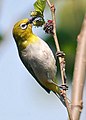
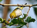 Oriental White Eye I IMG 0655.jpg 800 × 600; 385 KB
-
 Oriental White Eye I IMG 3997.jpg 800 × 600; 303 KB
-
 Oriental White Eye I- Himachal- IMG 3993.jpg 800 × 562; 335 KB
-
 Oriental White Eye- Bhopal I IMG 0656.jpg 800 × 560; 370 KB
-
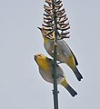 Oriental White Eye- Bhopal I IMG 0744.jpg 598 × 650; 262 KB
-
 Oriental White Eye- Bhopal I IMG 0759.jpg 467 × 650; 252 KB
-
 Panorama at Kullu.jpg 6,336 × 1,744; 5.52 MB
-
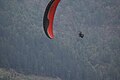 Paragliding-kullu.jpg 960 × 640; 73 KB
-
 Parbati Range, Nov21.jpg 4,608 × 2,696; 2.53 MB
-
 Percha village - panoramio.jpg 1,440 × 1,080; 1.26 MB
-
 Pine forest of himalayas.jpg 4,224 × 2,368; 4.01 MB
-
 Pine needle briquettes.jpg 5,184 × 3,456; 3.52 MB
-
 Pink Leaves (183848571).jpeg 2,048 × 1,365; 482 KB
-
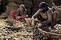
 Potato harvest in Himachal Pradesh India 2011.jpg 1,280 × 850; 248 KB
-
 Pulga water falls.jpg 3,024 × 4,032; 5.46 MB
-
 Real emotions.jpg 3,024 × 3,780; 1.79 MB
-
 Reeds (183848587).jpeg 2,048 × 1,365; 607 KB
-
 River Parvathi during peak monsoon.jpg 3,024 × 4,032; 4.21 MB
-
 Riverside @kulu.jpg 4,608 × 3,456; 4.67 MB
-
 Road workers crushing rocks, in the mountains near Kullu.jpg 1,804 × 1,444; 278 KB
-
 Road workers crushing rocks, Kullu, 2004.jpg 750 × 600; 330 KB
-
 Saheran IMG 20160425 131148.jpg 2,448 × 3,264; 1.16 MB
-
 Saryolsar.jpg 5,152 × 3,306; 4.61 MB
-
 Scuola di kullu, illustrazione dal madhu malti, 1790 ca.jpg 3,138 × 2,652; 5.1 MB
-
 Scuola di kullu, nobiluomo tra due donne, 1775.jpg 2,550 × 3,660; 5.08 MB
-
 Seruvalsar lake.jpg 4,032 × 3,024; 4.31 MB
-
 Sewing Supplies (Unsplash).jpg 4,000 × 6,000; 1.9 MB
-
 Shambhu ka dera - panoramio.jpg 3,488 × 2,616; 4.27 MB
-
 Shamshari Mahadev temple (under reconstruction) 01.jpg 3,024 × 4,032; 3.23 MB
-
 Shamshari Mahadev temple (under reconstruction) 02.jpg 3,024 × 4,032; 3.19 MB
-
 Shamshari Mahadev temple (under reconstruction) 03.jpg 3,024 × 4,032; 3.35 MB
-
 Shamshari Mahadev temple (under reconstruction) 04.jpg 3,024 × 4,032; 2.66 MB
-
 Shamshari Mahadev temple (under reconstruction) 05.jpg 3,024 × 4,032; 3.35 MB
-
 Shamshari Mahadev temple (under reconstruction) 06.jpg 4,032 × 3,024; 3.18 MB
-
 Shamshari Mahadev temple (under reconstruction) 07.jpg 4,032 × 3,024; 1.99 MB
-
 Shamshari Mahadev temple (under reconstruction) 08.jpg 4,032 × 3,024; 2.82 MB
-
 Shamshari Mahadev temple (under reconstruction) 09.jpg 4,032 × 3,024; 1.6 MB
-
 Shamshari Mahadev temple (under reconstruction) 10.jpg 4,032 × 3,024; 1.59 MB
-
 Shamshari Mahadev temple (under reconstruction) 11.jpg 4,032 × 3,024; 1.7 MB
-
 Shamshari Mahadev temple 01.jpg 4,160 × 3,120; 1.74 MB
-
 Shamshari Mahadev temple 02.jpg 3,264 × 1,504; 1,007 KB
-
 Shamshari Mahadev temple courtyard.jpg 1,504 × 3,264; 1.11 MB
-
 Sharinga Rishi Temple.jpg 3,888 × 5,184; 7 MB
-

-

-
 Snow mountain (40669995173).jpg 1,843 × 861; 896 KB
-
 Snow mountain (47583641342).jpg 1,843 × 1,037; 1.35 MB
-
 Solang valley 2019-02-28 .jpg 4,032 × 3,024; 4.09 MB
-
 Solang Valley, Auto rickshaw, India.jpg 3,072 × 2,048; 4.02 MB
-
 Solang Valley, Road, India.jpg 3,072 × 2,048; 4.43 MB
-
 Splashing water at beas river.jpg 3,024 × 4,032; 4.26 MB
-
 Stand Tall (216259765).jpeg 2,048 × 1,356; 628 KB
-
 Starry Evening (183937985).jpeg 2,048 × 1,366; 666 KB
-
 Starry Night (183937987).jpeg 2,048 × 1,365; 762 KB
-
 Temple, M A N A L I (4091420258).jpg 720 × 478; 48 KB
-
 The Bushman.jpg 2,296 × 3,060; 4.16 MB
-
 The green pastures of Himalayas.jpg 1,111 × 707; 133 KB
-
 The weather make best frame.jpg 5,449 × 4,000; 4.8 MB
-
 The White Mountains Are Calling (165343547).jpeg 2,048 × 1,365; 822 KB
-
 Threads for sewing in a workshop. (Unsplash).jpg 6,000 × 4,000; 1.37 MB
-
 Tila Lotani- Sunset I IMG 7123.jpg 1,000 × 508; 142 KB
-
 Tirthan River Tirthan Valley DSC00968.jpg 5,456 × 3,064; 6.41 MB
-
 Tirthan River, Himachal Pradesh.jpeg 2,400 × 3,200; 5.01 MB
-
 Treeline in Kullu.jpg 1,280 × 853; 121 KB
-
 Unfinished Business (Unsplash).jpg 6,000 × 4,000; 2.91 MB
-
 View near great himalayan national park in kullu.jpg 3,264 × 1,836; 3.42 MB
-
 View near great himalayan national park.jpg 1,836 × 3,264; 3.84 MB
-
 View of a Himalayan valley, Himchal Pradesh.jpg 3,648 × 2,736; 2.19 MB
-
 Views enroute Kasol and Manikaran1 (17180674989).jpg 1,800 × 1,200; 439 KB
-
 Waterfall Marhi Himachal Jun18 D72 8081.jpg 3,793 × 5,690; 13.81 MB
-
 Waters@kulu.jpg 4,608 × 3,456; 4.1 MB
-
 WikiLovesEarth2017.jpg 960 × 1,280; 658 KB
-
 Wild and beautiful.jpg 4,032 × 3,024; 5.42 MB
-
 Wild strawberry in himalayas.jpg 3,264 × 1,836; 2.94 MB
-
 Wildflowers Marhi Himachal Jul19 D72 11170.jpg 2,694 × 1,796; 3.85 MB
-
 WV banner Kullu district Goats in Rohtang.jpg 2,100 × 300; 208 KB

.jpeg)
.jpeg)

.jpeg)


.jpeg)
.jpeg)
.jpeg)


.jpg)


.jpeg)


.jpg)
.jpeg)


.jpg)
.jpg)
.jpg)


.jpg)

.jpg)


.jpeg)


.jpg)


.jpeg)
.jpg)


-3.jpg)
-4.jpg)
.jpg)
.jpg)
.jpg)
.jpg)
.jpg)
.jpg)
.jpg)
.jpg)
.jpg)
.jpg)
.jpg)
.jpg)
.jpg)
.jpg)
.jpg)
.jpg)
.jpg)
.jpg)
.jpg)
.jpg)
.jpg)
.jpg)


.jpeg)


.jpeg)


.jpg)

_01.jpg)
_02.jpg)
_03.jpg)
_04.jpg)
_05.jpg)
_06.jpg)
_07.jpg)
_08.jpg)
_09.jpg)
_10.jpg)
_11.jpg)


.jpg)
.jpg)


.jpeg)
.jpeg)
.jpeg)
.jpg)


.jpeg)
.jpg)


.jpg)


.jpg)


_(10441716153).jpg)