Category:Kwagunt Canyon
Kwagunt Canyon, from the easternmost North Rim, Grand Canyon, and adjacent south of Nankoweap Canyon.
Subcategories
This category has the following 15 subcategories, out of 15 total.
A
C
- Colter Butte (11 F)
D
- Duppa Butte (3 F)
G
H
- Hutton Butte (3 F)
K
- Kwagunt Rapids (6 F)
M
N
S
- Siegfried Pyre ridgeline (13 F)
- Swilling Butte (5 F)
T
- Tritle Peak (8 F)
Media in category "Kwagunt Canyon"
The following 12 files are in this category, out of 12 total.
-
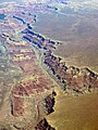 Aerial view of canyons.jpg 1,200 × 1,600; 382 KB
-
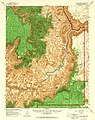 Arizona. LOC 99446126-11.jpg 4,883 × 6,157; 6.27 MB
-
 Arizona. LOC 99446126-7.jpg 4,873 × 6,139; 4.85 MB
-
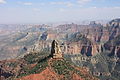
 Grand Canyon (3).jpg 2,000 × 3,000; 2.72 MB
-
 Grand Canyon Helio Ride 2004 (6467961061).jpg 1,099 × 1,736; 655 KB
-
 Grand Canyon panorama with rock formation 3.jpg 1,825 × 1,276; 449 KB
-
 Grand Canyon, Aerial view from East to West, North Rim at right - panoramio.jpg 2,304 × 3,072; 2.74 MB
-
 Grand Canyon, Mt. Hayden, from Point Imperial (7912923972).jpg 4,272 × 2,848; 5.33 MB
-
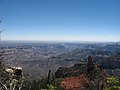
 Imperial Point Grand Canyon.jpg 600 × 450; 31 KB
-
 Point Imperial trees.jpg 5,616 × 3,744; 6.25 MB
-
 Point Imperial, North Rim, Grand Canyon National Park (15).jpg 2,816 × 2,112; 2.21 MB
-
 Point Imperial-Grand Canyon - panoramio.jpg 2,048 × 1,536; 1.54 MB


.jpg)
.jpg)


.jpg)


.jpg)
