Category:Lanivet
village and civil parish in Cornwall, England, UK  | |||||
| Upload media | |||||
| Instance of | |||||
|---|---|---|---|---|---|
| Location | Cornwall, South West England, England | ||||
 | |||||
English: Lanivet is a village and civil parish in Cornwall, United Kingdom. The main village is 2½ miles south-west of Bodmin and lies on the Saints' Way long-distance footpath, near the half-way point.
Kernowek: Lanneves (yn Sowsnak, Lanivet) yw gwyg ha plew yn randyr Kernow Gledh ha yn kens keverang Pydra. An wyg jyf yw desedhys peswar kilometer dheworth Vosvenehy tu wàr an soth-west. Yn eglos an plew yma meyn cofheans rag an teylu Courtenay a Tremere. Yma soras udn veneghva goth – huny St Benet, a'n urdh Benedyctyn – pòr ogas dh'an eglos. Udn hen sans, Congar, a wre byw y'n plew ma yn radn a-vàr an 6ves cansbledhen.
Subcategories
This category has the following 20 subcategories, out of 20 total.
B
- Bodwannick (1 F)
- Bokiddick (6 F)
F
- Fenton Pits (1 F)
L
- Lamorick (2 F)
- Lanivet War Memorial (1 F)
- Lesquite Cross (3 F)
- Lower Woodley (2 F)
M
- Mulberry, Cornwall (1 F)
N
R
- Ruthern Bridge (2 F)
- Ruthernbridge (2 F)
S
- St Ingunger Cross (7 F)
T
- Trebell Green (1 F)
- Tremore (2 F)
- Tremore Bridge (2 F)
- Tremorebridge (1 F)
Media in category "Lanivet"
The following 200 files are in this category, out of 265 total.
(previous page) (next page)-
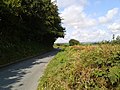
 A cornish country road - geograph.org.uk - 6138089.jpg 1,024 × 680; 267 KB
-
 A Cornish hedge at the entrance to Penburthen Farm - geograph.org.uk - 6017656.jpg 1,600 × 1,597; 1.28 MB
-
 A forest track in Dunmere Wood - geograph.org.uk - 3403632.jpg 480 × 640; 113 KB
-
 A frame holiday lodges at Lakeview - geograph.org.uk - 1842602.jpg 640 × 480; 142 KB
-
 A389 approaching Lanivet - geograph.org.uk - 5257146.jpg 3,072 × 2,048; 1.47 MB
-
 A389 to Dunmere - geograph.org.uk - 6387937.jpg 3,902 × 2,384; 2.1 MB
-
 All Change at Boscarne Junction - geograph.org.uk - 5021554.jpg 640 × 480; 98 KB
-
 Animal feeders west of Treliggon - geograph.org.uk - 5257934.jpg 3,072 × 1,820; 1.32 MB
-
 Baling straw, Treliggon - geograph.org.uk - 5077888.jpg 3,037 × 1,672; 1.11 MB
-
 Barn at Higher Mulbery - geograph.org.uk - 6137507.jpg 1,024 × 680; 218 KB
-
 Barn, Higher Boscarne Farm - geograph.org.uk - 6388361.jpg 4,288 × 2,361; 1.34 MB
-
 Bodmin and Wenford Railway - geograph.org.uk - 64105.jpg 640 × 480; 130 KB
-
 Boscarne Junction - geograph.org.uk - 5021559.jpg 640 × 480; 104 KB
-
-
 Boscarne Junction end of the line - geograph.org.uk - 3027167.jpg 640 × 394; 106 KB
-
 Boscarne Junction station (9566).jpg 4,288 × 2,848; 6.38 MB
-
 Boscarne Junction station (9568).jpg 4,288 × 2,848; 6.39 MB
-
 Boscarne Junction station (9569).jpg 4,288 × 2,848; 6.33 MB
-
 Boscarne Junction Station - geograph.org.uk - 3272197.jpg 1,022 × 1,600; 1.38 MB
-
 Boscarne Junction Station - geograph.org.uk - 3954032.jpg 640 × 480; 101 KB
-

-

-
 Bridge over River Camel for Camel Trail - geograph.org.uk - 2848137.jpg 800 × 600; 490 KB
-
 Bridge over stream at St Lawrence - geograph.org.uk - 2849122.jpg 800 × 600; 449 KB
-
 Bridge over the River Camel - geograph.org.uk - 6137520.jpg 1,024 × 680; 259 KB
-

-
 Building work at Lanivet school - geograph.org.uk - 4177118.jpg 640 × 480; 204 KB
-
 Camel Trail - geograph.org.uk - 5196629.jpg 1,600 × 1,067; 809 KB
-
 Camel Trail - geograph.org.uk - 5196636.jpg 1,600 × 1,067; 874 KB
-
 Camel Trail - geograph.org.uk - 5420508.jpg 3,072 × 2,048; 1.53 MB
-
 Camel Trail at Boscarne Junction - geograph.org.uk - 2848156.jpg 600 × 800; 446 KB
-
 Camel Trail at Boscarne Junction - geograph.org.uk - 5421383.jpg 3,072 × 2,048; 1.33 MB
-
 Camel Trail at Boscarne Junction - geograph.org.uk - 5421417.jpg 2,854 × 1,868; 958 KB
-
 Camel Trail at Boscarne Junction - geograph.org.uk - 5421552.jpg 3,072 × 2,048; 1.45 MB
-
 Camel Trail at Boscarne Junction - geograph.org.uk - 5421566.jpg 2,812 × 1,793; 1.13 MB
-
 Camel Trail at Camel Valley vineyard - geograph.org.uk - 5421265.jpg 3,072 × 2,048; 1.67 MB
-
 Camel Trail near Boscarne - geograph.org.uk - 5421316.jpg 2,956 × 1,931; 1.49 MB
-
 Camel Trail near Camel Valley vineyard - geograph.org.uk - 5421059.jpg 1,331 × 1,600; 485 KB
-
 Camel Trail near Denby stables - geograph.org.uk - 2848185.jpg 600 × 800; 532 KB
-
 Camel Trail, on the old railway trackbed - geograph.org.uk - 4175873.jpg 640 × 480; 199 KB
-
 Camel valley - geograph.org.uk - 5421290.jpg 1,359 × 1,934; 653 KB
-
 Camel valley near Boscarne - geograph.org.uk - 5420494.jpg 3,072 × 2,048; 1.24 MB
-
 Camel Valley Vineyard (9571).jpg 4,288 × 2,848; 6.67 MB
-
 Camel Valley Vineyard (9573).jpg 4,288 × 2,848; 6.35 MB
-
 Camel Valley vineyard - geograph.org.uk - 5421274.jpg 3,064 × 1,694; 1.29 MB
-

-
 Camel Valley Vineyard.jpg 4,136 × 2,848; 8.19 MB
-
 Camel Valley Vineyards - geograph.org.uk - 2079103.jpg 640 × 480; 102 KB
-
 Car on a lane near Higher Woodley - geograph.org.uk - 4177131.jpg 640 × 480; 207 KB
-
 Cattle near Hooper's Bridge - geograph.org.uk - 5254395.jpg 3,072 × 2,048; 1.2 MB
-
 Cattle, Nanstallon - geograph.org.uk - 5077814.jpg 3,072 × 2,048; 1.48 MB
-
 Cattle, Nanstallon - geograph.org.uk - 5253540.jpg 3,072 × 2,048; 1.59 MB
-
 Cemetery, Lanivet - geograph.org.uk - 5257395.jpg 3,052 × 1,640; 1.2 MB
-
 Chimney in woods, Treluggon - geograph.org.uk - 5290830.jpg 2,402 × 1,385; 652 KB
-
 Church of St Nivet, Lanivet - geograph.org.uk - 5257361.jpg 2,048 × 3,072; 1.31 MB
-
 Church of St Stephens, Nanstallon - geograph.org.uk - 5253484.jpg 2,296 × 1,824; 1.01 MB
-
 Construction work east of Tremeere Manor - geograph.org.uk - 5257404.jpg 3,072 × 2,048; 1.31 MB
-
 Continuous improvement - geograph.org.uk - 169888.jpg 640 × 426; 61 KB
-
 Converted barn at Lower Cadwin - geograph.org.uk - 1842116.jpg 640 × 480; 130 KB
-
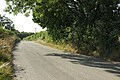
 Cornish Lane nr Bodmin - geograph.org.uk - 3126808.jpg 640 × 427; 114 KB
-
 Country road near Lamorick - geograph.org.uk - 6138224.jpg 1,024 × 768; 254 KB
-
 Country road to Nanstallon - geograph.org.uk - 6138228.jpg 1,024 × 768; 258 KB
-
 Cranesbill at Savath - geograph.org.uk - 474866.jpg 640 × 480; 80 KB
-
 Cross at Reperry Cross (6011).jpg 4,288 × 2,848; 5.8 MB
-
 Cross at Reperry Cross (6013).jpg 4,288 × 2,848; 6.29 MB
-
 Crossroads near Newton - geograph.org.uk - 2849125.jpg 800 × 600; 493 KB
-
 Crossroads nr Nanstallon 230910 - geograph.org.uk - 2098091.jpg 640 × 436; 94 KB
-
 Crossroads, Nanstallon - geograph.org.uk - 5253650.jpg 3,072 × 2,048; 1.4 MB
-

-
 Down the hill towards Ruthernbridge - geograph.org.uk - 2104352.jpg 640 × 417; 64 KB
-
 Drive near Nanstallon - geograph.org.uk - 5253482.jpg 3,072 × 2,048; 1.7 MB
-
 Electricity sub-station - geograph.org.uk - 379967.jpg 640 × 480; 122 KB
-
 Entering Dunmere on the A389 - geograph.org.uk - 3487689.jpg 800 × 585; 197 KB
-
 Farm track - geograph.org.uk - 4177111.jpg 640 × 480; 124 KB
-
 Farm track at Mulberry - geograph.org.uk - 1842085.jpg 480 × 640; 138 KB
-
 Farmhouse at Lower Cadwin - geograph.org.uk - 1842125.jpg 640 × 480; 136 KB
-
 Farmland above St Ingunger Farm - geograph.org.uk - 4871685.jpg 800 × 600; 148 KB
-
 Farmland near Tregullon - geograph.org.uk - 5077891.jpg 1,920 × 1,280; 969 KB
-
 Farmland near Washaway - geograph.org.uk - 6138097.jpg 1,024 × 680; 197 KB
-
 Farmland west of Treliggon - geograph.org.uk - 5257401.jpg 640 × 427; 80 KB
-
 Field at Bodwannick Manor - geograph.org.uk - 1842201.jpg 640 × 480; 69 KB
-
 Field at Newton - geograph.org.uk - 5254387.jpg 2,888 × 1,389; 876 KB
-
 Field at Tremabyn - geograph.org.uk - 2278964.jpg 640 × 480; 58 KB
-
 Field by Bodwannick - geograph.org.uk - 5254435.jpg 3,072 × 2,048; 1.49 MB
-
 Field by the A389 - geograph.org.uk - 6387939.jpg 3,612 × 2,406; 1.93 MB
-
 Field by the A389 - geograph.org.uk - 6387942.jpg 3,393 × 2,070; 1.23 MB
-
 Field by Tremabyn - geograph.org.uk - 5290744.jpg 2,753 × 1,560; 873 KB
-
 Field gate on the bend - geograph.org.uk - 1841899.jpg 640 × 480; 119 KB
-
 Field near Hooper's Bridge - geograph.org.uk - 5254416.jpg 2,002 × 2,878; 1.45 MB
-
 Field near Rosewarrick - geograph.org.uk - 5255752.jpg 3,072 × 1,849; 1.18 MB
-
 Field near Tregarden - geograph.org.uk - 5255308.jpg 3,072 × 2,048; 1.38 MB
-
 Field near Tregleath - geograph.org.uk - 1841907.jpg 640 × 480; 84 KB
-
 Field near Treleigh - geograph.org.uk - 5254446.jpg 3,052 × 1,757; 1.07 MB
-
 Field near Tremeers Manor - geograph.org.uk - 5257398.jpg 3,072 × 2,048; 1.39 MB
-
 Field near Westdowne Mine - geograph.org.uk - 5255897.jpg 2,966 × 1,581; 905 KB
-
 Field south of Tremayle - geograph.org.uk - 5254016.jpg 3,072 × 2,048; 1.64 MB
-
 Field west of Treliggon - geograph.org.uk - 5257964.jpg 2,498 × 1,610; 843 KB
-
 Field with Bodmin in the far distance - geograph.org.uk - 4177104.jpg 640 × 480; 125 KB
-
 Field, Milberry - geograph.org.uk - 5077872.jpg 2,665 × 1,794; 1.1 MB
-
 Field, Mulberry - geograph.org.uk - 5254544.jpg 2,974 × 1,915; 1.23 MB
-
 Fields beside the A30 - geograph.org.uk - 3424923.jpg 2,592 × 1,944; 1.47 MB
-
 Fields near Treluggon - geograph.org.uk - 5290843.jpg 2,269 × 1,028; 518 KB
-
 Fields, Nanstallon - geograph.org.uk - 5253522.jpg 3,072 × 2,048; 1.45 MB
-
-
 Flower near Boscarne Junction (9577).jpg 4,288 × 2,848; 6.39 MB
-
 Ford and Clapper Bridge at Trekillick - geograph.org.uk - 5139321.jpg 6,000 × 4,000; 6.28 MB
-
 Ford At Withielgoose Mills - geograph.org.uk - 5139463.jpg 6,000 × 4,000; 7.81 MB
-
 Forest track junction in Dunmere Wood - geograph.org.uk - 3403619.jpg 640 × 480; 108 KB
-

-
 Gateway above Mena - geograph.org.uk - 1690725.jpg 640 × 453; 90 KB
-
 Green lane by A389 - geograph.org.uk - 6387929.jpg 2,848 × 4,288; 3.1 MB
-
 Green, Lanivet - geograph.org.uk - 5257376.jpg 3,072 × 2,048; 1.41 MB
-
 Harvested field near Rosewarrick - geograph.org.uk - 5077884.jpg 3,070 × 1,835; 1.18 MB
-
 Higher Boscarne Farm - geograph.org.uk - 6388135.jpg 4,279 × 2,336; 1.91 MB
-
 Higher Woodley - geograph.org.uk - 5255598.jpg 3,072 × 2,048; 1.13 MB
-
 Houses at Lanivet - geograph.org.uk - 5257383.jpg 1,930 × 2,619; 1.01 MB
-
 Innis Downs junction ahead - geograph.org.uk - 4037581.jpg 640 × 415; 59 KB
-
 Junction near Mulberry Downs - geograph.org.uk - 5077878.jpg 1,920 × 1,280; 868 KB
-
 Junction near Mulberry Downs - geograph.org.uk - 5255445.jpg 3,072 × 2,048; 1.62 MB
-
 Junction west of Treliggon - geograph.org.uk - 5290706.jpg 3,033 × 1,805; 1.18 MB
-
 Lane at Lower Hillhead - geograph.org.uk - 5254188.jpg 1,689 × 2,079; 757 KB
-
 Lane at Nanstallon - geograph.org.uk - 5253488.jpg 3,072 × 2,048; 1.42 MB
-
 Lane east of Nanstallon - geograph.org.uk - 5253479.jpg 2,001 × 2,578; 1.04 MB
-
 Lane from Nanstallon - geograph.org.uk - 5254029.jpg 2,627 × 1,763; 1.52 MB
-
 Lane heading west near the A30 - geograph.org.uk - 4177107.jpg 640 × 480; 174 KB
-
 Lane near Lower Hillhead - geograph.org.uk - 5254178.jpg 2,048 × 3,072; 1.51 MB
-
 Lane near Newton - geograph.org.uk - 5254300.jpg 2,048 × 3,072; 1.41 MB
-
 Lane near Treliggon - geograph.org.uk - 5290775.jpg 1,230 × 1,413; 422 KB
-
 Lane to Boscarne - geograph.org.uk - 6388410.jpg 3,461 × 2,294; 1.36 MB
-
 Lane to Innis Downs - geograph.org.uk - 5255705.jpg 2,653 × 1,671; 996 KB
-
 Lane to Nanstallon - geograph.org.uk - 5253481.jpg 3,072 × 2,048; 1.64 MB
-
 Lane to Rosewarrick - geograph.org.uk - 5255710.jpg 3,072 × 2,048; 1.4 MB
-
 Lane to Rosewarrick - geograph.org.uk - 5255851.jpg 3,072 × 2,048; 1.61 MB
-
 Lane to St Lawrence - geograph.org.uk - 5254005.jpg 3,072 × 2,048; 1.79 MB
-
 Lane to Tregullon - geograph.org.uk - 5290785.jpg 3,072 × 2,048; 1.57 MB
-
 Lane, Mulberry - geograph.org.uk - 5255047.jpg 2,048 × 3,072; 1.37 MB
-
 Lanet Farm - geograph.org.uk - 5079647.jpg 2,440 × 1,671; 817 KB
-
 Lanivet , Fish ^ Chips - geograph.org.uk - 3862545.jpg 4,284 × 2,842; 3.9 MB
-
 Lanivet , Truro Road A389 - geograph.org.uk - 3862540.jpg 4,288 × 2,848; 5.83 MB
-
 Lanivet - Bible Christian Chapel.jpg 3,455 × 2,967; 1.69 MB
-
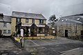
 Lanivet - Terrace.jpg 2,486 × 2,974; 1.14 MB
-
 Lanivet Methodist Church - geograph.org.uk - 4525720.jpg 2,560 × 1,920; 2.88 MB
-
 Lanivet Postbox.jpg 1,387 × 2,593; 719 KB
-
 Lanivet Tin Stamps - geograph.org.uk - 6415493.jpg 1,024 × 576; 217 KB
-
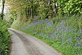 Lanivet, bluebell bank - geograph.org.uk - 2381235.jpg 640 × 427; 499 KB
-
 LanivetVillageCornwallUk.jpg 640 × 480; 84 KB
-
 Lanlivery, Bokiddick - geograph.org.uk - 2381274.jpg 640 × 427; 325 KB
-

-

-

-
 Maize east of Tremeere Manor - geograph.org.uk - 5257407.jpg 3,072 × 2,048; 1.35 MB
-
 Meadow near Hooper's Bridge - geograph.org.uk - 5254430.jpg 3,072 × 2,048; 1.44 MB
-

-
 Mud, gate and field, Higher Boscarne Farm - geograph.org.uk - 6388170.jpg 4,288 × 2,848; 1.82 MB
-
 Nanstallon Halt - geograph.org.uk - 5421334.jpg 2,558 × 1,778; 1.16 MB
-
 North Cornwall , Misty Scenery - geograph.org.uk - 2817619.jpg 4,288 × 2,848; 4.38 MB
-
 Old Direction Sign - Signpost by Nanstallon village - geograph.org.uk - 6094415.jpg 1,473 × 1,228; 209 KB
-

-

-
 Old milestone at Reperry Cross - geograph.org.uk - 2278948.jpg 640 × 480; 60 KB
-
 Old milestone at Reperry Cross - geograph.org.uk - 3028415.jpg 800 × 600; 172 KB
-
 Old milestone at Reperry Cross - geograph.org.uk - 3028419.jpg 600 × 800; 171 KB
-
 Old Milestone by the A389, Mount Charles - geograph.org.uk - 5623220.jpg 480 × 640; 163 KB
-

-
 Old Wayside Cross in Fenton Pits, Lanivet (geograph 6928597).jpg 526 × 705; 134 KB
-
-
 Outbuilding, Lanivet - geograph.org.uk - 5257355.jpg 3,072 × 2,048; 1.27 MB
-
 Overbridge near Tretoil - geograph.org.uk - 4037577.jpg 640 × 382; 124 KB
-
 Pasture and pipes - geograph.org.uk - 689416.jpg 640 × 480; 78 KB
-
 Pasture at Lesquite Farm - geograph.org.uk - 2278663.jpg 640 × 480; 65 KB
-
 Pasture at St Ingunger - geograph.org.uk - 2278941.jpg 640 × 480; 53 KB
-
 Pasture, Nanstallon - geograph.org.uk - 5253562.jpg 2,904 × 1,958; 1.29 MB
-
 Penaligon Downs - geograph.org.uk - 6138085.jpg 1,024 × 680; 191 KB
-
 Power lines heading south - geograph.org.uk - 4175855.jpg 640 × 480; 173 KB
-
 Proposers of the name of Jupiter moon Pandia (ann19054a).jpg 2,667 × 2,000; 1.36 MB
-
 Proposers of the name of Jupiter moon Pandia (ann19054a).tif 2,667 × 2,000; 8.97 MB
-
 Pylon and tree, Higher Woodley - geograph.org.uk - 5079659.jpg 2,121 × 1,356; 293 KB
-
 Pylon by the Camel Trail - geograph.org.uk - 5421259.jpg 2,048 × 3,072; 1.14 MB
-
 Pylons on Mulberry Downs - geograph.org.uk - 30927.jpg 640 × 480; 59 KB
-
 Railway east of Boscarne Junction station (9565).jpg 4,288 × 2,848; 6.37 MB
-
 Railway east of Boscarne Junction station (9567).jpg 4,288 × 2,848; 6.34 MB
-
 Reperry Cross - geograph.org.uk - 2278958.jpg 640 × 480; 78 KB
-
 Reperry Cross - geograph.org.uk - 2844499.jpg 800 × 600; 306 KB
-
 Reperry Cross - geograph.org.uk - 3028407.jpg 800 × 600; 250 KB
-
 Reperry Cross - geograph.org.uk - 492799.jpg 480 × 640; 137 KB
-
-
 River Camel at Boscarne - geograph.org.uk - 2849101.jpg 800 × 600; 487 KB
-
 River Camel from viaduct west of Dunmere Halt (9560).jpg 4,288 × 2,848; 6.42 MB
-
 River Camel from viaduct west of Dunmere Halt (9562).jpg 4,288 × 2,848; 6.45 MB
-
 River Camel from viaduct west of Dunmere Halt (9563).jpg 2,848 × 4,288; 6.38 MB
-
 Road sign at Reperry Cross (6012).jpg 4,288 × 2,848; 6.11 MB
-

-
 Road to Helman Tor - geograph.org.uk - 4871657.jpg 1,024 × 768; 412 KB
-
 Roadside Celtic Cross - geograph.org.uk - 155223.jpg 640 × 427; 161 KB
-
 Rocks in a field - geograph.org.uk - 6138217.jpg 1,024 × 768; 225 KB
-
 Running Round at Boscarne - geograph.org.uk - 5021545.jpg 640 × 443; 108 KB
-
 Running Round at Boscarne Junction - geograph.org.uk - 3272192.jpg 1,600 × 1,221; 1.52 MB
-
 Saints Way near Higher Woodley - geograph.org.uk - 5255590.jpg 2,625 × 1,980; 1.02 MB
-
 Saints Way, Tremore - geograph.org.uk - 5255594.jpg 3,072 × 2,048; 1.62 MB
-
 Saints Way, Tremore - geograph.org.uk - 5255596.jpg 2,504 × 1,456; 1.28 MB


.jpg)
.jpg)
.jpg)


.jpg)
.jpg)


.jpg)
.jpg)


.jpg)


.jpg)
.jpg)


.jpg)


.jpg)
.jpg)


.jpg)
.jpg)
.jpg)
.jpg)


