Category:Laurierstraat 70, Amsterdam
| Object location | | View all coordinates using: OpenStreetMap |
|---|
 | |||||
| Upload media | |||||
| Instance of |
| ||||
|---|---|---|---|---|---|
| Location | Amsterdam, North Holland, Netherlands | ||||
| Street address |
| ||||
| Located on street | |||||
| Heritage designation |
| ||||
 | |||||
|
This is a category about rijksmonument number 3251
|
| Address |
|
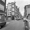
Media in category "Laurierstraat 70, Amsterdam"
The following 5 files are in this category, out of 5 total.
-
 Amsterdam Laurierstraat 70 door.jpg 2,304 × 1,728; 849 KB
-
 Amsterdam Laurierstraat 70 top.jpg 1,728 × 2,304; 773 KB
-
 Gevels - Amsterdam - 20018713 - RCE.jpg 807 × 1,200; 219 KB
-
 Hoek Laurierstraat voorgevel - Amsterdam - 20018570 - RCE.jpg 1,193 × 1,200; 271 KB
-
 Voorgevels - Amsterdam - 20018714 - RCE.jpg 1,200 × 1,195; 339 KB


