Category:Leeds New Line
disused railway line in West Yorkshire, England | |||||
| Upload media | |||||
| Instance of | |||||
|---|---|---|---|---|---|
| Location | West Yorkshire, Yorkshire and the Humber, England | ||||
| Owned by | |||||
| Date of official opening |
| ||||
| Date of official closure |
| ||||
| |||||
Subcategories
This category has the following 3 subcategories, out of 3 total.
Media in category "Leeds New Line"
The following 15 files are in this category, out of 15 total.
-
 Anchor for railway telegraph pole - geograph.org.uk - 500549.jpg 640 × 480; 123 KB
-
 Battyeford Station site of 1772802 e54962dd.jpg 640 × 382; 118 KB
-
 Bridleway over the disused railway north of Oakwell Hall - geograph.org.uk - 4144581.jpg 1,600 × 1,200; 311 KB
-
 Disused Railway Bridge LIV3 41 - geograph.org.uk - 3252196.jpg 640 × 427; 464 KB
-
 Disused railway bridge near Drub - geograph.org.uk - 500532.jpg 640 × 480; 161 KB
-
 Disused railway bridge near Drub - geograph.org.uk - 60078.jpg 640 × 480; 237 KB
-

-
 Heckmondwicke cutting-The Leeds new line - geograph.org.uk - 1042123.jpg 640 × 424; 106 KB
-
 Kirklees Way crossing a disused railway - geograph.org.uk - 5275464.jpg 1,024 × 683; 354 KB
-
 Railway Bridge over Station Lane - geograph.org.uk - 706250.jpg 640 × 429; 50 KB
-

-

-
 Railway Culvert running towards Mazebrook - geograph.org.uk - 500544.jpg 640 × 480; 125 KB
-

-
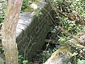
 The parapet of Gomersal Tunnel Portal - geograph.org.uk - 500580.jpg 640 × 480; 129 KB


