Category:Lichtenvoorde
village in Oost Gelre, Netherlands    | |||||
| Upload media | |||||
| Spoken text audio | |||||
|---|---|---|---|---|---|
| Instance of | |||||
| Location |
| ||||
| Population |
| ||||
 | |||||
Subcategories
This category has the following 6 subcategories, out of 6 total.
Media in category "Lichtenvoorde"
The following 28 files are in this category, out of 28 total.
-
 Coat of arms of Lichtenvoorde.svg 962 × 895; 239 KB
-
 Lichtenvwapen.gif 226 × 262; 5 KB
-
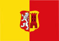
 Lichtenvoorde flag.gif 326 × 217; 4 KB
-
 Lichtenvoorde vlag 1970.svg 730 × 451; 59 KB
-
 Lichtenvoorde vlag.svg 1,062 × 747; 94 KB
-
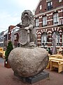
 De Lichtenvoorde zwerfkei1.JPG 3,648 × 2,736; 543 KB
-
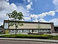 Hamalandhal Lichtenvoorde 2.jpg 4,000 × 3,000; 2.82 MB
-
 Hamalandhal Lichtenvoorde.jpg 4,000 × 3,000; 3.72 MB
-
 Harreveld.jpg 300 × 232; 53 KB
-
 Interieur, aanzicht orgel - Lichtenvoorde - 20429249 - RCE.jpg 813 × 1,200; 140 KB
-
 Kasteel lichtenvoorde.jpg 500 × 249; 46 KB
-
 Kruisbeeld, Lichtenvoorde 2.JPG 3,456 × 4,608; 5.98 MB
-
 Kruisbeeld, Lichtenvoorde.JPG 3,456 × 4,608; 5.96 MB
-
 Lechtenvoorde darp.jpg 640 × 480; 348 KB
-
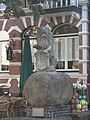 Lechtenvoorde kei.jpg 480 × 640; 284 KB
-
 Lechtenvoorde stadpompe.jpg 480 × 640; 296 KB
-
 Lechtenvoorde zitt-n.jpg 4,608 × 3,456; 4.82 MB
-
 Lichtenvoorde 441.JPG 2,448 × 3,264; 2.39 MB
-
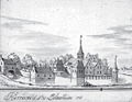
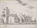
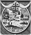 Lichtenvoorde circa 1600.jpg 187 × 211; 39 KB
-
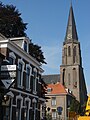 Lichtenvoorde kerk.jpg 480 × 640; 259 KB
-
-

-
 Schuur - Lichtenvoorde - 20510603 - RCE.jpg 1,200 × 900; 91 KB
-
 St Eloy. Fysiotherapie Lichtenvoorde.JPG 800 × 600; 137 KB
-
 Tongerlo 1881-1887.svg 288 × 356; 5 KB
-
 Tongerlo.jpg 1,140 × 864; 562 KB
-
 Vakwerkboerderij, gevel - Lichtenvoorde - 20139546 - RCE.jpg 799 × 1,200; 184 KB
-
 Wentholtpark in Lichtenvoorde .jpg 4,000 × 3,000; 4.98 MB


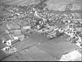
_AEROCARTO_NEG.-KLM-AEROCARTO_3888_-_Lichtenvoorde_-_20468121_-_RCE.jpg)
_AEROCARTO_NEG.-KLM-AEROCARTO_63929_-_Lichtenvoorde_-_20468122_-_RCE.jpg)


