Category:Maps of Lichtenvoorde
Wikimedia category | |||||
| Upload media | |||||
| Instance of | |||||
|---|---|---|---|---|---|
| Category combines topics | |||||
| Lichtenvoorde | |||||
village in Oost Gelre, Netherlands    | |||||
| Spoken text audio | |||||
| Instance of | |||||
| Location |
| ||||
| Population |
| ||||
 | |||||
Media in category "Maps of Lichtenvoorde"
The following 4 files are in this category, out of 4 total.
-
 1634 stad lichtenvoorde.jpg 500 × 350; 176 KB
-
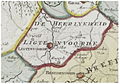 Heerlijkheid lichtenvoorde 1741.jpg 770 × 540; 364 KB
-
 Lichtenvoorde, Gemeenteatlas van Nederland.jpg 2,964 × 2,384; 7.43 MB
-
 LocatieLichtenvoorde.png 280 × 140; 9 KB


