Category:Lichterfelde (Schorfheide)
| Object location | | View all coordinates using: OpenStreetMap |
|---|
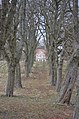
part of Schorfheide municipality, Brandenburg state, Germany _church_2015_NW.jpg)  | |||||
| Upload media | |||||
| Pronunciation audio | |||||
|---|---|---|---|---|---|
| Instance of |
| ||||
| Location | Schorfheide, Barnim District, Brandenburg, Germany | ||||
| Area |
| ||||
| Elevation above sea level |
| ||||
 | |||||
Subcategories
This category has the following 4 subcategories, out of 4 total.
Media in category "Lichterfelde (Schorfheide)"
The following 9 files are in this category, out of 9 total.
-
 Wappen Lichterfelde.png 133 × 165; 21 KB
-
-
 Bieberfutter.jpg 1,000 × 1,500; 1.07 MB
-
 Ehemalige Kaufhalle Lichterfelde (Schorfheide) 2024 WNW.jpg 4,032 × 3,024; 2.96 MB
-
 Gedenkpark Lichterfelde (Schorfheide) 2024 W.jpg 3,024 × 3,780; 4.18 MB
-
 Gefallenendenkmal Befreiungskriege Lichterfelde (Schorfheide) 2024 SW.jpg 2,979 × 3,972; 3.93 MB
-
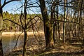
 Lichterfelde, Brandenburg - Werbellinsee (Zeno Ansichtskarten).jpg 2,193 × 1,389; 227 KB
-
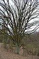 Lichterfelde, Schorfheide, Stiel-Eiche, ND 124-03.jpg 419 × 633; 99 KB
-
 Nistplatz.jpg 1,500 × 1,000; 1.31 MB


_2024_WNW.jpg)
_2024_W.jpg)
_2024_SW.jpg)
.jpg)

