Category:Llanerchymedd
English: Llannerch-y-medd, sometimes also spelt Llanerch-y-Medd, Llannerch-y-Medd or Llanerchymedd, is a small village and community on the Isle of Anglesey in Wales. The Royal Mail postcode is LL71, and it has a population of 1,185.
Español: Llannerch-y-medd (a veces como Llanerch-y-medd o Llanerchymedd) es un pequeño pueblo en Anglesey, al norte de Gales, en SH415844. El código postal del Royal Mail es LL71.

village and community in Anglesey, Wales, UK  | |||||
| Upload media | |||||
| Pronunciation audio | |||||
|---|---|---|---|---|---|
| Instance of | |||||
| Location | Isle of Anglesey, Wales | ||||
| Population |
| ||||
 | |||||
Subcategories
This category has the following 9 subcategories, out of 9 total.
B
- Bachau (7 F)
- The Bull Inn, Llanerchymedd (3 F)
C
- Capel Ifan, Llanerchymedd (2 F)
- Carmel, Anglesey (34 F)
- Ceidio, Anglesey (2 F)
L
M
R
Media in category "Llanerchymedd"
The following 200 files are in this category, out of 252 total.
(previous page) (next page)-
 A bend in the Carmel road - geograph.org.uk - 918998.jpg 640 × 480; 71 KB
-

-
 A greeting from Neddy - geograph.org.uk - 882071.jpg 608 × 640; 157 KB
-

-
 A picture of parts - geograph.org.uk - 6620141.jpg 4,278 × 2,562; 1.66 MB
-

-

-

-

-
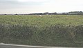
 Anglesey Countryside - geograph.org.uk - 231564.jpg 640 × 480; 107 KB
-

-
 Approaching Pwllgynau-isaf Farm - geograph.org.uk - 883036.jpg 640 × 390; 44 KB
-
 Approaching the Gorslwyd Fawr farmhouse - geograph.org.uk - 1402437.jpg 640 × 481; 109 KB
-

-

-

-

-
 B5111 In Rhosybol - geograph.org.uk - 1437504.jpg 640 × 480; 227 KB
-
 B5111 Near Ty-Hen Newydd - geograph.org.uk - 1437523.jpg 640 × 480; 166 KB
-
 B5111 South Of Cae Mawr - geograph.org.uk - 1437516.jpg 640 × 480; 240 KB
-

-
 Bodafon.jpg 640 × 446; 65 KB
-
 Bridge over disused railway, Anglesey - geograph.org.uk - 73862.jpg 640 × 479; 80 KB
-
 Bridge Street from the railway bridge - geograph.org.uk - 882981.jpg 640 × 480; 64 KB
-
 Bryn Medd Farm, Llannerch-y-medd - geograph.org.uk - 1011903.jpg 640 × 480; 53 KB
-
 Bungalows at Cae'r Delyn Estate - geograph.org.uk - 882513.jpg 640 × 480; 46 KB
-
 Cae'r Delyn Estate - geograph.org.uk - 882509.jpg 640 × 480; 49 KB
-

-

-
 Capel Carmel, Llechgynfarwy - geograph.org.uk - 919102.jpg 640 × 538; 71 KB
-

-
 Capel Gorslwyd, Rhosybol - geograph.org.uk - 1402274.jpg 640 × 375; 48 KB
-
 Carmel chapel - geograph.org.uk - 6619116.jpg 4,320 × 3,240; 1.26 MB
-

-

-
 Cefn Roger Farm from the B5111 - geograph.org.uk - 1399390.jpg 640 × 295; 53 KB
-
 Ceidio Farm - geograph.org.uk - 882006.jpg 640 × 332; 43 KB
-
 Climbing Out Of Llanerchymedd - geograph.org.uk - 1437520.jpg 640 × 480; 175 KB
-
 Coal delivery at Tai Newydd - geograph.org.uk - 1399309.jpg 640 × 379; 78 KB
-
 Coarse pasture south-west of Gwredog - geograph.org.uk - 995415.jpg 640 × 480; 46 KB
-
 Cofeb ryfel Llanerchymedd.jpg 720 × 960; 136 KB
-
 Converted farmhouse at Brynkir - geograph.org.uk - 882501.jpg 640 × 432; 57 KB
-
 Country road near Llyn Edna - geograph.org.uk - 918981.jpg 640 × 480; 77 KB
-
 Craft Workshops off Farmers Street - geograph.org.uk - 882746.jpg 640 × 521; 103 KB
-
 Cropland above the lake shore - geograph.org.uk - 883554.jpg 640 × 480; 40 KB
-
 Cropland north of the Plavena Covert - geograph.org.uk - 1399274.jpg 640 × 225; 53 KB
-

-
 Cropland on the shores of Llyn Alaw - geograph.org.uk - 882015.jpg 640 × 480; 32 KB
-

-
 Derelict railway line - geograph.org.uk - 152493.jpg 480 × 640; 141 KB
-

-

-
 Dilapidated buildings - geograph.org.uk - 550396.jpg 640 × 480; 78 KB
-
 Downhill From Llanerchymedd - geograph.org.uk - 1437522.jpg 640 × 480; 157 KB
-
 Early 18thC houses in the High Street - geograph.org.uk - 882555.jpg 640 × 394; 43 KB
-

-
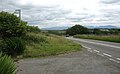
 Entering Llanerch-y-medd - geograph.org.uk - 231550.jpg 640 × 480; 99 KB
-

-
 Entrance to Gwredog Farm - geograph.org.uk - 883548.jpg 640 × 480; 119 KB
-

-
 Enwau ar cofeb ryfel Llanerchymedd.jpg 637 × 960; 156 KB
-
 Farm buildings at Gwredog - geograph.org.uk - 883547.jpg 640 × 394; 36 KB
-

-
 Farm buildings at Tyddyn-deugain - geograph.org.uk - 1361151.jpg 640 × 480; 41 KB
-
 Farm lane at Gwredog - geograph.org.uk - 883561.jpg 640 × 480; 71 KB
-

-
 Farm road and footpath - geograph.org.uk - 6619756.jpg 4,296 × 2,946; 1.59 MB
-

-
 Farm road to Mynydd Mwyn Mawr - geograph.org.uk - 1011726.jpg 640 × 480; 45 KB
-
 Farm road to Penwerthyr - geograph.org.uk - 883549.jpg 640 × 480; 75 KB
-
 Farm road to Sarnfadog - geograph.org.uk - 1361158.jpg 640 × 481; 107 KB
-
 Farm road to Ty-hen-isa - geograph.org.uk - 882460.jpg 640 × 480; 60 KB
-

-
 Farmland at Neuadd Farm - geograph.org.uk - 1399217.jpg 640 × 333; 30 KB
-
 Farmland east of the B5111 - geograph.org.uk - 1402268.jpg 640 × 480; 50 KB
-

-
 Flush bracket S7306 on Triangulation pillar, Carmel - geograph.org.uk - 2026410.jpg 2,004 × 2,668; 1.8 MB
-

-
 Garage, Llannerch-y-medd - geograph.org.uk - 3773722.jpg 1,600 × 841; 248 KB
-

-
 Grassland with cattle - geograph.org.uk - 6620123.jpg 4,320 × 3,240; 1.89 MB
-
 Grazing land at Tan Rallt Farm - geograph.org.uk - 919294.jpg 640 × 340; 34 KB
-
 Grazing land west of the road - geograph.org.uk - 1361149.jpg 640 × 480; 50 KB
-

-
 Grazing sheep north of the B 5112 - geograph.org.uk - 1012194.jpg 640 × 371; 46 KB
-
 Green pastures towards Chwaen Bach farm - geograph.org.uk - 6619151.jpg 4,320 × 3,240; 1.47 MB
-
 Gwredog seen across farmland - geograph.org.uk - 883552.jpg 640 × 341; 38 KB
-
 Hay field near Ty'n Cae - geograph.org.uk - 1012237.jpg 640 × 365; 52 KB
-
 Hay making at Mynydd Mwyn Mawr - geograph.org.uk - 1011670.jpg 640 × 480; 40 KB
-
 Hayfields west of the road - geograph.org.uk - 1011679.jpg 640 × 306; 34 KB
-

-
 High Street, Llanerchymedd - geograph.org.uk - 3395593.jpg 1,280 × 856; 244 KB
-
 High Street, Llannerch-y-medd - geograph.org.uk - 3773699.jpg 1,024 × 742; 122 KB
-
 High Street, Llannerch-y-medd - geograph.org.uk - 3773709.jpg 1,024 × 796; 147 KB
-
 Houses on Holyhead Road, Llanerchymedd - geograph.org.uk - 5347859.jpg 4,669 × 3,501; 3.84 MB
-
 Improved pasture at Cefn-gribyn - geograph.org.uk - 919683.jpg 640 × 321; 33 KB
-
 Isfron Ceidio Farm - geograph.org.uk - 882000.jpg 640 × 342; 33 KB
-

-
 Lane leading to Drws y Coed - geograph.org.uk - 882464.jpg 640 × 480; 125 KB
-
 Lane leading to Prys-owain Fawr Farm - geograph.org.uk - 981098.jpg 640 × 462; 70 KB
-
-
 Large modern house at Carmel - geograph.org.uk - 1323911.jpg 640 × 398; 35 KB
-
 Lengthening shadows - geograph.org.uk - 6620138.jpg 4,320 × 3,240; 1.32 MB
-
 Little used country road - geograph.org.uk - 918831.jpg 640 × 480; 62 KB
-
 Llanerch y medd.jpg 3,968 × 2,976; 2.63 MB
-

-
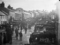 Llannerch-y-medd fair NLW3362369.jpg 584 × 441; 54 KB
-

-

-

-
 Lon Cilgwyn Lane - geograph.org.uk - 882540.jpg 640 × 480; 76 KB
-
 Marshy hollow near Pen-y-bryn - geograph.org.uk - 6620129.jpg 4,320 × 3,240; 1.61 MB
-
 Meadow flowers above Llyn Alaw - geograph.org.uk - 995401.jpg 640 × 480; 50 KB
-

-

-
 Melin Gallt y Benddu, Llanerchymedd - geograph.org.uk - 4951382.jpg 1,201 × 1,600; 253 KB
-
 Melin Galt y Benddu, Llanerch-y-medd.jpg 480 × 640; 101 KB
-

-
 Mynydd Mwyn Farm, Llannerch-y-medd - geograph.org.uk - 979980.jpg 640 × 447; 72 KB
-
 Neuadd Farm from Pont Glan Rhyd - geograph.org.uk - 1399204.jpg 640 × 481; 49 KB
-
 New farm road to Plas Cynan - geograph.org.uk - 1011768.jpg 640 × 357; 46 KB
-

-

-

-

-

-

-

-

-
 Obstructed line - geograph.org.uk - 1011785.jpg 640 × 480; 124 KB
-

-
 Overarching trees near Ceidio Farm - geograph.org.uk - 883308.jpg 640 × 480; 125 KB
-
 Overgrown path to the Amlwch road - geograph.org.uk - 883259.jpg 640 × 480; 145 KB
-

-

-
 Pen-llidiard Cottage - geograph.org.uk - 918795.jpg 640 × 480; 54 KB
-
 Plevna Covert - geograph.org.uk - 1399252.jpg 640 × 480; 57 KB
-
 Pony and donkey in a paddock (2) - geograph.org.uk - 918690.jpg 640 × 361; 49 KB
-
 Pony and donkey in a paddock - geograph.org.uk - 918686.jpg 640 × 348; 66 KB
-
 Pool north of Sarnfadog - geograph.org.uk - 1361160.jpg 640 × 480; 64 KB
-

-
 Pwllgynau Isaf - geograph.org.uk - 236322.jpg 640 × 480; 106 KB
-
 Quarry south of Plas Cynan - geograph.org.uk - 1011748.jpg 640 × 386; 55 KB
-

-
 Road Scene In Llanerchymedd - geograph.org.uk - 1437518.jpg 579 × 454; 184 KB
-
 Roadside pool near Sarnfadog - geograph.org.uk - 1361163.jpg 640 × 480; 165 KB
-
 Rock outcrops south of Plevna Covert - geograph.org.uk - 1399238.jpg 640 × 480; 61 KB
-
 Ruin on the hillside - geograph.org.uk - 6620125.jpg 4,320 × 3,240; 2.33 MB
-

-

-
 Sharp Bend Near Ynys Goed - geograph.org.uk - 1437525.jpg 635 × 368; 174 KB
-
 Sheep pasture below Nantanog - geograph.org.uk - 6620146.jpg 4,320 × 3,240; 2.08 MB
-
 Sheep pastures south west of Llanerchymedd - geograph.org.uk - 6619144.jpg 4,320 × 3,240; 1.73 MB
-
 Sheltered housing in Farmers' Street - geograph.org.uk - 882715.jpg 640 × 366; 46 KB
-
 Stream north of the Llantrisant road - geograph.org.uk - 1324802.jpg 640 × 480; 79 KB
-

-

-

-
 Tafarn-y-botel from the west - geograph.org.uk - 1012254.jpg 640 × 382; 45 KB
-

-

-

-
 The Bryn-gwyddon farm track - geograph.org.uk - 1399293.jpg 640 × 480; 47 KB
-
 The Carmel to Llantrisant road - geograph.org.uk - 1323919.jpg 640 × 480; 78 KB
-
 The cemetery of Capel Carmel - geograph.org.uk - 1323898.jpg 640 × 480; 64 KB
-
 The Cors-y-bol fen from the dam - geograph.org.uk - 1403886.jpg 624 × 640; 124 KB
-

-

-

-

-
 The hamlet of Carmel - geograph.org.uk - 6619121.jpg 4,320 × 3,240; 1.65 MB
-
 The inlet from the Cors-y-bol dam - geograph.org.uk - 1403884.jpg 640 × 459; 34 KB
-

-

-

-

-

-

-
 The mile long Lon Cilgwyn - geograph.org.uk - 882542.jpg 640 × 480; 79 KB
-

-

-
 The Old Police Station, Llanerchymedd - geograph.org.uk - 864016.jpg 640 × 480; 130 KB
-
 The Old Rectory - geograph.org.uk - 882583.jpg 640 × 480; 66 KB
-

-
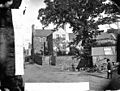 The rectory, Llannerch-y-medd NLW3362072.jpg 590 × 449; 81 KB
-

-
 The road to Llwydiarth-Esgob - geograph.org.uk - 1399923.jpg 479 × 640; 133 KB
-
 The Road To Plas Coedana - geograph.org.uk - 231989.jpg 640 × 480; 100 KB
-
 The ruined Pen-y-bryn Farmhouse - geograph.org.uk - 918770.jpg 640 × 383; 35 KB
-
 The same stream below the bridge - geograph.org.uk - 883169.jpg 640 × 480; 74 KB
-
 The shores of Llyn Alaw - geograph.org.uk - 882028.jpg 640 × 480; 50 KB
-

-
 The top of Tudor Street - geograph.org.uk - 882538.jpg 640 × 420; 45 KB
-
 The vestry of Capel Carmel - geograph.org.uk - 1323908.jpg 640 × 480; 55 KB
-
 The vestry of Capel Carmel - geograph.org.uk - 919286.jpg 640 × 480; 44 KB
-

-
 Track south from Meinir Farm - geograph.org.uk - 882062.jpg 640 × 480; 59 KB
-
 Track towards Meinir Farm - geograph.org.uk - 883566.jpg 640 × 480; 82 KB
-
 Track westwards towards the B 5112 - geograph.org.uk - 1011701.jpg 640 × 393; 58 KB
-


,_Rhosybol_-_geograph.org.uk_-_1402342.jpg)


_-_geograph.org.uk_-_5408984.jpg)
_-_geograph.org.uk_-_5409007.jpg)
_-_geograph.org.uk_-_5409015.jpg)
_-_geograph.org.uk_-_5409051.jpg)
_-_geograph.org.uk_-_5409055.jpg)
_-_geograph.org.uk_-_5409068.jpg)
_-_geograph.org.uk_-_5409077.jpg)


_-_geograph.org.uk_-_918690.jpg)


