Category:Locator maps of former parliamentary constituencies of England
Maps of Parliamentary constituencies in England. They may include constituencies which still exist in name.
Subcategories
This category has the following 8 subcategories, out of 8 total.
1
Media in category "Locator maps of former parliamentary constituencies of England"
The following 6 files are in this category, out of 6 total.
-
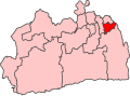
 Croydon East 1950 Constituency.svg 2,056 × 1,518; 81 KB
-
 Croydon North 1945 Constituency.svg 1,827 × 1,348; 73 KB
-
 Croydon North 1950 Constituency.svg 2,056 × 1,518; 81 KB
-
 Croydon South 1945 Constituency.svg 1,827 × 1,348; 73 KB
-
 Croydon South 1955 Constituency.svg 2,056 × 1,514; 79 KB
-
 Croydon West 1950 Constituency.svg 2,056 × 1,518; 81 KB


