Category:Locator maps of states of Germany (gray scheme)
Subcategories
This category has the following 16 subcategories, out of 16 total.
B
S
Media in category "Locator maps of states of Germany (gray scheme)"
The following 19 files are in this category, out of 19 total.
-
 Deutsche Bundeslaender1990.gif 500 × 646; 266 KB
-
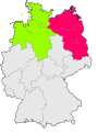
 Deutschland Nordstaat 2.svg 1,852 × 2,505; 230 KB
-
 Deutschland Nordstaat 3.svg 1,852 × 2,505; 230 KB
-
 Deutschland Nordstaat 4.svg 1,852 × 2,505; 230 KB
-
 Deutschland Nordstaat 5.svg 1,852 × 2,505; 230 KB
-
 Germany lv bayern.gif 166 × 225; 5 KB
-
 Germany lv berlin.gif 166 × 225; 5 KB
-
 Germany lv brandenburg.gif 166 × 225; 5 KB
-
 Germany lv bremen.gif 166 × 225; 5 KB
-
 Germany lv hessen.gif 166 × 225; 5 KB
-
 Germany lv mecklenburg vorpommern.gif 166 × 225; 5 KB
-
 Germany lv niedersachsen.gif 166 × 225; 5 KB
-
 Germany lv nordrhein westfalen.gif 166 × 225; 5 KB
-
 Germany lv rheinland pfalz.gif 166 × 225; 5 KB
-
 Germany lv saarland.gif 166 × 225; 5 KB
-
 Germany lv sachsen.gif 166 × 225; 5 KB
-
 Germany lv schleswig holstein.gif 166 × 225; 5 KB
-
 Germany lv thüringen.gif 166 × 225; 5 KB
-
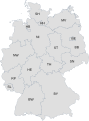 States of Germany coded.svg 592 × 801; 118 KB


