Category:Longden
English: Longden is a village and civil parish Shropshire, England, about 5 miles southwest of Shrewsbury.
village and civil parish in Shropshire, United Kingdom  | |||||
| Upload media | |||||
| Instance of | |||||
|---|---|---|---|---|---|
| Location | Shropshire, West Midlands, England | ||||
 | |||||
Subcategories
This category has the following 2 subcategories, out of 2 total.
L
R
Media in category "Longden"
The following 200 files are in this category, out of 215 total.
(previous page) (next page)-
 'Long Lane' towards Longden Common. - geograph.org.uk - 651120.jpg 640 × 480; 82 KB
-

-
 A distant view of the chapel - geograph.org.uk - 2785923.jpg 1,142 × 857; 311 KB
-
 A dry section after all the mud... - geograph.org.uk - 2786027.jpg 734 × 979; 407 KB
-
 A field-edge footpath near Bayston Hill - geograph.org.uk - 2787725.jpg 1,142 × 857; 317 KB
-

-
 A narrow field, Annscroft - geograph.org.uk - 5876606.jpg 1,024 × 1,024; 716 KB
-
 A one-time pond, now dried up - geograph.org.uk - 3514255.jpg 1,142 × 857; 429 KB
-
 A pond near Lythwood Hall in winter - geograph.org.uk - 2787679.jpg 1,142 × 857; 358 KB
-
 A pool in a field near Oaks - geograph.org.uk - 2236633.jpg 1,152 × 864; 478 KB
-
 A private estate road - geograph.org.uk - 3518381.jpg 979 × 734; 417 KB
-
 A very narrow lane - geograph.org.uk - 3518391.jpg 979 × 734; 343 KB
-
 Across fields towards Lythwood View - geograph.org.uk - 2784878.jpg 1,142 × 857; 327 KB
-
 Across the fields towards Lower Lythwood Hall - geograph.org.uk - 2787673.jpg 1,142 × 857; 291 KB
-
 Almost hidden stream - geograph.org.uk - 2119074.jpg 480 × 640; 181 KB
-
 Along the footpath towards Bayston Hill - geograph.org.uk - 2784860.jpg 1,306 × 979; 413 KB
-
 An intriguing collection of signs - geograph.org.uk - 3520116.jpg 1,142 × 857; 470 KB
-
-
 Approaching woodland - geograph.org.uk - 6062717.jpg 640 × 480; 89 KB
-
 Arscott Villa and a junction of lanes - geograph.org.uk - 2786008.jpg 857 × 1,142; 370 KB
-
 Autumn colours - geograph.org.uk - 5935370.jpg 640 × 480; 69 KB
-
 Autumn colours on trees near Oaks - geograph.org.uk - 5935355.jpg 640 × 480; 85 KB
-
 Barley, Longden - geograph.org.uk - 5063242.jpg 800 × 534; 206 KB
-
 Barn at 'The Vinnals'. - geograph.org.uk - 651134.jpg 640 × 480; 74 KB
-
 Bend on the green lane near Oaks - geograph.org.uk - 6062699.jpg 640 × 480; 81 KB
-
 Brick barns and a footpath at The Vinnals - geograph.org.uk - 3518456.jpg 1,142 × 857; 433 KB
-
 Bridleway and access to the houses at Radleth - geograph.org.uk - 2236636.jpg 864 × 1,152; 560 KB
-
 Bridleway back to Woodhouse Farm - geograph.org.uk - 3514248.jpg 1,142 × 857; 352 KB
-
 Bridleway ford through the Pontesford Brook - geograph.org.uk - 2237189.jpg 1,024 × 768; 440 KB
-
 Brook, Annscroft - geograph.org.uk - 5876602.jpg 1,024 × 1,024; 853 KB
-
 Buildings at Oaks Hall Farm - geograph.org.uk - 2237144.jpg 1,280 × 960; 457 KB
-
 Cattle grazing at Broompatch - geograph.org.uk - 3518361.jpg 979 × 734; 426 KB
-
 Cattle troughs and livestock - geograph.org.uk - 2119665.jpg 640 × 480; 297 KB
-
 Chris Bagley Walk waymarker - geograph.org.uk - 2926264.jpg 640 × 480; 86 KB
-
 Coppiced alders beside a stream - geograph.org.uk - 2784855.jpg 979 × 734; 334 KB
-
 Cottages at Radleth - geograph.org.uk - 2237164.jpg 1,152 × 864; 578 KB
-
 Cottages in the manor - geograph.org.uk - 3514260.jpg 781 × 620; 264 KB
-

-
 Cross house, Longden - geograph.org.uk - 763695.jpg 640 × 480; 60 KB
-
 Crossroads - geograph.org.uk - 798277.jpg 640 × 480; 59 KB
-

-
 Daft Dog's on a mission again - geograph.org.uk - 3518410.jpg 1,142 × 857; 339 KB
-
 Derelict outbuildings - geograph.org.uk - 2119684.jpg 640 × 480; 167 KB
-
 Earl's Hill from the east - geograph.org.uk - 2237134.jpg 1,280 × 960; 414 KB
-
 East of Shrewsbury - geograph.org.uk - 2107458.jpg 2,048 × 1,536; 1.32 MB
-

-
 Fair View - geograph.org.uk - 2376885.jpg 1,024 × 944; 132 KB
-
 Farm buildings - geograph.org.uk - 5935382.jpg 640 × 480; 102 KB
-

-

-
 Farmland near Hanwood - geograph.org.uk - 4645432.jpg 640 × 426; 35 KB
-
 Field edge - geograph.org.uk - 5936514.jpg 640 × 480; 112 KB
-
 Fields at Longden - geograph.org.uk - 2785074.jpg 1,142 × 857; 336 KB
-
 Fields E of Longden, Shropshire - View N - geograph.org.uk - 5620357.jpg 5,184 × 2,920; 5.57 MB
-

-
 First of three signs at the view point on Lyth Hill - geograph.org.uk - 2068646.jpg 2,848 × 2,136; 1.55 MB
-
 Footpath and forest road in Oaks Wood - geograph.org.uk - 2236625.jpg 2,560 × 1,920; 2.05 MB
-
 Footpath and waymarker in Oaks Wood - geograph.org.uk - 2926252.jpg 640 × 480; 152 KB
-
 Footpath down to Westley farm - geograph.org.uk - 3469498.jpg 1,142 × 857; 423 KB
-
 Footpath from Great Lyth - geograph.org.uk - 2785062.jpg 1,306 × 979; 366 KB
-
 Footpath in a field near Welbatch - geograph.org.uk - 2787718.jpg 1,142 × 857; 365 KB
-
 Footpath through a wheatfield - geograph.org.uk - 3518416.jpg 857 × 1,142; 439 KB
-
 Footpath up Lyth Hill - geograph.org.uk - 3469493.jpg 857 × 1,142; 388 KB
-
 Free range chickens at Moat Hall - geograph.org.uk - 2787663.jpg 979 × 734; 282 KB
-
 Gate in Lyth Hill country park - geograph.org.uk - 6385634.jpg 5,184 × 3,888; 5.2 MB
-
 Gate in the field edge - geograph.org.uk - 5935323.jpg 640 × 480; 92 KB
-
 Gate on the footpath - geograph.org.uk - 5935271.jpg 640 × 480; 121 KB
-
 Great Lyth from the southwest - geograph.org.uk - 2785067.jpg 1,142 × 857; 317 KB
-
 Great Lyth Manor.jpg 1,142 × 857; 327 KB
-
 Green lane near Oaks - geograph.org.uk - 6062672.jpg 640 × 480; 66 KB
-
 Green lane near Oaks - geograph.org.uk - 6062685.jpg 640 × 480; 74 KB
-
 Hall Farm, Longden - geograph.org.uk - 3518405.jpg 1,142 × 857; 327 KB
-
 Hanwood Bank from the railway - geograph.org.uk - 4556457.jpg 1,600 × 1,064; 409 KB
-
 Houses at Oaks village - geograph.org.uk - 2926279.jpg 640 × 480; 93 KB
-
 In part of Oaks Wood near Earl's Hill - geograph.org.uk - 2926236.jpg 640 × 480; 123 KB
-
 In the garden of Moat Hall farm - geograph.org.uk - 2787668.jpg 1,142 × 857; 374 KB
-

-
 It's getting busy on the bypass - geograph.org.uk - 2110527.jpg 640 × 480; 91 KB
-
 Kissing gate, Lyth Hill - geograph.org.uk - 1614232.jpg 640 × 359; 100 KB
-
 Lane from Longden Manor to Longden. - geograph.org.uk - 651102.jpg 640 × 480; 93 KB
-
 Lane leaving Oaks - geograph.org.uk - 5936506.jpg 640 × 480; 79 KB
-
 Lane near New Buildings - geograph.org.uk - 5279529.jpg 640 × 480; 24 KB
-
 Lane towards Chatford - geograph.org.uk - 3520124.jpg 857 × 1,142; 467 KB
-
 Large fields - geograph.org.uk - 6062710.jpg 640 × 480; 50 KB
-
 Line of trees beside path, W of Longden, Shropshire - geograph.org.uk - 5620355.jpg 5,184 × 2,920; 1.53 MB
-
 Lingcroft Pool - geograph.org.uk - 3514265.jpg 979 × 734; 485 KB
-
 Livestock near Plealey Villa - geograph.org.uk - 2119657.jpg 627 × 463; 142 KB
-
 Long Lane, Longden - geograph.org.uk - 5063239.jpg 800 × 534; 199 KB
-
 Longden - geograph.org.uk - 2204224.jpg 640 × 480; 99 KB
-
 Longden Common - geograph.org.uk - 5063247.jpg 800 × 534; 174 KB
-
 Longden Common Lane - geograph.org.uk - 3514223.jpg 1,142 × 857; 343 KB
-
 Longden Coppice - geograph.org.uk - 651111.jpg 640 × 480; 92 KB
-
 Longden Manor parkland - geograph.org.uk - 3514252.jpg 1,142 × 857; 408 KB
-
 Longden Manor stables - geograph.org.uk - 3514264.jpg 1,142 × 857; 448 KB
-
 Longden Methodist Chapel - geograph.org.uk - 2785922.jpg 1,142 × 857; 273 KB
-
 Longden pub and post office - geograph.org.uk - 763704.jpg 640 × 480; 66 KB
-
 Longden village looking south.jpg 2,848 × 2,134; 1.05 MB
-
 Longden, milestone - geograph.org.uk - 1239767.jpg 640 × 480; 100 KB
-
 Longden, The Tankerville Arms - geograph.org.uk - 1239747.jpg 640 × 480; 47 KB
-
 Looking East to the Wrekin - geograph.org.uk - 2068656.jpg 2,848 × 2,136; 1.58 MB
-

-
 Lower Lythwood Hall - geograph.org.uk - 2787676.jpg 979 × 734; 283 KB
-
 Lythbank - geograph.org.uk - 5876592.jpg 1,024 × 683; 426 KB
-
 Lythbank - geograph.org.uk - 5876593.jpg 1,024 × 683; 452 KB
-
 Lythbank reprise - geograph.org.uk - 2119695.jpg 640 × 480; 308 KB
-
 Narrow path up onto Spring Coppice - geograph.org.uk - 3469508.jpg 857 × 1,142; 493 KB
-

-
 North of Chapel Field - geograph.org.uk - 4427629.jpg 640 × 426; 42 KB
-
 Oaks and winter wheat near Longden - geograph.org.uk - 2785988.jpg 1,142 × 857; 367 KB
-
 Oaks Hall Farm - geograph.org.uk - 2119638.jpg 615 × 447; 108 KB
-
 Oaks Hall farm buildings - geograph.org.uk - 3514259.jpg 1,142 × 857; 496 KB
-

-
 Old Mile post - geograph.org.uk - 208529.jpg 480 × 640; 123 KB
-
 Old workshops and outbuildings at Longden, Shropshire, England.jpg 640 × 480; 104 KB
-
 On a footpath heading for Hook-a-Gate - geograph.org.uk - 2787683.jpg 1,142 × 857; 432 KB
-
 On Lyth Hill - geograph.org.uk - 3919997.jpg 640 × 480; 50 KB
-

-
 On the footpath to Lower Common - geograph.org.uk - 3518424.jpg 857 × 1,142; 442 KB
-
 Outbuildings at Lower Common - geograph.org.uk - 2119681.jpg 640 × 480; 148 KB
-
 Paddock at Manorfields Equestrian - geograph.org.uk - 5279493.jpg 640 × 480; 53 KB
-
 Part of Lyth Hill car park in June - geograph.org.uk - 3023115.jpg 640 × 480; 54 KB
-
 Pastures - geograph.org.uk - 5935294.jpg 640 × 480; 71 KB
-
 Path across parkland and pastures - geograph.org.uk - 5935286.jpg 640 × 480; 58 KB
-

-
 Path and track junction in Oaks Wood - geograph.org.uk - 2237116.jpg 1,152 × 864; 397 KB
-
 Path in forestry plantation - geograph.org.uk - 6062725.jpg 640 × 480; 113 KB
-
 Path into woodland - geograph.org.uk - 2926310.jpg 640 × 480; 133 KB
-
 Path sign near Longden - geograph.org.uk - 5063225.jpg 800 × 534; 183 KB
-

-
 Post box, Longden Common - geograph.org.uk - 5063249.jpg 534 × 800; 114 KB
-
 Postbox and notice board at Lower Common - geograph.org.uk - 2119683.jpg 640 × 480; 224 KB
-
 Properly daft dog in a field near Arscott - geograph.org.uk - 2785993.jpg 1,142 × 857; 350 KB
-
 Properly muddy - geograph.org.uk - 2786015.jpg 734 × 979; 360 KB
-
 Properly wet - geograph.org.uk - 2786022.jpg 734 × 979; 437 KB
-

-
 Red Lion - geograph.org.uk - 521582.jpg 640 × 480; 89 KB
-
 Red Lion at Longden Common - geograph.org.uk - 4896428.jpg 1,200 × 799; 370 KB
-
 Red Lion at Longden Common - geograph.org.uk - 4896431.jpg 970 × 1,200; 355 KB
-

-
 Road bridge, A5 - geograph.org.uk - 3145904.jpg 640 × 430; 48 KB
-
 Road junction at Lower Common - geograph.org.uk - 4896437.jpg 1,200 × 803; 458 KB
-
 Road junction near Exfords Green - geograph.org.uk - 4896445.jpg 1,200 × 799; 300 KB
-
 Road junction on Lower Common - geograph.org.uk - 3518453.jpg 1,142 × 857; 404 KB
-
 Road near Longden - geograph.org.uk - 5063214.jpg 800 × 534; 205 KB
-
 Roadsign at Oaks - geograph.org.uk - 5936497.jpg 640 × 480; 55 KB
-
 Scene on Shrewsbury Road in Longden - geograph.org.uk - 5749312.jpg 640 × 480; 62 KB
-
 School Lane Longden - geograph.org.uk - 419656.jpg 600 × 640; 96 KB
-
 Second of three signs at view point on Lyth Hill - geograph.org.uk - 2068650.jpg 2,848 × 2,136; 1.54 MB
-
 Sheep country near Church Hill Wood - geograph.org.uk - 2926306.jpg 640 × 480; 39 KB
-
 Sheep grazing near Great Lyth - geograph.org.uk - 5876599.jpg 1,024 × 683; 341 KB
-

-
 Shropshire oaks - geograph.org.uk - 2784872.jpg 1,142 × 857; 408 KB
-
 Sign to a public footpath - geograph.org.uk - 2119686.jpg 640 × 480; 262 KB
-
 Signpost at a junction on NCR 44 - geograph.org.uk - 2119668.jpg 640 × 480; 305 KB
-
 Signpost at Longden (view southwards) - geograph.org.uk - 419652.jpg 481 × 640; 93 KB
-
 Signpost in Longden - geograph.org.uk - 419650.jpg 600 × 600; 96 KB
-
 Spangly new stile and a footbridge - geograph.org.uk - 2236597.jpg 960 × 1,280; 606 KB
-
 Spring Coppice - geograph.org.uk - 1614240.jpg 640 × 359; 121 KB
-
 Spring Coppice in winter - geograph.org.uk - 6385635.jpg 3,888 × 5,184; 6.22 MB
-
 Still properly muddy - geograph.org.uk - 5876610.jpg 1,024 × 1,024; 686 KB
-
 Stone gate posts - geograph.org.uk - 5935315.jpg 640 × 480; 97 KB
-
 Strip of woodland cleared of brash - geograph.org.uk - 5935331.jpg 640 × 480; 138 KB
-
 Stubble field north of Longden - geograph.org.uk - 2786003.jpg 1,142 × 857; 370 KB
-
 Stubble, Exford Green - geograph.org.uk - 5063231.jpg 800 × 534; 211 KB
-
 Stubble, Exford Green - geograph.org.uk - 5063235.jpg 800 × 534; 189 KB
-
 Summer House - geograph.org.uk - 208535.jpg 480 × 640; 105 KB
-
 Summer house and garden wall - geograph.org.uk - 1322680.jpg 503 × 640; 100 KB
-
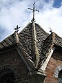 Summer house roof detail - geograph.org.uk - 1322681.jpg 480 × 640; 89 KB
-
 The bluebells are a-coming - geograph.org.uk - 3469496.jpg 979 × 734; 449 KB
-
 The centre of Lythbank - geograph.org.uk - 2784882.jpg 1,404 × 1,053; 334 KB
-
 The end of Longden Common Lane - geograph.org.uk - 3514219.jpg 979 × 734; 423 KB
-
 The entrance to Oaks Hall Farm and Longden Manor - geograph.org.uk - 2237155.jpg 1,280 × 960; 401 KB
-
 The footpath cuts the corner - geograph.org.uk - 3514243.jpg 857 × 1,142; 397 KB
-
 The footpath towards Great Lyth - geograph.org.uk - 2785070.jpg 1,306 × 979; 355 KB
-
 The lane into Great Lyth - geograph.org.uk - 2784890.jpg 857 × 1,142; 326 KB
-
 The lane to Exfords Green - geograph.org.uk - 2785081.jpg 857 × 1,142; 413 KB
-
 The lone walker - geograph.org.uk - 1322703.jpg 640 × 455; 88 KB
-
 The Red Lion at Longden Common - geograph.org.uk - 3514232.jpg 1,142 × 857; 345 KB
-

-
 The Stile. - geograph.org.uk - 628878.jpg 480 × 640; 141 KB
-
 The Tankerville Arms in Longden - geograph.org.uk - 2785927.jpg 1,306 × 979; 319 KB
-
 The Tankerville Arms, Longden - geograph.org.uk - 798288.jpg 640 × 480; 58 KB
-

-
 The top of Longden Common Lane - geograph.org.uk - 3514226.jpg 1,142 × 857; 310 KB
-
 Third of three signs at view point on Lyth Hill - geograph.org.uk - 2070568.jpg 2,848 × 2,136; 1.53 MB
-
 Track in the wood - geograph.org.uk - 6062736.jpg 640 × 480; 115 KB
-
 Track in the wood - geograph.org.uk - 6062744.jpg 640 × 480; 156 KB
-

-
 Up the lane towards Moat Hall - geograph.org.uk - 2787670.jpg 1,142 × 857; 364 KB
-
 Upper Oaks Farm, Oaks - geograph.org.uk - 2237139.jpg 1,152 × 864; 381 KB
-

-
 Victorian postbox in a wall in Longden Common - geograph.org.uk - 3514242.jpg 1,102 × 1,469; 341 KB
-
 View down Longden Common Lane - geograph.org.uk - 5935216.jpg 640 × 480; 53 KB
-
 View S from Lyth Hill, Shropshire - geograph.org.uk - 5620359.jpg 5,184 × 2,920; 5.08 MB
-
 View SSE from Lyth Hill towards The Lawley - geograph.org.uk - 5620360.jpg 5,184 × 2,920; 4.99 MB
-

-

-
 Village sign at Longden Common - geograph.org.uk - 5935238.jpg 640 × 480; 72 KB
-
 VR Wall box at Oaks Hall Farm - geograph.org.uk - 2237149.jpg 960 × 1,280; 596 KB
-


_-_geograph.org.uk_-_419652.jpg)


