Category:Lordship Lane, Haringey
Main Wikipedia article: Lordship Lane, Haringey.

street in the London Borough of Haringey  | |||||
| Upload media | |||||
| Instance of | |||||
|---|---|---|---|---|---|
| Part of | |||||
| Location | London Borough of Haringey, Greater London, London, England | ||||
| Connects with | |||||
 | |||||
Subcategories
This category has the following 4 subcategories, out of 4 total.
Pages in category "Lordship Lane, Haringey"
This category contains only the following page.
Media in category "Lordship Lane, Haringey"
The following 119 files are in this category, out of 119 total.
-
 10 February 2014 Lordship Lane N22.jpg 3,600 × 2,100; 1.41 MB
-
 14 -18 Lordship Lane.jpg 3,400 × 2,660; 2.18 MB
-
 Litter bin rubbish Lordship Lane Tottenham, London, England 1.jpg 4,021 × 3,217; 10.46 MB
-
 20 to 24 Lordship Lane N17.jpg 1,930 × 1,348; 399 KB
-
 Coronavirus Covid-19 Lordship Lane, Tottenham, London, England 1.jpg 3,873 × 2,905; 8.98 MB
-
 Coronavirus Covid-19 Lordship Lane, closed shops, Tottenham, London, England 1.jpg 4,032 × 2,688; 8.85 MB
-
 Coronavirus Covid-19 Lordship Lane, closed shops, Tottenham, London, England 2.jpg 4,032 × 2,688; 9.06 MB
-
 Coronavirus Covid-19 Lordship Lane, closed shops, Tottenham, London, England 3.jpg 4,032 × 3,024; 10.72 MB
-
 Coronavirus Covid-19 Lordship Lane, closed shops, Tottenham, London, England 4.jpg 4,032 × 2,688; 8.54 MB
-
 Coronavirus Covid-19 Lordship Lane, closure notice,Tottenham, London, England 1.jpg 2,881 × 3,841; 9.25 MB
-
 Coronavirus Covid-19 Lordship Lane, closed shops, Tottenham, London, England 5.jpg 4,032 × 2,688; 9.35 MB
-
 Block of flats on Lordship Lane, Tottenham, London, England 1.jpg 3,783 × 2,837; 7.51 MB
-
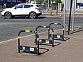 Bike rack in Lordship Lane, Tottenham, London, England 1.jpg 4,032 × 3,024; 6.5 MB
-
 Lordship Recreation Ground gates, Tottenham, London 1.jpg 4,608 × 3,072; 9.82 MB
-
 Coronavirus Covid-19 Lordship Lane, Tottenham, London, England 2.jpg 4,608 × 2,592; 9.37 MB
-
 Covid-19 pandemic food store Lordship Lane Tottenham, London, England 1.jpg 4,325 × 3,244; 9.47 MB
-
 Covid-19 pandemic food store Lordship Lane Tottenham, London, England 2.jpg 4,310 × 3,233; 9.93 MB
-
 Apartment balconies Lordship Lane Tottenham, London, England 1.jpg 4,485 × 3,364; 11.05 MB
-
 Commercial waste bins rubbish Lordship Lane Tottenham, London, England 1.jpg 4,608 × 3,456; 10.82 MB
-
 Dumped urine stained mattress Lordship Lane Tottenham, London, England 1.jpg 4,308 × 3,231; 10.57 MB
-
 The Elmhurst pub Lordship Lane Tottenham, London, England 1.jpg 4,393 × 3,295; 8.39 MB
-
 Covid-19 PPE gloves dumped Tottenham style, London, England.jpg 4,291 × 3,218; 13.51 MB
-
 Covid-19 PPE glove dumped Tottenham style, London, England.jpg 3,262 × 3,262; 9.35 MB
-
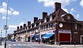
 259-331 Lordship Lane, London N17 - geograph.org.uk - 1407761.jpg 640 × 480; 60 KB
-
 29 Lordship Lane -2.jpg 2,900 × 2,400; 1.51 MB
-
 29 Lordship Lane N17.jpg 2,800 × 2,800; 1.21 MB
-
 341-385 Lordship Lane, London N17 - geograph.org.uk - 1407802.jpg 640 × 317; 57 KB
-
 342 to 384 Lordship Lane London N17.jpg 1,627 × 934; 263 KB
-
 347-351 Lordship Lane, London N17 - geograph.org.uk - 1407798.jpg 626 × 640; 132 KB
-
 421 Lordship Lane N17.jpg 2,854 × 2,199; 1.09 MB
-

-
 725 - 731 Lordship Lane, Wood Green N22 (7527910712) (2).jpg 2,277 × 2,401; 934 KB
-
 A109, Lordship Lane - geograph.org.uk - 1281755.jpg 640 × 480; 69 KB
-
 A109, Lordship Lane - geograph.org.uk - 293919.jpg 640 × 432; 83 KB
-
 Andrula Court Lordship Lane N22.jpg 2,019 × 1,497; 622 KB
-
 Animal Shelter Lordship Lane N22.jpg 1,736 × 1,296; 390 KB
-
 Another side of customer care (3339678858).jpg 3,140 × 3,140; 2.2 MB
-
 Atlas Equipment Company Lordship Lane N17.jpg 2,046 × 1,461; 597 KB
-
 Barclays bank, Wood Green - geograph.org.uk - 1277768.jpg 480 × 640; 96 KB
-
 Block at corner of Lordship Lane and A10.jpg 1,228 × 1,896; 419 KB
-
 Boarded-up. 639 High Road, Tottenham.jpg 3,360 × 2,660; 1.25 MB
-
 Broadwater Farm House looking South from Lordship Lane 1892.jpg 1,472 × 946; 623 KB
-
 Bruce Castle Court.jpg 1,630 × 1,044; 491 KB
-
 Bulletin Board.jpg 1,800 × 1,350; 522 KB
-
 Buses on Lordship Lane, Wood Green - geograph.org.uk - 2247266.jpg 1,600 × 1,200; 1.28 MB
-
 Chapmans Park Lordship Lane N22.jpg 2,019 × 1,227; 424 KB
-
 Cinematograph Cinema Lordship Lane N17 1913.jpg 1,824 × 946; 805 KB
-
 Coldham Court Lordship Lane N22.jpg 1,846 × 1,084; 600 KB
-
 Congregational Chapel in Lordship Lane c1905.jpg 864 × 539; 178 KB
-
 Customer Care (3339356638).jpg 3,095 × 3,095; 2.15 MB
-
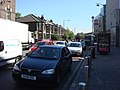
 Double Yella - 1.jpg 2,700 × 1,900; 915 KB
-
 Eastern End of Lordship Lane looking North.jpg 998 × 946; 235 KB
-
 Elmhurst Hotel Lordship Lane N17.jpg 1,998 × 1,364; 419 KB
-
 Enfield Magistrates Court.jpg 1,782 × 712; 191 KB
-

-
 Extract from Earl of Dorset Survey Tottenham Parish Plan 1619.png 1,914 × 696; 3.01 MB
-
 Extract from Greenwood Map of Middlesex 1819.png 632 × 208; 144 KB
-
 Extract from John Carey Map of Middlesex 1793.png 390 × 79; 68 KB
-
 Extract from John Ogilby Map of Middlesex 1677.png 696 × 262; 20 KB
-

-
 Former Gas Showrooms at E end of Lordship Lane N17.jpg 1,947 × 1,140; 329 KB
-
 Fryer's Delight, Lordship Lane, N22 - geograph.org.uk - 5271819.jpg 640 × 480; 87 KB
-
 Honeypot Café (Formerly- Marmalade).jpg 3,450 × 2,983; 1.64 MB
-
 Junction of LL and Boreham Road looking E 2006.jpg 1,622 × 686; 190 KB
-
 Junction of Lordship Lane and Boreham Road looking East c1908.jpg 1,476 × 688; 433 KB
-
 Junction of Lordship Lane and Mount Plesant Road looking East 1903.jpg 1,476 × 626; 345 KB
-
 Looking west along Lordship Lane at The Roundway.jpg 1,587 × 1,026; 194 KB
-
 Lordship Lane at Moselle bridge looking West 1893.jpg 1,306 × 514; 259 KB
-
 Lordship Lane N17 (1) - geograph.org.uk - 189397.jpg 640 × 480; 119 KB
-
 Lordship Lane N17 (2) - geograph.org.uk - 189408.jpg 640 × 480; 117 KB
-
 Lyndum Court Lordship Lane N22.jpg 2,046 × 1,266; 375 KB
-
 Marmalade Reflections.jpg 3,560 × 3,560; 1.98 MB
-
 Millicent Fawcett Court (North Block) from Lordship Lane N17.jpg 1,992 × 1,094; 352 KB
-
 Mount Plesant Fields looking South from Lordship Lane 1892.jpg 1,466 × 624; 351 KB
-
 Nicolas House Lordship Lane N17.jpg 2,028 × 1,188; 350 KB
-
 Number 26 Lordship Lane N17 - Gosport Engineering Co Ltd.jpg 2,048 × 1,218; 641 KB
-
 Numbers 132 to 138 Lordship Lane N17.jpg 2,048 × 1,334; 620 KB
-
 Numbers 2 to 6 Lordship Lane N17.jpg 1,578 × 1,215; 381 KB
-
 Numbers 2 to 6 Lordship Lane N17.png 1,578 × 1,215; 3.66 MB
-
 Numbers 212 to 234 Lordship Lane.jpg 2,019 × 1,362; 526 KB
-
 Numbers 259 to 331 Lordship Lane N17.jpg 2,048 × 1,536; 350 KB
-
 Numbers 28 to 34 Lordship Lane N17.jpg 1,998 × 1,290; 582 KB
-
 Numbers 341 to 385 Lordship Lane N17.jpg 1,748 × 751; 442 KB
-
 Numbers 347 to 351 Lordship Lane N17.jpg 1,014 × 1,036; 210 KB
-
 Numbers 387 to 403b Lordship Lane N17.jpg 1,768 × 808; 236 KB
-
 Numbers 409 to 419 Lordship Lane N17.jpg 1,638 × 938; 276 KB
-
 Numbers 425 to 435 Lordship Lane N22.jpg 1,664 × 834; 225 KB
-
 Numbers 439 to 465 Lordship Lane N22.jpg 1,676 × 920; 358 KB
-
 Numbers 467 to 483 Lordship Lane N22.jpg 2,500 × 1,401; 455 KB
-
 Numbers 482 to 490 Lordship Lane N22.jpg 1,592 × 1,094; 322 KB
-
 Numbers 492 to 510 Lordship Lane N22.jpg 1,662 × 1,132; 318 KB
-
 Numbers 495 to 509 Lordship Lane N22.jpg 1,770 × 994; 287 KB
-
 Numbers 515 to 529 Lordship Lane N22.jpg 1,980 × 1,042; 330 KB
-
 Numbers 52 to 56 Lordship Lane N17.jpg 2,034 × 938; 457 KB
-
 Numbers 535 to 545 Lordship Lane N22.jpg 1,780 × 1,118; 312 KB
-
 Numbers 550 to 556 Lordship Lane N22.jpg 1,680 × 1,202; 287 KB
-
 Numbers 551 to 569 Lordship Lane N22.jpg 1,995 × 1,149; 393 KB
-
 Numbers 578 to 584 Lordship Lane N22.jpg 1,514 × 1,044; 245 KB
-
 Numbers 710 to 732 Lordship Lane N22.jpg 2,046 × 1,022; 345 KB
-
 Numbers 734 to 748 Lordship Lane N22.jpg 1,926 × 1,236; 362 KB
-
 Numbers 8 to 18 Lordship Lane N17.jpg 2,050 × 1,228; 703 KB
-
 Omnibus House. 725-731 Lordship Lane N22.jpg 3,800 × 3,000; 1.52 MB
-
 OS Edition1 1864 25inch map of Lordship Lane N17 and N22.png 3,631 × 679; 1.3 MB
-
 OS Edition2 1895 25inch map of Lordship Lane N17 and N22.png 2,904 × 608; 1.16 MB
-
 Pembury Road.jpg 3,590 × 2,685; 2.72 MB
-
 Pickering Court Lordship Lane N22.jpg 1,617 × 1,203; 225 KB
-
 Potholes Lordship Lane, London N22.jpg 3,600 × 3,000; 2.51 MB
-
 Potholes Pembury Road N17.jpg 1,600 × 1,600; 1.18 MB
-
 Public toilets outside recreation ground Lordship Lane N17.jpg 1,794 × 1,166; 467 KB
-
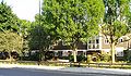
 River Park House, Wood Green, London.jpg 3,660 × 2,500; 1.36 MB
-
 River Park House, Wood Green.JPG 4,000 × 3,000; 4.13 MB
-
 Rubbish on the pavement 27-31 Lordship Lane N17 (27600211176).jpg 2,560 × 1,536; 1.08 MB
-
 Telephone Exchange Lordship Lane N22.jpg 1,479 × 1,482; 387 KB
-
 Texaco Lordship Lane N22.jpg 2,046 × 1,506; 613 KB
-
 The Freemasons 2008 02-03 13-30-55b.jpg 1,604 × 1,146; 406 KB
-
 Unfit for Purpose -2.jpg 3,073 × 2,662; 1.23 MB
-
 Vincent Square Lordship Lane N22.jpg 1,994 × 1,106; 509 KB
-
 We Buy Houses.jpg 3,540 × 2,546; 992 KB
-
 Western End of Lordship Lane looking North c1910.jpg 904 × 552; 209 KB


_(2).jpg)


.jpg)


.jpg)


.jpg)


_-_geograph.org.uk_-_189397.jpg)
_-_geograph.org.uk_-_189408.jpg)


_from_Lordship_Lane_N17.jpg)


.jpg)


