Category:Low Bradley
village in North Yorkshire, England | |||||
| Upload media | |||||
| Instance of | |||||
|---|---|---|---|---|---|
| Location | Bradleys Both, Craven, North Yorkshire, Yorkshire and the Humber, England | ||||
 | |||||
Low Bradley (sometimes called Bradley) is a village in North Yorkshire, England.
Subcategories
This category has the following 6 subcategories, out of 6 total.
Media in category "Low Bradley"
The following 64 files are in this category, out of 64 total.
-
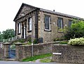 Bradley Methodist Church - geograph.org.uk - 879932.jpg 640 × 489; 95 KB
-
-

-
 Bradley Swing Bridge.jpg 640 × 480; 144 KB
-
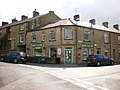 Bradley Village Store - geograph.org.uk - 1656109.jpg 640 × 480; 70 KB
-
 College Farmhouse, Low Bradley.jpg 4,000 × 3,000; 4.98 MB
-
 Croft Cottage and Farmhouse, Low Bradley 01.jpg 4,000 × 3,000; 1.46 MB
-
 Croft Cottage and Farmhouse, Low Bradley 02.jpg 4,000 × 3,000; 4.8 MB
-
 Cross Lane Mill - geograph.org.uk - 682806.jpg 640 × 480; 71 KB
-
 Cross Lane Mill - geograph.org.uk - 879879.jpg 640 × 480; 58 KB
-
 Cross Lane Mill, Low Bradley - geograph.org.uk - 1656103.jpg 640 × 480; 43 KB
-
 Cross Lane Mill, Low Bradley - geograph.org.uk - 1656106.jpg 640 × 480; 60 KB
-
 Cross Lane Mill, Low Bradley - geograph.org.uk - 1656107.jpg 480 × 640; 68 KB
-
 Cross Lane Mill, Low Bradley - geograph.org.uk - 1656108.jpg 480 × 640; 78 KB
-
 Descending into Low Bradley - geograph.org.uk - 724736.jpg 640 × 480; 74 KB
-
 Green Lane above Bradley Gill - geograph.org.uk - 675368.jpg 640 × 480; 66 KB
-
 Hamblethorpe Bridge - geograph.org.uk - 682182.jpg 640 × 480; 83 KB
-
 Ings Lane, Low Bradley - geograph.org.uk - 1656114.jpg 640 × 480; 77 KB
-
 Ings Lane, Low Bradley - geograph.org.uk - 1656115.jpg 480 × 640; 75 KB
-
 Ivy Terrace, Low Bradley - geograph.org.uk - 1401378.jpg 640 × 527; 110 KB
-

-
 Low Bradley - geograph.org.uk - 879876.jpg 640 × 418; 49 KB
-
 Low Bradley - geograph.org.uk - 879882.jpg 640 × 372; 83 KB
-
 Low Bradley - geograph.org.uk - 879885.jpg 640 × 590; 110 KB
-
 Low Bradley - geograph.org.uk - 879887.jpg 640 × 434; 66 KB
-
 Low Bradley cricket ground - geograph.org.uk - 1401406.jpg 640 × 480; 56 KB
-
 Low Bradley Cricket Ground - geograph.org.uk - 1656101.jpg 640 × 480; 47 KB
-
 Low Bradley Cricket Ground - geograph.org.uk - 1656104.jpg 640 × 480; 65 KB
-
 Low Bradley swing bridge - geograph.org.uk - 2303339.jpg 2,641 × 1,632; 1.01 MB
-
 Low Bradley Swing Bridge - geograph.org.uk - 879881.jpg 640 × 516; 59 KB
-
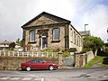
 Low Bradley village hall - geograph.org.uk - 1401390.jpg 640 × 359; 53 KB
-
 Low Bradley, former Post Office. - geograph.org.uk - 878704.jpg 640 × 480; 70 KB
-
 Low Bradley, near Skipton - geograph.org.uk - 3245.jpg 640 × 363; 45 KB
-
 Main Street, Low Bradley - geograph.org.uk - 1401388.jpg 640 × 480; 78 KB
-
 Main Street, Low Bradley - geograph.org.uk - 1656097.jpg 640 × 480; 72 KB
-
 North Gill Beck - geograph.org.uk - 473216.jpg 480 × 640; 206 KB
-
 Old Hall, Bradley - geograph.org.uk - 674075.jpg 640 × 480; 116 KB
-
 Roadside dog roses - geograph.org.uk - 473335.jpg 640 × 480; 161 KB
-
 Scarr House, Low Bradley 01.jpg 4,052 × 3,070; 2.08 MB
-
 Scarr House, Low Bradley 02.jpg 4,000 × 3,000; 1.67 MB
-
 Skipton Road, Low Bradley - geograph.org.uk - 1656110.jpg 640 × 480; 80 KB
-
 Stone trough, Low Bradley - geograph.org.uk - 1656099.jpg 640 × 480; 136 KB
-
 The canal at Low Bradley - geograph.org.uk - 783356.jpg 516 × 640; 92 KB
-
 The village shop - geograph.org.uk - 1401393.jpg 640 × 480; 81 KB
-
 Victoria Terrace, Low Bradley - geograph.org.uk - 1401396.jpg 640 × 480; 71 KB
-
 View over Low Bradley - geograph.org.uk - 675364.jpg 640 × 480; 77 KB
-
 Water Trough - geograph.org.uk - 879886.jpg 640 × 326; 54 KB
-
 West Lane Farm, Low Bradley 01.jpg 4,000 × 3,000; 5.29 MB
-
 West Lane Farm, Low Bradley 02.jpg 4,000 × 3,000; 1.64 MB
-
 Box Tree Farm, Low Bradley - geograph.org.uk - 1401382.jpg 640 × 470; 104 KB
-
 Bridleway, Bradley to Moor Gate - geograph.org.uk - 473206.jpg 640 × 480; 230 KB
-
 Cross Lane Mill, Low Bradley - geograph.org.uk - 1401364.jpg 548 × 640; 100 KB
-
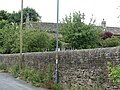
 Footpath fingerpost, Jackson's Lane - geograph.org.uk - 473351.jpg 640 × 480; 114 KB
-
 Footpath next to Bradley Methodist Church - geograph.org.uk - 473202.jpg 480 × 640; 208 KB
-
 Infant plantation on High Pasture - geograph.org.uk - 640702.jpg 640 × 480; 77 KB
-

-

-
 Low Bradley - geograph.org.uk - 319951.jpg 422 × 640; 72 KB
-
 Lower House Farm - geograph.org.uk - 473215.jpg 480 × 640; 199 KB
-
 NP Wardens Lunching in Walden - geograph.org.uk - 503309.jpg 640 × 480; 102 KB
-
 Rose Terrace, Low Bradley - geograph.org.uk - 682812.jpg 640 × 480; 64 KB
-
 Skipton Road, Bradley - geograph.org.uk - 473195.jpg 640 × 480; 138 KB
-

-
 Tree on High Edge. - geograph.org.uk - 152820.jpg 640 × 480; 115 KB


