Category:M-28 (Michigan highway)
 | number: | (twenty-eight) |
|---|---|---|
| State highways in Michigan: | 8 · 10 · 11 · 13 · 14 · 15 · 17 · 18 · 19 · 20 · 21 · 22 · 24 · 25 · 26 · 27 · 28 · 29 · 30 · 32 · 33 · 34 · 35 · 36 · 37 · 38 · 39 · 40 · 42 · 43 · 44 · 45 · 46 · 47 · 48 |
state highway in Michigan, United States  | |||||
| Upload media | |||||
| Instance of | |||||
|---|---|---|---|---|---|
| Location | |||||
| Transport network | |||||
| Owned by | |||||
| Maintained by | |||||
| Start time |
| ||||
| Length |
| ||||
| Terminus | |||||
| |||||
Subcategories
This category has only the following subcategory.
M
Media in category "M-28 (Michigan highway)"
The following 29 files are in this category, out of 29 total.
-
 M-28.svg 600 × 600; 4 KB
-
 Michigan 28 map.png 2,172 × 1,333; 83 KB
-
 05 Summer trip 04 Da Yoopers Tourist Trap Cropped.JPG 1,078 × 361; 83 KB
-
 2009-0617-DaYooperTouristTrap.jpg 3,648 × 2,736; 4.97 MB
-
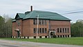
 2009-0618-Munising-CityHall.jpg 2,694 × 1,908; 2.77 MB
-
 Bergland, Michigan Highway M-28-M-64.jpg 5,760 × 3,026; 9.41 MB
-
 Christmas, Michigan welcome road sign.jpg 1,800 × 1,215; 1.06 MB
-
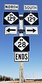 Eastern terminus of M-28.jpg 1,653 × 3,215; 3.04 MB
-
 First National Bank-Munising.jpg 3,953 × 2,438; 3.01 MB
-
 Hiawatha National Forest.jpg 600 × 403; 77 KB
-
 Lincoln School (McMillan, MI).jpg 5,183 × 2,916; 2.7 MB
-
 M-117 northern terminus.jpg 5,184 × 2,916; 2.24 MB
-
 M-28 & M-178.jpg 3,203 × 1,857; 1.32 MB
-
 M-28 1926.svg 600 × 600; 8 KB
-
 M-28 M-64 Duplex Near Lake Gogebic.JPG 2,939 × 2,204; 2.86 MB
-
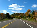
 M-28 McMillan.jpg 1,818 × 1,228; 669 KB
-
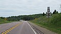
 M-28 Trout Creek.jpg 1,818 × 1,228; 2.84 MB
-
 Marquette Bypass.jpg 3,008 × 2,000; 2.87 MB
-
 McMillan, Michigan (June 2021).jpg 5,184 × 2,916; 2.59 MB
-
 Mich left m-553.jpg 1,298 × 1,078; 527 KB
-
 Seney stretch.jpg 1,600 × 1,200; 349 KB
-
 Seney Stretch1.jpg 650 × 400; 53 KB
-
 Sunday Lake.jpg 500 × 375; 56 KB
-
 U-P02.jpg 1,200 × 798; 284 KB
-
 Up Chucks Trout Creek MI.jpg 600 × 321; 57 KB
-
 US 41 M-28 Marquette roundabout.jpg 400 × 266; 28 KB
-
 US 41 M-28 Veterans Memorial Highway.jpg 3,264 × 2,448; 1.68 MB
-
 US 41 Peshekee Bridge.jpg 3,008 × 2,000; 2.97 MB
-
 US141NorthernTerminusUS41M28.jpg 1,936 × 1,288; 879 KB


.jpg)


.jpg)


