Category:Madley
village in United Kingdom  | |||||
| Upload media | |||||
| Instance of | |||||
|---|---|---|---|---|---|
| Location | Herefordshire, West Midlands, England | ||||
 | |||||

Subcategories
This category has the following 5 subcategories, out of 5 total.
M
- Madley Communications Centre (3 F)
- Madley Wayside Cross (4 F)
T
- The Red Lion, Madley (9 F)
Media in category "Madley"
The following 180 files are in this category, out of 180 total.
-

-
 A B4352 road junction, Madley - geograph.org.uk - 3111914.jpg 640 × 545; 82 KB
-
 A green corner of Madley - geograph.org.uk - 3116918.jpg 640 × 539; 75 KB
-
 Apple trees at Little Brampton - geograph.org.uk - 1991628.jpg 640 × 480; 83 KB
-
 Approach to Madley - geograph.org.uk - 1569569.jpg 640 × 463; 111 KB
-
 Archenfield, Madley - geograph.org.uk - 2404320.jpg 640 × 480; 105 KB
-
 Avenue of trees, near Madley - geograph.org.uk - 1998105.jpg 640 × 480; 74 KB
-
 B4352 Madley to Tyberton Road - geograph.org.uk - 4772080.jpg 1,600 × 901; 699 KB
-
 Bage Mill - geograph.org.uk - 3103295.jpg 1,024 × 680; 202 KB
-
 Beautiful Quaint Cottage in Madley - geograph.org.uk - 1554815.jpg 480 × 640; 58 KB
-
 Bower Farm, Shenmore - geograph.org.uk - 1992793.jpg 640 × 480; 93 KB
-
 Bridleway to Timberline Wood - geograph.org.uk - 1992777.jpg 640 × 480; 60 KB
-
 BT Satellite station, Madley - geograph.org.uk - 1608174.jpg 640 × 480; 54 KB
-

-
 Bus stop at Great Brampton - geograph.org.uk - 1991629.jpg 640 × 480; 54 KB
-
 By way over Brampton Hill - geograph.org.uk - 1991634.jpg 640 × 480; 129 KB
-
 Canon Bridge - geograph.org.uk - 1998114.jpg 640 × 480; 74 KB
-
 Castle Farm, Near Madley - geograph.org.uk - 1569551.jpg 640 × 481; 112 KB
-
 Chicken farm - geograph.org.uk - 958089.jpg 640 × 480; 94 KB
-
 Church House, Madley - geograph.org.uk - 5992882.jpg 2,610 × 1,949; 2.47 MB
-
 Cider orchard at Little Brampton - geograph.org.uk - 4642110.jpg 800 × 451; 202 KB
-
 Cottages at Chilstone Cross - geograph.org.uk - 4772090.jpg 1,600 × 901; 678 KB
-
 Country Cut, Madley - geograph.org.uk - 3116881.jpg 564 × 640; 88 KB
-
 Country road near Madley - geograph.org.uk - 3103312.jpg 1,024 × 680; 268 KB
-
 Disused farm buildings, Lulham - geograph.org.uk - 1997730.jpg 640 × 480; 89 KB
-
 Disused farm buildings, Lulham - geograph.org.uk - 1997732.jpg 640 × 480; 111 KB
-
 Driveway to Cawardine Farm - geograph.org.uk - 1997738.jpg 640 × 480; 76 KB
-
 Dutch barn at Shenmore Court - geograph.org.uk - 1992786.jpg 640 × 480; 67 KB
-

-
 Entrance to Pantile Lane Madley - geograph.org.uk - 1513219.jpg 640 × 480; 107 KB
-

-
 Farm at Little Brampton - geograph.org.uk - 1991627.jpg 640 × 480; 62 KB
-
 Farm SW of Lulham - geograph.org.uk - 5843929.jpg 1,024 × 768; 158 KB
-

-
 Field entrance at Shenmore - geograph.org.uk - 1994983.jpg 640 × 480; 79 KB
-
 Field near Holsty Farm - geograph.org.uk - 2288965.jpg 1,024 × 680; 170 KB
-
 Field of potatoes near Brampton - geograph.org.uk - 1992773.jpg 640 × 480; 91 KB
-
 Field of potatoes, Lulham - geograph.org.uk - 1997741.jpg 640 × 480; 87 KB
-
 Field of wheat near Shenmore - geograph.org.uk - 1992800.jpg 3,072 × 2,304; 2.15 MB
-
 Field of wheat, near Lulham - geograph.org.uk - 1997729.jpg 640 × 480; 133 KB
-
 Field of young cereals - geograph.org.uk - 4773759.jpg 1,600 × 901; 686 KB
-

-
 Footpath through Lady Coppice - geograph.org.uk - 2289849.jpg 680 × 1,024; 340 KB
-
 Fork in the road on Batchy Hill - geograph.org.uk - 316700.jpg 640 × 480; 96 KB
-
 Former Methodist Chapel at Shenmore - geograph.org.uk - 4341926.jpg 640 × 480; 251 KB
-
 Former R.A.F. Madley (2) - geograph.org.uk - 5843957.jpg 800 × 533; 107 KB
-
 Former R.A.F. Madley, aerial 2018 (1) - geograph.org.uk - 5843947.jpg 1,024 × 683; 129 KB
-
 Four trees in a stubble field - geograph.org.uk - 4772172.jpg 1,600 × 899; 1.1 MB
-
 Garnons Hill - geograph.org.uk - 3792773.jpg 800 × 531; 211 KB
-

-
 Gateway to Waterworks - geograph.org.uk - 1512365.jpg 640 × 442; 148 KB
-
 Green lane with tractor tramlines - geograph.org.uk - 4773771.jpg 1,600 × 901; 583 KB
-
 Hangar 1, Madley - geograph.org.uk - 1991620.jpg 640 × 480; 75 KB
-
 Herefordshire hop yard - geograph.org.uk - 1758040.jpg 800 × 600; 163 KB
-
 House at Lulham corner - geograph.org.uk - 4642118.jpg 800 × 451; 188 KB
-
 Junction for Madley - geograph.org.uk - 1991637.jpg 640 × 480; 80 KB
-
 Lane to Brampton - geograph.org.uk - 1992779.jpg 640 × 480; 73 KB
-
 Lane to Canon Bridge - geograph.org.uk - 4772051.jpg 1,600 × 901; 653 KB
-
 Large pond at Swinmoor - geograph.org.uk - 4772043.jpg 1,600 × 901; 691 KB
-
 Lawnsdown Nurseries - geograph.org.uk - 317009.jpg 640 × 480; 78 KB
-
 Line of a footpath - geograph.org.uk - 4772014.jpg 1,600 × 901; 673 KB
-

-
 Lower Cublington Farm - geograph.org.uk - 1992796.jpg 640 × 480; 83 KB
-

-
 Madley entrance sign - geograph.org.uk - 2404306.jpg 640 × 480; 66 KB
-
 Madley Methodist Church - geograph.org.uk - 3115971.jpg 640 × 636; 106 KB
-
 Madley Parish Hall - geograph.org.uk - 3111897.jpg 640 × 480; 66 KB
-
 Madley Playing Fields - geograph.org.uk - 1554832.jpg 640 × 480; 114 KB
-
 Madley Post Office - geograph.org.uk - 1009914.jpg 640 × 426; 79 KB
-
 Madley Primary School - geograph.org.uk - 3111949.jpg 640 × 414; 67 KB
-
 Madley Tennis Club - geograph.org.uk - 1513202.jpg 640 × 415; 68 KB
-
 Madley Tennis Club clubhouse - geograph.org.uk - 3116172.jpg 640 × 480; 95 KB
-
 Madley Tennis Club courts - geograph.org.uk - 3116168.jpg 640 × 480; 79 KB
-
 Madley Tennis Club, Herefordshire - geograph.org.uk - 1554269.jpg 640 × 480; 66 KB
-
 Madley Village playing field - geograph.org.uk - 1513211.jpg 640 × 480; 87 KB
-
 Madley, farmland - geograph.org.uk - 1810627.jpg 1,024 × 768; 184 KB
-
 Madley, sheep - geograph.org.uk - 1810611.jpg 1,024 × 768; 187 KB
-
 Maize crop at Handley's Cross - geograph.org.uk - 3103306.jpg 1,024 × 680; 296 KB
-
 Methodist Chapel, Brampton Road, Madeley - geograph.org.uk - 1495052.jpg 640 × 482; 106 KB
-
 Mistletoe in the poplars - geograph.org.uk - 1758051.jpg 800 × 600; 151 KB
-
 Modern house near Brampton - geograph.org.uk - 1992776.jpg 640 × 480; 86 KB
-
 Oak trees - geograph.org.uk - 2288966.jpg 1,024 × 680; 241 KB
-
 Oak trees, Canon Bridge - geograph.org.uk - 3792767.jpg 800 × 531; 179 KB
-
 Old cider press, Madley - geograph.org.uk - 3116910.jpg 640 × 480; 100 KB
-
 Old Milepost by the B4352, near Showel Farm, Madley parish (geograph 6048281).jpg 1,261 × 1,704; 441 KB
-
 Ordnance Survey Cut Mark - geograph.org.uk - 6127676.jpg 1,024 × 842; 210 KB
-
 Pasture land with oak trees - geograph.org.uk - 4642113.jpg 800 × 451; 194 KB
-
 Pennyplock and Rosemary Lane, Madley - geograph.org.uk - 3116932.jpg 640 × 454; 61 KB
-
 Ploughed Field - geograph.org.uk - 1500791.jpg 640 × 482; 104 KB
-
 Ploughing Competition - geograph.org.uk - 1501281.jpg 640 × 482; 87 KB
-
 Poplar trees - geograph.org.uk - 1998100.jpg 480 × 640; 95 KB
-
 Potatoes near Lower Cublington Farm - geograph.org.uk - 1992795.jpg 640 × 480; 92 KB
-
 Public footpath across cereal land - geograph.org.uk - 4507778.jpg 800 × 451; 207 KB
-

-
 Road from Kingstone to Madley - geograph.org.uk - 3102329.jpg 640 × 397; 47 KB
-
 Road from Madley to Canon Bridge - geograph.org.uk - 3115920.jpg 640 × 480; 61 KB
-

-

-
 Road junction near Swinmoor Farm - geograph.org.uk - 1998067.jpg 640 × 480; 86 KB
-
 Road to Batchy Hill Reservoir - geograph.org.uk - 4773772.jpg 1,600 × 901; 725 KB
-
 Road to Bridge Sollers - geograph.org.uk - 2788317.jpg 1,024 × 768; 404 KB
-
 Road to Clehonger, Madley - geograph.org.uk - 3115934.jpg 640 × 476; 62 KB
-
 Road to Madley - geograph.org.uk - 1991625.jpg 640 × 480; 70 KB
-
 Road to Madley - geograph.org.uk - 4642116.jpg 800 × 451; 191 KB
-
 Roman road near Madley - geograph.org.uk - 1009900.jpg 640 × 426; 73 KB
-

-
 Rutted field - geograph.org.uk - 4773763.jpg 1,600 × 901; 712 KB
-

-
 Seabourne Gardens, Madley - geograph.org.uk - 3111757.jpg 640 × 446; 60 KB
-

-
 Spring wheat, Canon Bridge - geograph.org.uk - 1998078.jpg 640 × 480; 93 KB
-
 St Mary's Close, Madley - geograph.org.uk - 3116868.jpg 640 × 565; 84 KB
-
 Stack of timber - geograph.org.uk - 4506345.jpg 800 × 451; 230 KB
-
 Steps to the works - geograph.org.uk - 1512408.jpg 640 × 481; 88 KB
-
 Stone Street - geograph.org.uk - 908808.jpg 640 × 480; 115 KB
-
 Stone Street South - geograph.org.uk - 1495746.jpg 640 × 482; 164 KB
-
 Stoney Street Car Boot Sale - geograph.org.uk - 3103272.jpg 1,024 × 680; 245 KB
-
 Straight path, 1 - geograph.org.uk - 4507781.jpg 800 × 600; 261 KB
-
 Stubble field at Shenmore - geograph.org.uk - 4773755.jpg 1,600 × 901; 688 KB
-
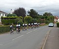 Sunday cyclists in Madley - geograph.org.uk - 3111859.jpg 640 × 534; 60 KB
-
 Sunrise over Brightwell's, 1 - geograph.org.uk - 4786987.jpg 1,024 × 620; 102 KB
-
 Sunrise over Brightwell's, 2 - geograph.org.uk - 4786989.jpg 1,023 × 1,024; 156 KB
-
 Sunrise, reflected - geograph.org.uk - 4787092.jpg 1,024 × 576; 198 KB
-
 Sycamore Croft houses, Madley - geograph.org.uk - 3116110.jpg 640 × 539; 76 KB
-
 Sycamore Croft, Madley - geograph.org.uk - 1513226.jpg 640 × 480; 76 KB
-
 Sycamore Croft, Madley - geograph.org.uk - 2404340.jpg 640 × 480; 66 KB
-
 T- Junction Right to Upper Shenmore - geograph.org.uk - 1569517.jpg 640 × 476; 122 KB
-
 The Comet Inn near Madley - geograph.org.uk - 1009866.jpg 640 × 426; 64 KB
-
 The Comet Inn, Madley - geograph.org.uk - 1998109.jpg 640 × 480; 57 KB
-
 The Farm, Canon Bridge - geograph.org.uk - 1998071.jpg 640 × 480; 68 KB
-
 The Old Forge, Madley - geograph.org.uk - 3115884.jpg 640 × 433; 52 KB
-

-
 The River Wye at Canon Bridge - geograph.org.uk - 3792762.jpg 1,024 × 680; 262 KB
-
 The Vicarage, Madley - geograph.org.uk - 5996870.jpg 2,546 × 1,709; 1.72 MB
-
 The Weir Garden Swainshill - geograph.org.uk - 5880278.jpg 4,000 × 3,000; 4.68 MB
-
 The Yard, Brampton Road, Madley - geograph.org.uk - 3116048.jpg 640 × 480; 88 KB
-
 Timber - geograph.org.uk - 4506346.jpg 800 × 800; 560 KB
-
 Tinglebrook Close, Madley - geograph.org.uk - 3111753.jpg 640 × 433; 70 KB
-
 Track to Lower Chilstone Farm - geograph.org.uk - 4772075.jpg 1,600 × 901; 711 KB
-
 Track to The Batcho - geograph.org.uk - 1991635.jpg 640 × 480; 85 KB
-
 Trees and hedgerow - geograph.org.uk - 2288963.jpg 1,024 × 680; 226 KB
-

-
 Two semi-detached cottages, Madley - geograph.org.uk - 3116138.jpg 640 × 428; 72 KB
-
 Underground reservoir - geograph.org.uk - 1512401.jpg 640 × 481; 86 KB
-
 Upper Shenmore - geograph.org.uk - 1569536.jpg 640 × 416; 83 KB
-
 Victorian Cottages Brampton Road Madley - geograph.org.uk - 1503641.jpg 612 × 640; 114 KB
-
 View down the Brampton Road - geograph.org.uk - 1555245.jpg 480 × 640; 56 KB
-
 View North from Batchy Hill - geograph.org.uk - 1503951.jpg 640 × 482; 89 KB
-
 View Northwest from Batchy Hill. - geograph.org.uk - 1512393.jpg 640 × 481; 106 KB
-
 View over fields near Madley - geograph.org.uk - 1554307.jpg 640 × 480; 33 KB
-
 View up the Brampton Road - geograph.org.uk - 1555236.jpg 480 × 640; 83 KB
-
 Wheat crop - geograph.org.uk - 4642124.jpg 800 × 451; 200 KB
-
 Wheat field - geograph.org.uk - 3103280.jpg 1,024 × 680; 299 KB
-
 Wheat field and Garrett's Leasow - geograph.org.uk - 4505661.jpg 800 × 451; 208 KB
-
 Wheat field at Brampton - geograph.org.uk - 1991641.jpg 640 × 480; 95 KB
-
 Wheat field at Lulham - geograph.org.uk - 1997734.jpg 640 × 480; 111 KB
-
 Wheat field near Brampton - geograph.org.uk - 1992774.jpg 640 × 480; 98 KB
-
 Wheat field near Swinmore Farm - geograph.org.uk - 1997744.jpg 640 × 480; 93 KB
-
 Wormhill and Warlow Farm - geograph.org.uk - 4772018.jpg 1,600 × 901; 690 KB
-
 Brick barn - geograph.org.uk - 349049.jpg 640 × 480; 90 KB
-
 Brick barn in Upper Shenmore - geograph.org.uk - 317304.jpg 640 × 480; 86 KB
-
 BT at work - geograph.org.uk - 349084.jpg 640 × 480; 86 KB
-
 Cherry Trees Cottage - geograph.org.uk - 1503691.jpg 640 × 482; 88 KB
-
 Cottages by Chilstone Cross - geograph.org.uk - 317395 (cropped).jpg 146 × 389; 29 KB
-
 Cottages by Chilstone Cross - geograph.org.uk - 317395.jpg 640 × 480; 72 KB
-
 ETL buildings at Coldwell - geograph.org.uk - 349090.jpg 640 × 480; 112 KB
-
 Footpath to The Bage - geograph.org.uk - 349081.jpg 640 × 480; 120 KB
-
 Green lane near Swinmoor - geograph.org.uk - 349052.jpg 640 × 480; 90 KB
-
 Herefordshire cider orchard - geograph.org.uk - 317002.jpg 640 × 480; 91 KB
-
 Lower Cublington Farm - geograph.org.uk - 317014.jpg 640 × 480; 89 KB
-
 Madley - The Comet Inn - geograph.org.uk - 167902.jpg 640 × 480; 69 KB
-
 Madley Cemetery - geograph.org.uk - 627462.jpg 640 × 480; 146 KB
-

-
 Pasture near Madley - geograph.org.uk - 316693.jpg 640 × 480; 78 KB
-
 Road junction by Little Brampton - geograph.org.uk - 317006.jpg 640 × 480; 85 KB
-
 The Comet Inn - geograph.org.uk - 349086.jpg 640 × 480; 73 KB
-
 The other end of the lane - geograph.org.uk - 349057.jpg 640 × 480; 98 KB
-
 Two poplars - geograph.org.uk - 378027.jpg 640 × 480; 114 KB
-
 Unmarked pond - geograph.org.uk - 349083.jpg 640 × 480; 92 KB
-
 Woodfield Lane - geograph.org.uk - 317344.jpg 640 × 480; 75 KB


_-_geograph.org.uk_-_5843957.jpg)
_-_geograph.org.uk_-_5843947.jpg)


.jpg)


.jpg)