Category:Malvern Wells
village in Worcestershire, England, UK  | |||||
| Upload media | |||||
| Instance of | |||||
|---|---|---|---|---|---|
| Location | Malvern Hills, Worcestershire, West Midlands, England | ||||
 | |||||
Subcategories
This category has the following 8 subcategories, out of 8 total.
A
E
H
- Holy Well, Malvern Wells (12 F)
M
- Malvern Wells Primary School (2 F)
- Malvern Wells War Memorial (1 F)
T
- Three Counties Showground (73 F)
W
- Wyche (13 F)
Media in category "Malvern Wells"
The following 200 files are in this category, out of 1,337 total.
(previous page) (next page)-

-
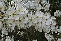
 'Feathers in our cap' - geograph.org.uk - 5302328.jpg 2,304 × 1,704; 1.29 MB
-
 'Quiet Contemplation' - geograph.org.uk - 6151180.jpg 1,600 × 776; 625 KB
-
 60 Old Wyche Road, demolished - geograph.org.uk - 2473626.jpg 640 × 480; 134 KB
-
 A choice of tracks on Malvern Common - geograph.org.uk - 5650378.jpg 1,024 × 683; 289 KB
-
 A corner of Malvern Common - geograph.org.uk - 6495011.jpg 1,024 × 768; 407 KB
-
 A couple enjoy the view - geograph.org.uk - 5866896.jpg 1,024 × 768; 234 KB
-
 A doggy bag - geograph.org.uk - 6292428.jpg 1,024 × 768; 265 KB
-
 A fine array of seasonal plants - geograph.org.uk - 4950290.jpg 1,600 × 965; 1,014 KB
-
 A glimpse of the Worcestershire Beacon - geograph.org.uk - 5507180.jpg 1,024 × 768; 263 KB
-
 A Hereford bound train - geograph.org.uk - 5394079.jpg 1,024 × 768; 194 KB
-
 A hint of a rainbow over Malvern - geograph.org.uk - 5660363.jpg 683 × 1,024; 164 KB
-

-
 A lone silver birch tree - geograph.org.uk - 5987025.jpg 1,024 × 768; 289 KB
-
 A pair of walkers on Summer Hill - geograph.org.uk - 6337059.jpg 1,024 × 683; 123 KB
-
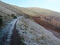 A partially frozen path - geograph.org.uk - 5983603.jpg 1,024 × 768; 236 KB
-
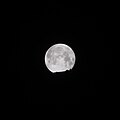 A setting blue 'super moon' - geograph.org.uk - 5667628.jpg 1,024 × 1,024; 54 KB
-
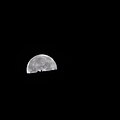
 A setting blue 'super moon' - geograph.org.uk - 5667632.jpg 1,024 × 1,024; 52 KB
-
 A setting blue 'super moon' - geograph.org.uk - 5667636.jpg 1,024 × 1,024; 50 KB
-
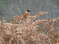 A stonechat - geograph.org.uk - 5626984.jpg 1,024 × 768; 251 KB
-
 A thunderstorm over Worcestershire - geograph.org.uk - 5487087.jpg 1,024 × 683; 125 KB
-
 A train and bracken - geograph.org.uk - 6309383.jpg 1,024 × 768; 350 KB
-
 A trio of seats - geograph.org.uk - 1056552.jpg 640 × 480; 366 KB
-
 A very dry Worcestershire Beacon - geograph.org.uk - 5859832.jpg 1,024 × 768; 266 KB
-
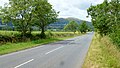
 A449 at Malvern Wells boundary - geograph.org.uk - 3059397.jpg 640 × 480; 88 KB
-
 Abbey College'05 - panoramio.jpg 2,048 × 1,536; 1.02 MB
-
 Acer palmatum 'Nicholsonii' - geograph.org.uk - 6151192.jpg 1,600 × 1,170; 635 KB
-
 After the solstice sun set over Herefordshire - geograph.org.uk - 1927058.jpg 4,272 × 2,848; 4.55 MB
-
 Aiming for gold - geograph.org.uk - 5302338.jpg 2,304 × 1,704; 1.57 MB
-
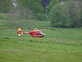 Air ambulance on Malvern Common - geograph.org.uk - 6144246.jpg 1,024 × 768; 188 KB
-

-
 Animal Track, St. Wulstan's Nature Reserve - geograph.org.uk - 97963.jpg 479 × 640; 146 KB
-
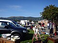 Antique Fair, Malvern - geograph.org.uk - 4675505.jpg 4,608 × 3,456; 3.64 MB
-
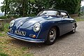 Apal Speedster - geograph.org.uk - 5849076.jpg 1,024 × 683; 312 KB
-
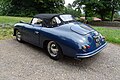 Apal Speedster - geograph.org.uk - 5849077.jpg 1,024 × 683; 315 KB
-
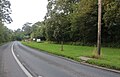
 Approach to school on Wells Road - geograph.org.uk - 5046898.jpg 800 × 587; 109 KB
-
 Approaching Wyche Cutting - geograph.org.uk - 2405925.jpg 1,024 × 658; 193 KB
-
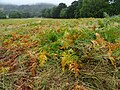
 Arable farmland - geograph.org.uk - 6381169.jpg 1,024 × 683; 286 KB
-

-
 Arrangement of rocks at RHS Malvern Show 2016 - geograph.org.uk - 4948840.jpg 1,600 × 1,200; 919 KB
-
 Arts and Crafts style house (geograph 6748479).jpg 1,024 × 768; 340 KB
-
 Ascending Pinnacle Hill, The Malverns - geograph.org.uk - 4127328.jpg 1,024 × 563; 470 KB
-
 Ash tree flowering - geograph.org.uk - 6436021.jpg 1,024 × 768; 197 KB
-
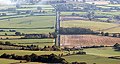
 Assarts and Upper Welland - geograph.org.uk - 2234214.jpg 4,272 × 2,848; 4.12 MB
-
 Assarts Lane - geograph.org.uk - 2791826.jpg 427 × 640; 290 KB
-

-
 Assarts Playing Ffield - geograph.org.uk - 425491.jpg 640 × 407; 256 KB
-
 Assarts playing field - geograph.org.uk - 4268711.jpg 1,600 × 1,000; 1.68 MB
-
 Assarts Playing Field, Malvern Wells - geograph.org.uk - 6377.jpg 640 × 480; 123 KB
-
 Assarts Road, Upper Welland - geograph.org.uk - 1077178.jpg 640 × 426; 79 KB
-
 Atop Pinnacle Hill - geograph.org.uk - 2284499.jpg 4,000 × 3,000; 2.23 MB
-
 Auricula display at Malvern - geograph.org.uk - 1293746.jpg 640 × 480; 303 KB
-
 Autumn colour on Malvern Common - geograph.org.uk - 1130688.jpg 640 × 480; 124 KB
-
 Autumn colours on Malvern Common - geograph.org.uk - 5973318.jpg 1,024 × 768; 372 KB
-
 Autumn colours on Pinnacle Hill - geograph.org.uk - 1468647.jpg 640 × 412; 103 KB
-
 Autumn colours on the Malvern Hills - geograph.org.uk - 5973294.jpg 1,024 × 768; 284 KB
-
 Autumn colours on the Malvern Hills - geograph.org.uk - 5978228.jpg 1,024 × 768; 255 KB
-
 Autumn leaves - geograph.org.uk - 5941136.jpg 1,024 × 768; 320 KB
-
 Autumn mist on Malvern Common - geograph.org.uk - 1129511.jpg 640 × 480; 73 KB
-
 Autumn on Malvern Common - geograph.org.uk - 6322579.jpg 1,024 × 768; 295 KB
-
 Autumn on the Malvern Hills - geograph.org.uk - 5963911.jpg 1,024 × 768; 237 KB
-
 Autumn Show, Three Counties Showground - geograph.org.uk - 2083614.jpg 4,159 × 2,731; 6.59 MB
-
 Autumn trees - geograph.org.uk - 5602307.jpg 1,024 × 768; 357 KB
-
 Autumn trees on Malvern Common - geograph.org.uk - 5941138.jpg 1,024 × 768; 301 KB
-
 Autumn trees on Malvern Common - geograph.org.uk - 5978224.jpg 1,024 × 683; 311 KB
-
 Autumn trees on the Malvern Hills - geograph.org.uk - 5977300.jpg 1,024 × 768; 257 KB
-
 Autumn trees on the side of the Malvern Hills - geograph.org.uk - 5612139.jpg 1,024 × 768; 331 KB
-
 Autumnal avenue - geograph.org.uk - 6294060.jpg 1,600 × 899; 775 KB
-
 Back yard at Common Farm - geograph.org.uk - 647504.jpg 640 × 469; 111 KB
-
 Badger sett - geograph.org.uk - 6033785.jpg 1,024 × 768; 368 KB
-
 Bare trees - geograph.org.uk - 5634520.jpg 1,024 × 768; 397 KB
-
 Bare trees on the Malvern Hills - geograph.org.uk - 5996945.jpg 1,024 × 768; 255 KB
-
 Barley Field, Malvern Wells - geograph.org.uk - 428647.jpg 640 × 401; 278 KB
-
 Barn Owl - Malvern Spring Show 2010 - geograph.org.uk - 1850451.jpg 1,200 × 856; 560 KB
-
 Barriers across the entrance to Langdale Wood - geograph.org.uk - 5691119.jpg 1,024 × 680; 262 KB
-
 Barry Jackson Commemorative Plaque - geograph.org.uk - 501075.jpg 640 × 437; 284 KB
-
 Barry Jackson Commemorative Seats - geograph.org.uk - 501033.jpg 640 × 427; 285 KB
-

-
 Beacon Road, Upper Colwall - geograph.org.uk - 2113710.jpg 3,961 × 2,606; 4.88 MB
-
 Beech tree trunk - geograph.org.uk - 6005651.jpg 768 × 1,024; 320 KB
-
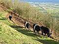 Belted Galloway cattle - geograph.org.uk - 5660332.jpg 1,024 × 768; 365 KB
-
 Belted Galloway cattle - geograph.org.uk - 6378961.jpg 1,024 × 683; 305 KB
-
 Bench Mark on a Wells Road milestone - geograph.org.uk - 1774190.jpg 640 × 427; 320 KB
-
 Bench on Black Hill - geograph.org.uk - 1480538.jpg 640 × 427; 340 KB
-
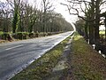
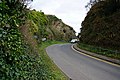
 Bend at Lower Wyche - geograph.org.uk - 5048486.jpg 800 × 513; 112 KB
-
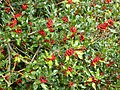 Berries on a holly bush - geograph.org.uk - 5667275.jpg 1,024 × 768; 349 KB
-
 Berrington's Quarry - geograph.org.uk - 683574.jpg 640 × 427; 307 KB
-
 Between Jubilee Hill and Perseverance Hill - geograph.org.uk - 4910819.jpg 1,600 × 1,200; 556 KB
-
 Black Hill - geograph.org.uk - 2781149.jpg 4,000 × 2,667; 7.46 MB
-
 Black Hill - geograph.org.uk - 428733.jpg 640 × 424; 103 KB
-
 Black Hill and British Camp - geograph.org.uk - 4275010.jpg 1,600 × 793; 1,006 KB
-
 Black Hill from Pinnacle Hill - geograph.org.uk - 2234154.jpg 4,272 × 2,848; 3.72 MB
-
 Black Hill on the Malvern Hills - geograph.org.uk - 3828786.jpg 1,024 × 680; 169 KB
-
 Black Hill, The Malvern Hills - geograph.org.uk - 3179232.jpg 4,358 × 2,662; 6.74 MB
-
 Black Poplar after pollarding - geograph.org.uk - 2661000.jpg 3,750 × 2,500; 6.8 MB
-
 Black thorn blossom - geograph.org.uk - 6080312.jpg 1,024 × 683; 170 KB
-
 Blackmore Park Road - geograph.org.uk - 4084139.jpg 800 × 451; 175 KB
-
 Blackmore Park Road - geograph.org.uk - 5631749.jpg 1,024 × 768; 354 KB
-
 Blackmore Park Road, Malvern - geograph.org.uk - 6227863.jpg 1,920 × 1,280; 1.06 MB
-
 Blackmore Park Road, Malvern - geograph.org.uk - 6255154.jpg 1,872 × 1,204; 1.37 MB
-
 Blackmore Park Road, with Malvern Hills beyond - geograph.org.uk - 3822300.jpg 1,536 × 614; 541 KB
-
 Blackthorn in bloom - geograph.org.uk - 2825274.jpg 3,615 × 2,283; 2.2 MB
-
 Bluebells on Malvern Common - geograph.org.uk - 5755576.jpg 1,024 × 576; 273 KB
-
 Bluebells on Malvern Common - geograph.org.uk - 5756305.jpg 576 × 1,024; 248 KB
-
 Bluebells on Malvern Common - geograph.org.uk - 5756306.jpg 1,024 × 576; 283 KB
-
 Bluebells on Malvern Common - geograph.org.uk - 6144202.jpg 1,024 × 768; 238 KB
-
 Bluebells on Malvern Common - geograph.org.uk - 6461944.jpg 1,024 × 683; 323 KB
-
 Bluebells on the Malvern Hills - geograph.org.uk - 417264.jpg 640 × 427; 339 KB
-
 Bluebells on the Malvern Hills - geograph.org.uk - 467466.jpg 640 × 480; 147 KB
-
 Bluebells on the Malvern Hills - geograph.org.uk - 467470.jpg 640 × 480; 152 KB
-

-
 Boundary Stone on the Malvern Hills - geograph.org.uk - 5508883.jpg 768 × 1,024; 279 KB
-
-
 Bracken in autumn - geograph.org.uk - 6322584.jpg 1,024 × 768; 314 KB
-
 Bracken on Malvern Common - geograph.org.uk - 6309377.jpg 1,024 × 768; 349 KB
-
 Brick-built chimney - geograph.org.uk - 6385149.jpg 768 × 1,024; 203 KB
-
 Brickbarns Farm - geograph.org.uk - 1152152.jpg 640 × 359; 233 KB
-
 Brickbarns Farm - geograph.org.uk - 1772850.jpg 640 × 427; 297 KB
-
 Brickbarns Farm - geograph.org.uk - 429018.jpg 640 × 426; 230 KB
-
 Brickbarns Farm - geograph.org.uk - 5612154.jpg 1,024 × 768; 215 KB
-
 Brickbarns Farm - geograph.org.uk - 5706047.jpg 1,024 × 680; 223 KB
-
 Brickbarns Farm - near Malvern Wells - geograph.org.uk - 833451.jpg 640 × 480; 84 KB
-
 Brickbarns Farm and the Malvern Hills - geograph.org.uk - 6381187.jpg 1,024 × 683; 228 KB
-
 Brickbarns Farm at Dawn - geograph.org.uk - 590295.jpg 640 × 427; 182 KB
-
 Brickbarns Farm from the East - geograph.org.uk - 2994286.jpg 640 × 427; 238 KB
-
 Brickbarns Farm, Malvern Wells - geograph.org.uk - 1077315.jpg 640 × 426; 102 KB
-
 Brickbarns Farm, Malvern Wells - geograph.org.uk - 3742494.jpg 640 × 451; 335 KB
-
 Bridge in St. Wulstan's Nature Reserve - geograph.org.uk - 1651380.jpg 640 × 427; 280 KB
-
 Bridleway and Oak Tree Cottage - geograph.org.uk - 6381153.jpg 1,024 × 683; 268 KB
-
 Bridleway and the Malvern Hills - geograph.org.uk - 5887172.jpg 1,024 × 768; 308 KB
-
 Bridleway approaching the Wyche Cutting - geograph.org.uk - 5612111.jpg 1,024 × 768; 309 KB
-
 Bridleway around the back of St.Wulstans - geograph.org.uk - 425538.jpg 640 × 427; 283 KB
-
 Bridleway below Perseverance Hill - geograph.org.uk - 5755478.jpg 1,024 × 576; 255 KB
-
 Bridleway east to Gilbert's End - geograph.org.uk - 4084167.jpg 800 × 451; 178 KB
-
 Bridleway from the Holy Well - geograph.org.uk - 2052149.jpg 3,966 × 2,753; 6.16 MB
-
 Bridleway near Warren Farm - geograph.org.uk - 5507178.jpg 1,024 × 768; 362 KB
-
 Bridleway near Warren Farm, Malvern - geograph.org.uk - 5603330.jpg 1,024 × 768; 326 KB
-
 Bridleway on Pinnacle Hill - geograph.org.uk - 5508853.jpg 1,024 × 768; 289 KB
-
 Bridleway on the Malvern Hills - geograph.org.uk - 5755463.jpg 1,024 × 576; 311 KB
-
 Bridleway on the side of the Malvern Hills - geograph.org.uk - 5612118.jpg 768 × 1,024; 431 KB
-
 Bridleway passing New Pool - geograph.org.uk - 5631117.jpg 1,024 × 768; 384 KB
-
 Bridleway passing New Pool - geograph.org.uk - 5700658.jpg 1,024 × 680; 264 KB
-
 Bridleway passing New Pool - geograph.org.uk - 5978035.jpg 1,024 × 768; 365 KB
-
 Bridleway to the Holy Well - geograph.org.uk - 2533377.jpg 3,800 × 2,330; 7.1 MB
-
 Bridleway to the Holy Well, Malvern Wells - geograph.org.uk - 2533409.jpg 3,745 × 2,186; 5.96 MB
-
 British Camp, Malvern Hills - geograph.org.uk - 2781473.jpg 4,446 × 2,461; 6.91 MB
-
 Broom on the Malvern Hills - geograph.org.uk - 5996949.jpg 1,024 × 768; 257 KB
-
 Building a show garden, 1 - geograph.org.uk - 6137350.jpg 1,600 × 901; 686 KB
-
 Building a show garden, 2 - geograph.org.uk - 6137362.jpg 1,600 × 901; 722 KB
-

-
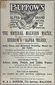 Burrows advertisement.jpg 606 × 927; 664 KB
-
 Bus shelter on the Wells Road - geograph.org.uk - 1774132.jpg 640 × 427; 251 KB
-
 Bus Stop on Wells Road - geograph.org.uk - 5048480.jpg 1,024 × 664; 170 KB
-
 Butcher's stall, Autumn Show, Malvern - geograph.org.uk - 2083556.jpg 4,272 × 2,848; 4.8 MB
-
 Cambridge Close in the snow. - geograph.org.uk - 1653028.jpg 640 × 427; 260 KB
-
-
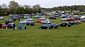
 Car park at RHS Malvern Show 2016 - geograph.org.uk - 4948844.jpg 1,600 × 1,200; 750 KB
-
 Car park at The Worcestershire Golf Club - geograph.org.uk - 6436029.jpg 1,024 × 768; 223 KB
-
-
 Car park for the RHS Spring Show 2016 - geograph.org.uk - 4943979.jpg 800 × 450; 102 KB
-
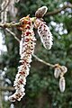 Catkins on a tree - geograph.org.uk - 6080342.jpg 683 × 1,024; 177 KB
-
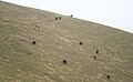
 Cattle grazing Pinnacle Hill - geograph.org.uk - 1419404.jpg 640 × 393; 238 KB
-
 Cattle on Pinnacle Hill - geograph.org.uk - 586076.jpg 640 × 396; 205 KB
-
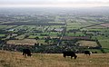
 Cattle on the Malvern Hills - geograph.org.uk - 371551.jpg 640 × 426; 102 KB
-
 Chalet House - geograph.org.uk - 6164983.jpg 1,024 × 768; 287 KB
-
 Chase Road in the snow - geograph.org.uk - 1653038.jpg 640 × 427; 270 KB
-
 Chicken on a trampoline - geograph.org.uk - 4084159.jpg 800 × 451; 210 KB
-
 Children in Need day on the Malvern Hills - geograph.org.uk - 5976999.jpg 1,024 × 683; 93 KB
-
 Christchurch, Avenue Road, Great Malvern - geograph.org.uk - 3747384.jpg 640 × 422; 323 KB
-

-

-

-
-
 Closed car park - geograph.org.uk - 6436014.jpg 1,024 × 768; 297 KB
-
 Cloud drifting over the Malvern Hills - geograph.org.uk - 5675738.jpg 1,024 × 768; 197 KB
-
 Colourful houses on Westminster Road - geograph.org.uk - 6443125.jpg 1,024 × 768; 245 KB
-
 Coming and going - geograph.org.uk - 1844908.jpg 640 × 334; 176 KB
-
 Coton Cottage Farm - geograph.org.uk - 5700594.jpg 1,024 × 680; 136 KB
-
 Cottage on junction of Holywell Road (geograph 7044435).jpg 1,600 × 1,069; 543 KB
-
 Cottage on Wells Road - geograph.org.uk - 5641500.jpg 1,024 × 768; 297 KB
-
 Council seat, Malvern Wells - geograph.org.uk - 2533005.jpg 3,750 × 2,500; 7.69 MB
-
 Countryside at the Malvern Hills - geograph.org.uk - 6383674.jpg 3,648 × 2,056; 3.1 MB
-

-
 Court Road, Malvern - geograph.org.uk - 3976760.jpg 1,600 × 1,133; 1.66 MB
-
 Covid-19 precautions - geograph.org.uk - 6436019.jpg 1,024 × 768; 257 KB
-
 Cow parsley and oak - geograph.org.uk - 6469015.jpg 768 × 1,024; 463 KB
-
 Cow parsley on an old railway - geograph.org.uk - 6461662.jpg 1,024 × 768; 370 KB
-
 Craeg Lea - geograph.org.uk - 6381229.jpg 1,024 × 768; 242 KB
-
 Crowds at RHS Malvern Show 2016 and hang gliders above - geograph.org.uk - 4948837.jpg 1,200 × 1,600; 723 KB
-
 Crowds at the Malvern Flower Show - geograph.org.uk - 6320364.jpg 640 × 454; 77 KB
-
 Cur bracken on Malvern Common - geograph.org.uk - 5882199.jpg 1,024 × 683; 272 KB
-
 Cut bracken - geograph.org.uk - 5859183.jpg 1,024 × 768; 403 KB
-
 Cut bracken on Malvern Common - geograph.org.uk - 5544217.jpg 1,024 × 683; 262 KB
-
 Cut bracken on Malvern Common - geograph.org.uk - 5833397.jpg 1,024 × 768; 432 KB
-
 Cut bracken on Malvern Common - geograph.org.uk - 5858612.jpg 1,024 × 768; 337 KB
-
 Cut bracken on Malvern Common - geograph.org.uk - 5859188.jpg 1,024 × 768; 434 KB
-
 Cutting over the Malvern Hills - geograph.org.uk - 4297900.jpg 5,400 × 3,600; 2.42 MB
-
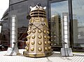 Dalek in chains - geograph.org.uk - 5302317.jpg 2,304 × 1,704; 1.43 MB
-
 Danemoor crossroads - geograph.org.uk - 3179790.jpg 640 × 339; 260 KB
-
 Date stone on Rock Cottage - geograph.org.uk - 2052118.jpg 3,839 × 2,535; 4.32 MB


.jpg)


.jpg)


