Category:Maps & Atlases, Leiden University Library
Subcategories
This category has only the following subcategory.
D
Media in category "Maps & Atlases, Leiden University Library"
The following 118 files are in this category, out of 118 total.
-
 Kennemerland op kaart De VII Vereenigde Nederlandsche Provinciën uit 1773.jpg 1,171 × 767; 200 KB
-

-

-

-

-

-

-

-

-

-
-
 Beleg en ontzet van Leiden in 1574 COLLBN 22599-27-001.tif 10,087 × 13,151; 379.55 MB
-
 BIBLIOTHECÆ LUGDUNO-BATAVÆ CUM PULPITIS ET ARCIS VERA IXNOGRAPHIA COLLBN Port 315-III N 22.tiff 4,882 × 3,978; 55.56 MB
-

-
 Brasilia COLLBN Port 191 N 5.tiff 4,733 × 3,793; 51.36 MB
-
 Brasilia sub regimine Batavorum COLLBN Port 191 N 8.tiff 2,171 × 1,870; 11.62 MB
-
 Brouillon de carte - ou plan des prairies de Doorweerth COLLBN Port 10 N 208.tif 11,612 × 4,544; 150.98 MB
-
 Caarte van Haagh-Ambagt COLLBN Port 16 N 38, COLLBN Port 16 N 38.tif 11,725 × 7,502; 251.68 MB
-

-
 Caerte vande tienden in Voorhout, Sassenheim en Lisse toebehoorende de Universiteijt der stadt Leyden COLLBN Atlas 430.pdf 1,195 × 2,085, 27 pages; 61.03 MB
-
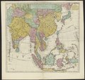 Carte des Indes et de la Chine COLLBN 009-09-002.tif 8,958 × 8,425; 215.95 MB
-

-
 Carte nouvelle de la Mer du Sud COLLBN Port 184 N 136.tif 11,993 × 7,626; 261.69 MB
-
 Charte vom Königreich Griechenland COLLBN Port 145 N 82.tif 7,604 × 6,640; 144.48 MB
-

-
 Comitatus Zelandiae accurata & novissima delineatia COLLBN Port 33 N 52, COLLBN Port 33 N 52.tif 6,879 × 6,273; 123.46 MB
-
 Copye. Caarte van de Heerlykheeden Amijden, Tienhoven en Herlaard enz. COLLBN Port 21 N 29.tif 8,193 × 8,274; 193.97 MB
-

-
 De slach opt Slaeck, 1631 Port 37 N 12, COLLBN Port 37 N 12.tiff 5,245 × 4,086; 61.32 MB
-
 De VII Vereenigde Nederlandsche Provinciën COLLBN Port 3 N 87 - sheet 1.tif 8,491 × 6,470; 157.18 MB
-
 De VII Vereenigde Nederlandsche Provinciën COLLBN Port 3 N 87 - sheet 2.tif 6,807 × 6,365; 123.96 MB
-
 De VII Vereenigde Nederlandsche Provinciën COLLBN Port 3 N 87 - sheet 3.tif 8,449 × 6,330; 153.01 MB
-
-
 Embouchure du Peïho COLLBN 002-12-081, COLLBN 002-12-081.tif 3,006 × 2,423; 20.84 MB
-
 Fort Real COLLBN Port 191 N 70.tiff 4,541 × 3,773; 49.02 MB
-
 Frederica Civitas COLLBN Port 191 N 46.tiff 6,263 × 5,295; 94.88 MB
-
 Golfo de Ankaos ofte Den Grooten in ham van Chiloue COLLBN Port 191 N 193.tiff 3,237 × 2,320; 21.49 MB
-
 Grond-Teyckening van het Eylandt Anthony Vaaz COLLBN Port 191 N 66.tiff 6,102 × 4,511; 78.75 MB
-
 Gronden en opstallen van Ameilastein in ʾt Viaanse Bos COLLBN Port 21 N 60 sheet 1.tif 7,117 × 5,936; 120.87 MB
-
 Gronden en opstallen van Ameilastein in ʾt Viaanse Bos COLLBN Port 21 N 60 sheet 2.tif 7,118 × 5,936; 120.89 MB
-
 Gronden en opstallen van Ameilastein in ʾt Viaanse Bos COLLBN Port 21 N 60 sheet 3.tif 7,118 × 5,966; 121.5 MB
-
 Gronden en opstallen van Ameilastein in ʾt Viaanse Bos COLLBN Port 21 N 60 sheet 4.tif 7,455 × 5,613; 119.72 MB
-
 Gronden en opstallen van Ameilastein in ʾt Viaanse Bos COLLBN Port 21 N 60 sheet 5.tiff 7,162 × 4,521; 92.64 MB
-
 Handgeschreven catalogus van de Collectie Bodel Nijenhuis COLLBN z. sgn. - part 1 Port 1 N 1 tm Port 46 N 200.pdf 2,720 × 2,204, 164 pages; 263.03 MB
-
 Huijs te Persijn, plattegrond van het landgoed, circa 1700.tif 4,346 × 5,284; 65.7 MB
-
 Ioannes Dou, Caerte van tienden in Voorhout, Sassenheim en Lisse, toebehoorende aan de Universiteyt der Stadt Leyden BPL 1824.pdf 2,391 × 3,231, 13 pages; 35.24 MB
-

-

-

-

-

-
 Kaart der stad Leiden met aantekening der riolen COLLBN Port 52 N 7 - sheet 1.tif 9,909 × 7,020; 199.02 MB
-
 Kaart der stad Leiden met aantekening der riolen COLLBN Port 52 N 7 - sheet 2.tif 9,909 × 7,020; 199.02 MB
-
 Kaart der stad Leiden met aantekening der riolen COLLBN Port 52 N 7 - sheet 3.tif 9,909 × 7,062; 200.21 MB
-
 Kaart der stad Leiden met aantekening der riolen COLLBN Port 52 N 7 - sheet 4.tif 10,148 × 7,061; 205.01 MB
-
 Kaart der stad Leiden met aantekening der riolen COLLBN Port 52 N 7 - sheet 5.tif 10,151 × 6,991; 203.04 MB
-

-
 Kaart met mondiale prehistorische migraties, waaronder Zuidoost-Azië, KITLV 123104.tiff 2,801 × 1,850; 14.85 MB
-
 Kaart met prehistorische landbruggen in Zuidoost-Azië, KITLV 123090.tiff 2,782 × 1,288; 10.28 MB
-

-

-
 Kasteel Persijn in vogelvlucht, circa 1700.png 6,670 × 4,185; 30.23 MB
-

-

-

-

-

-

-

-

-
-

-
 Pascaerte van Brasil COLLBN Port 191 N 3.tif 6,743 × 5,228; 100.86 MB
-

-
 Pehoe COLLBN 002-12-078, COLLBN 002-12-078.tiff 2,964 × 2,533; 21.48 MB
-
-

-
-

-

-

-
-

-
 Plan der Kayserlichen Gouvernements Stadt Riga COLLBN Port 161 N 15, COLLBN Port 161 N 15.tif 11,887 × 7,576; 257.67 MB
-
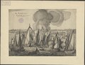
 Plan du bombardement de Canton par les navires anglais COLLBN 002-12-083, COLLBN 002-12-083.tif 2,736 × 1,641; 12.85 MB
-
 Platte-grond der stad Gouda COLLBN Port 18 N 102, COLLBN Port 18 N 102.tiff 4,098 × 3,390; 39.75 MB
-
 Platte-grond der stad Leiden COLLBN Port 14 N 53.tiff 5,149 × 4,190; 61.73 MB
-

-
 Plattegrond van Groningen COLLBN Port 46 N 123, COLLBN Port 46 N 123.tiff 4,423 × 3,249; 41.11 MB
-
 Plenilunii lumina Austriaca Philippica COLLBN 505-10-003.tiff 5,098 × 6,289; 91.73 MB
-

-
 Prospect of Constantinople - overview, BPL 1758.tif 129,240 × 5,012; 1.81 GB
-
 Prospect of Constantinople - part 1, BPL 1758 1.tiff 6,510 × 4,996; 93.07 MB
-
 Prospect of Constantinople - part 10, BPL 1758 10.tif 6,925 × 5,282; 104.67 MB
-
 Prospect of Constantinople - part 11, BPL 1758 11.tif 6,859 × 5,265; 103.34 MB
-
 Prospect of Constantinople - part 12, BPL 1758 12.tiff 3,488 × 5,274; 52.65 MB
-
 Prospect of Constantinople - part 13, BPL 1758 13.tif 7,107 × 5,400; 109.82 MB
-
 Prospect of Constantinople - part 14, BPL 1758 14.tif 7,254 × 5,400; 112.09 MB
-
 Prospect of Constantinople - part 15, BPL 1758 15.tif 7,179 × 5,370; 110.32 MB
-
 Prospect of Constantinople - part 16, BPL 1758 16.tif 7,209 × 5,394; 111.27 MB
-
 Prospect of Constantinople - part 17, BPL 1758 17.tif 7,208 × 5,335; 110.04 MB
-
 Prospect of Constantinople - part 18, BPL 1758 18.tiff 6,093 × 5,362; 93.49 MB
-
 Prospect of Constantinople - part 19, BPL 1758 19.tiff 5,811 × 5,277; 87.75 MB
-
 Prospect of Constantinople - part 2, BPL 1758 2.tif 6,931 × 5,044; 100.04 MB
-
 Prospect of Constantinople - part 20, BPL 1758 20.tif 7,110 × 5,235; 106.51 MB
-
 Prospect of Constantinople - part 21, BPL 1758 21.tiff 5,238 × 5,250; 78.7 MB
-
 Prospect of Constantinople - part 3, BPL 1758 3.tif 6,984 × 5,301; 105.94 MB
-
 Prospect of Constantinople - part 4, BPL 1758 4.tif 6,909 × 5,389; 106.54 MB
-
 Prospect of Constantinople - part 5, BPL 1758 5.tif 6,843 × 5,307; 103.92 MB
-
 Prospect of Constantinople - part 6, BPL 1758 6.tif 6,909 × 5,219; 103.18 MB
-
 Prospect of Constantinople - part 7, BPL 1758 7.tif 6,624 × 5,338; 101.18 MB
-
 Prospect of Constantinople - part 8, BPL 1758 8.tif 6,979 × 5,233; 104.51 MB
-
 Prospect of Constantinople - part 9, BPL 1758 9.tiff 7,007 × 4,619; 92.62 MB
-
 Sanct Salvador COLLBN Port 191 N 137.tif 8,159 × 6,303; 147.13 MB
-
-

-
 Teekening van de voormalige schans Slikkenburg COLLBN Port 37 N 142, COLLBN Port 37 N 142.tif 7,808 × 6,601; 147.46 MB
-
 Villa d Olinda d Pernambuco COLLBN Port 191 N 61.tiff 5,101 × 3,886; 56.71 MB

