File:Carte du cours du Maragnon ou de la grande riviere des Amazones dans sa partie navigable depuis Jaen de Bracamoros jusqu 'à son embouchure et qui comprend la province de Quito et la Côte de la Guian, COLLBN Port 191 N 33.tiff

Size of this JPG preview of this TIF file: 800 × 516 pixels. Other resolutions: 320 × 207 pixels | 640 × 413 pixels | 1,024 × 661 pixels | 1,280 × 826 pixels | 2,560 × 1,652 pixels | 5,037 × 3,251 pixels.
Original file (5,037 × 3,251 pixels, file size: 46.85 MB, MIME type: image/tiff)
Captions
Captions
Add a one-line explanation of what this file represents
Summary edit
| Description |
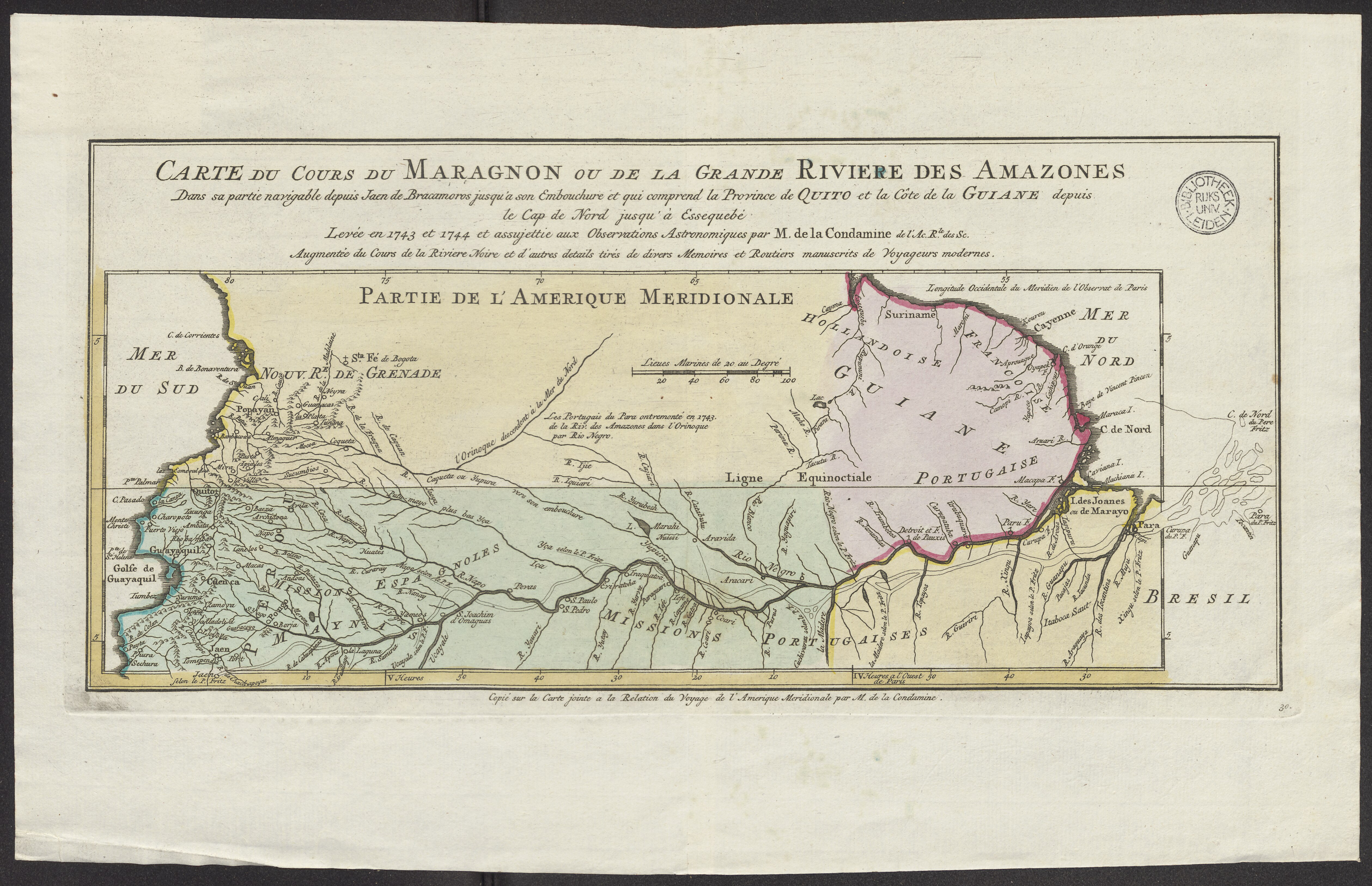
English: Title: Carte du cours du Maragnon ou de la grande riviere des Amazones dans sa partie navigable depuis Jaen de Bracamoros jusqu\'à son embouchure et qui comprend la province de Quito et la Côte de la Guiane depuis le Cap de Nord jusqu\'à Essequebé COLLBN Port 191 N 33 Author/creator: La Condamine, Charles Marie de (1701-1774) Harrevelt, Evert van Shelfmark: COLLBN Port 191 N 33 Subject (geographic): Amazon River (river) Note: Scale bar 100 Lieues marines de 20 au degré (= 4,9 cm) Copié sur la carte jointe à la Relation du voyage de l\'Amerique Méridionale par M. de la Condamine. Language: French Country: Netherlands Published: 1773 Persistent URL: http://hdl.handle.net/1887.1/item:2528873 Published (digital): E. van Harrevelt ; D.J. Changuion, Extent: 1 scan. : Atlas portatif (Amsterdam: Part of: E. van Harrevelt, 1773) |
| Date | Unknown date |
| Source | http://hdl.handle.net/1887.1/item:2528873 |
| Author | La Condamine, Charles Marie de (1701-1774) |
Licensing edit
This file is licensed under the Creative Commons Attribution 4.0 International license.
- You are free:
- to share – to copy, distribute and transmit the work
- to remix – to adapt the work
- Under the following conditions:
- attribution – You must give appropriate credit, provide a link to the license, and indicate if changes were made. You may do so in any reasonable manner, but not in any way that suggests the licensor endorses you or your use.
File history
Click on a date/time to view the file as it appeared at that time.
| Date/Time | Thumbnail | Dimensions | User | Comment | |
|---|---|---|---|---|---|
| current | 18:26, 9 January 2021 |  | 5,037 × 3,251 (46.85 MB) | Mr.Nostalgic (talk | contribs) | == {{int:filedesc}} == {{Information |Description={{en|1=<br> Title: Carte du cours du Maragnon ou de la grande riviere des Amazones dans sa partie navigable depuis Jaen de Bracamoros jusqu\'à son embouchure et qui comprend la province de Quito et la Côte de la Guiane depuis le Cap de Nord jusqu\'à Essequebé COLLBN Port 191 N 33<br> Author/creator: La Condamine, Charles Marie de (1701-1774)<br> Harrevelt, Evert van<br> Shelfmark: COLLBN Port 191 N 33<br> Subject (geographic): Amazon River (ri... |
You cannot overwrite this file.
File usage on Commons
There are no pages that use this file.