Category:Maps about the COVID-19 pandemic in the Republic of Ireland
Countries of Europe: Albania · Armenia‡ · Austria · Azerbaijan‡ · Belarus · Belgium · Bosnia and Herzegovina · Bulgaria · Croatia · Czech Republic · Denmark · Estonia · Finland · France‡ · Georgia‡ · Germany · Greece · Hungary · Iceland · Republic of Ireland · Italy · Kazakhstan‡ · Latvia · Liechtenstein · Lithuania · Luxembourg · Malta · Moldova · Monaco · Montenegro · Netherlands‡ · North Macedonia · Norway · Poland · Portugal‡ · Romania · Russia‡ · San Marino · Serbia · Slovakia · Slovenia · Spain‡ · Sweden · Switzerland · Turkey‡ · Ukraine · United Kingdom
Limited recognition: Abkhazia‡ · Kosovo
‡: partly located in Europe
Limited recognition: Abkhazia‡ · Kosovo
‡: partly located in Europe
Media in category "Maps about the COVID-19 pandemic in the Republic of Ireland"
The following 12 files are in this category, out of 12 total.
-
 Confirmed cases of COVID-19 in Ireland by county.gif 1,104 × 1,254; 11.47 MB
-
 Confirmed cases of COVID-19 in Ireland by county.svg 2,300 × 2,500; 1.6 MB
-
Confirmed cases of COVID-19 in Ireland by county.webm 51 s, 1,472 × 1,600; 847 KB
-
 Confirmed cases of COVID-19 per 100k inhabitants in Ireland by county.gif 1,036 × 1,236; 9.93 MB
-
 Confirmed cases of COVID-19 per 100k inhabitants in Ireland.svg 2,300 × 2,500; 1.6 MB
-
Confirmed cases of COVID-19 per 100k inhabitants in Ireland.webm 51 s, 1,472 × 1,600; 705 KB
-
 COVID-19 14-day incidence rate per 100,000 population in Ireland.png 1,240 × 1,340; 280 KB
-
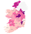
 COVID-19 Outbreak Cases in Ireland.svg 400 × 500; 204 KB
-
 COVID-19 Outbreak Cases in Republic of Ireland.jpg 819 × 1,024; 76 KB
-
 COVID-19 vaccination centres in the Republic of Ireland.png 1,768 × 1,920; 566 KB
-
 Cumulative confirmed cases of COVID-19 in Ireland by county.png 1,240 × 1,340; 283 KB
-