Category:Maps by Gerardus Mercator
English: Maps made by Gerardus Mercator.
Français : Cartes réalisées par Gerardus Mercator.
Deutsch: Karten von Gerardus Mercator.
 | |||||
| Upload media | |||||
| Instance of | |||||
|---|---|---|---|---|---|
| Main subject | |||||
| Publisher |
| ||||
| Creator | |||||
| Publication date |
| ||||
| |||||
Subcategories
This category has the following 10 subcategories, out of 10 total.
A
D
M
P
T
Media in category "Maps by Gerardus Mercator"
The following 20 files are in this category, out of 20 total.
-
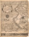
 (Map of western South America). LOC 2010592481.jpg 4,969 × 6,347; 7.16 MB
-
 (Map of western South America). LOC 2010592481.tif 4,969 × 6,347; 90.23 MB
-
 1537 Mercator map of Palestine (Candido lectori S. Palestinam hanc).jpg 14,040 × 7,520; 16.39 MB
-
 Cassackia 1554.png 1,920 × 1,080; 3.75 MB
-
-
-
 Greenland Mercator 1569.jpg 993 × 1,500; 509 KB
-

-
 Kempen in Brabant.jpg 1,276 × 963; 796 KB
-
 Literarum latinarum 1.jpg 930 × 1,550; 919 KB
-
 Lucas 1898 Plate 7 Mercator Europa 1554 Facsimile annalsofvoyageso00luca 0283.jpg 5,605 × 4,160; 9.07 MB
-
 Mercator Britain copied by Ortelius.jpg 800 × 535; 208 KB
-
 Mercator Hondius atlas 1633.jpg 510 × 800; 165 KB
-
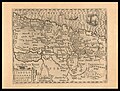
 Mercator Palestine 1537.jpeg 1,432 × 702; 506 KB
-
 Mercator1609.jpg 1,600 × 1,200; 432 KB
-

-
 Morocco 1634, Gerardus Mercator (4172298-verso).jpg 6,690 × 5,453; 7.55 MB
-
 PMa B 459 Sint Niklaas.jpg 415 × 600; 272 KB
-
-
 Venezuela, cum parte Auftrali Novae Andalausiae.jpg 2,952 × 2,280; 1.53 MB
._LOC_2010592481.jpg)
.jpg)

.jpg)
.jpg)

,_NG-501-92.jpg)


.jpg)

.jpg)
