Category:Maps of 19th-century Poland
Subcategories
This category has only the following subcategory.
M
- Maps of 19th-century Prussia (23 F)
Media in category "Maps of 19th-century Poland"
The following 2 files are in this category, out of 2 total.
-
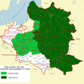 Russian Partition in 1821.png 2,350 × 2,355; 1.16 MB
-
 Battles of January Uprising in Lithuania, Belarus and Ukraine.JPG 5,020 × 6,902; 3.73 MB

