Category:Maps of Alphen aan den Rijn
Wikimedia category | |||||
| Upload media | |||||
| Instance of | |||||
|---|---|---|---|---|---|
| Category combines topics | |||||
| Alphen aan den Rijn | |||||
municipality in the Netherlands    .png) | |||||
| Spoken text audio | |||||
| Pronunciation audio | |||||
| Instance of | |||||
| Part of | |||||
| Location | South Holland, Netherlands | ||||
| Located in or next to body of water | |||||
| Capital | |||||
| Population |
| ||||
| Area |
| ||||
| Elevation above sea level |
| ||||
| Replaces | |||||
| Different from | |||||
| official website | |||||
 | |||||
Subcategories
This category has the following 5 subcategories, out of 5 total.
Media in category "Maps of Alphen aan den Rijn"
The following 22 files are in this category, out of 22 total.
-
 2013-AlphenaandenRijn.jpg 2,946 × 2,369; 4.7 MB
-
 Alphen aan den Rijn-plaats.png 900 × 900; 870 KB
-
 Alphen aan den Rijn-topografie.jpg 1,409 × 1,574; 1.77 MB
-
 AlphenadRijn-plaats-OpenTopo.jpg 1,806 × 2,043; 2.39 MB
-
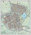
 AlphenadRijn-stad-2014Q1.jpg 1,774 × 2,043; 2.31 MB
-
 BAG woonplaatsen - Gemeente Alphen aan den Rijn.png 2,419 × 2,419; 527 KB
-
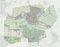
 Gem-AlphenadRijn-2014Q1.jpg 5,720 × 4,663; 14.63 MB
-
 Gem-AlphenadRijn-OpenTopo.jpg 5,602 × 4,387; 3.81 MB
-
 Hoekwater polderkaart - Benthuizerpolder.PNG 428 × 547; 633 KB
-
 Hoekwater polderkaart - Kerk en Zanen.PNG 420 × 533; 622 KB
-
 Hoekwater polderkaart - Oostbuurtse polder.PNG 353 × 363; 361 KB
-
 Hoekwater polderkaart - Polder Steekt.PNG 406 × 334; 350 KB
-
 Hoekwater polderkaart - Vierambachtspolder.PNG 435 × 347; 408 KB
-
 Kaart gemeente Alphen.gif 2,288 × 1,962; 109 KB
-
 LocatieAlphenAanDenRijn.png 280 × 130; 8 KB
-
 Map - NL - Alphen aan den Rijn (2009).svg 625 × 575; 2.2 MB
-
 Map - NL - Municipality code 0484 (2009).svg 300 × 160; 530 KB
-
 Map - NL - Municipality code 0484 (2014).png 2,000 × 1,067; 209 KB
-
 Map - NL - Municipality code 0484 (2019).svg 300 × 160; 444 KB
-
 Netherlands, Kaartboek door Mr. Floris Balthasar, 1611, kaart 1.jpg 3,304 × 4,384; 4.21 MB
-
 OpenStreetMap van de Gouwe (Rivier) Zuid-Holland.png 1,044 × 996; 1.71 MB
-
 Ring Alphen aan den Rijn.jpg 511 × 472; 65 KB


.svg)
.svg)
.svg)

_Zuid-Holland.png)
